• Skip to primary navigation
  • Skip to main content
  • Skip to primary sidebar
  • Skip to footer

California Through My Lens

California Travel, Food, Hiking & Road Trips

  • Start Here
  • Explore
    • Beaches
    • Bizarre
    • Caves
    • Food
    • Hikes
    • Historical Structures
    • Natural Wonders
    • Waterfalls
  • Drive
    • El Camino Real
    • Highway 395
    • LA to Las Vegas
    • Pacific Coast Highway
    • Route 66
  • National Parks
    • Channel Islands
    • Death Valley
    • Joshua Tree
    • Lassen Volcanic
    • Pinnacles
    • Redwoods
    • Sequoia & Kings Canyon
    • Yosemite
  • Cities
    • Los Angeles
    • Palm Springs
    • Sacramento
    • San Diego
    • San Francisco
  • Resources
    • Day Trip Ideas
    • Road Trip eBooks
    • Hotels
    • My Favorite Travel Products
    • Travel Videos
  • Browse By …
    • Map Of Locations
    • Cities
    • Counties
    • National Parks
    • State Parks

Cascade Falls Hike in South Lake Tahoe

Last Modified: May 11, 2020

20shares
  • Share
  • Tweet

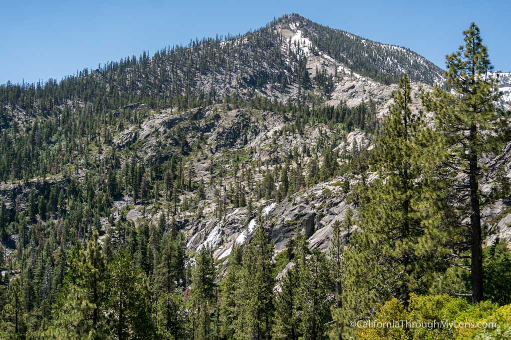
Cascade Falls is one of the most impressive waterfalls in the South Lake Tahoe area when it is flowing. You can see it in the distance when you make the drive to South Lake Tahoe from Emerald Bay, and it is surprisingly quick to hike there as well. The trail is only 1.5 miles round trip, but don’t let the mileage make you think it is easy as there is a good amount of both uphill and downhill on your way to the waterfall. Here is all the information so you can check it out.

Details

  • 1.5 miles
  • 150 feet of elevation
  • Not much shade
  • Location: Bayview Trailhead on Emerald Bay Road
  • This information is from my visit in 2017
  • Read more about South Lake Tahoe here

Getting There

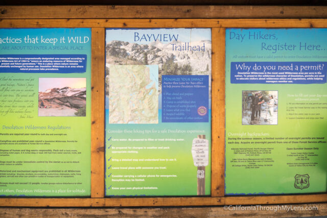
The trailhead for Cascade Falls is located right across the street from Inspiration Point, the viewpoint for Emerald Lake, and it is called the Bayview Trailhead. It can get pretty busy during the weekends, so go early. During the weekdays, there is usually parking in the small lot about a quarter mile from the road though, and the turnaround is relatively fast since the hike is short. There is no charge to park.

The Trail

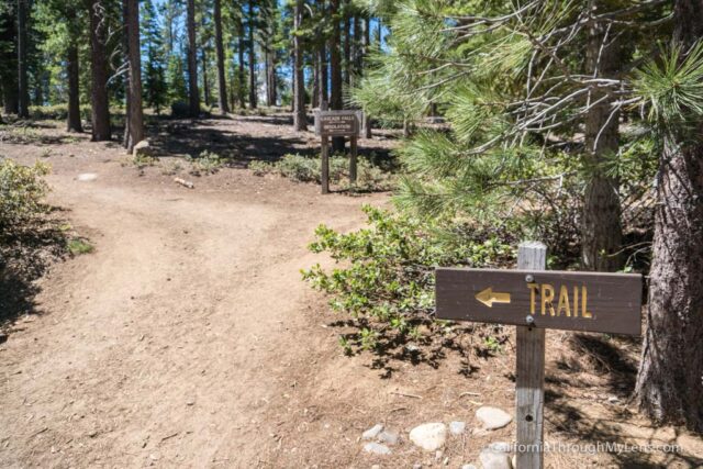
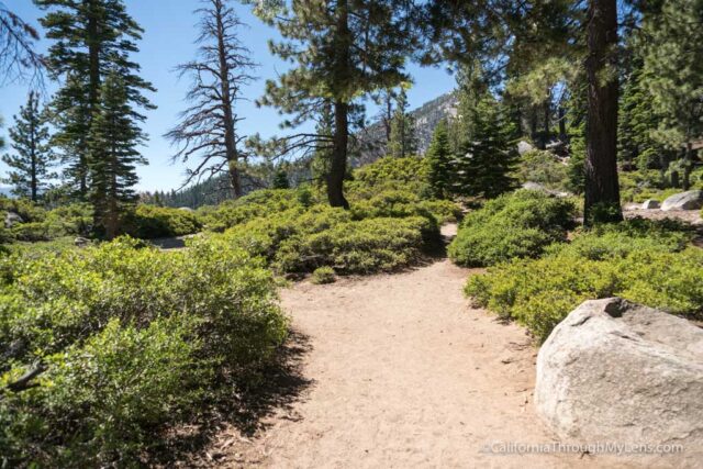
Leaving from the parking lot, the trail starts a gradual uphill through one of the most shaded areas of the hike.

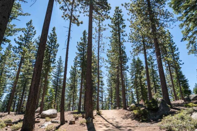
After about a tenth of a mile, you will be out in the open again on the roughly hewn rock stairs that you will be cursing by the end of this hike.

This hike is short, but it has a lot of up and down on a series of rough stairs all the way to the waterfall. Most people can do it, but it is harder than you would think.

After about a quarter of a mile, you will reach a small leveled off area that provides your first view of the falls. This is also where people turn around if they are not feeling motivated to go down to the falls.

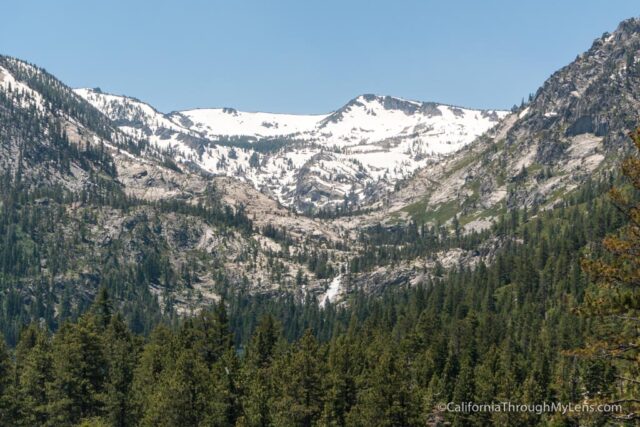
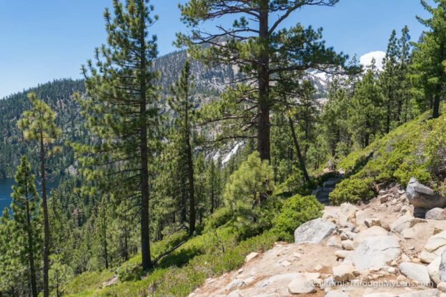
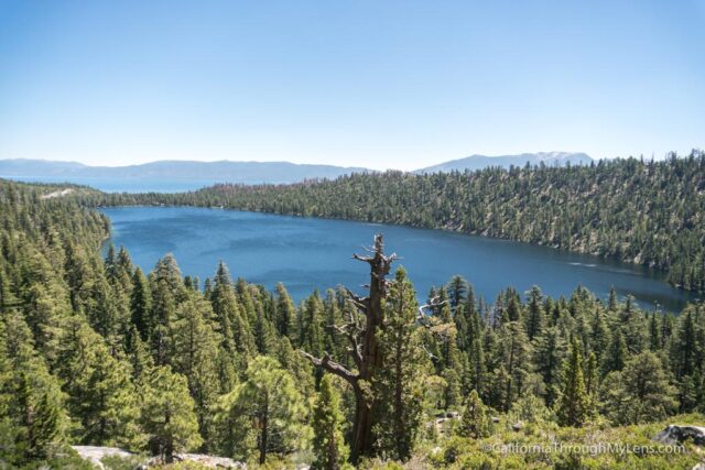
From here, you continue downhill for the next quarter mile as you get excellent views of Cascade Lake to your left.

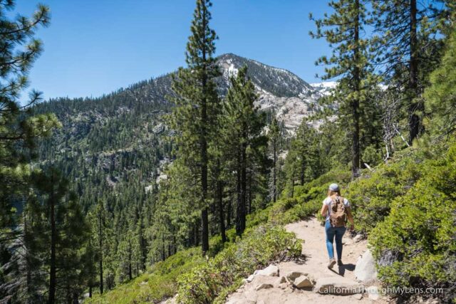
The trail eventually flattens out before making the last uphill push.

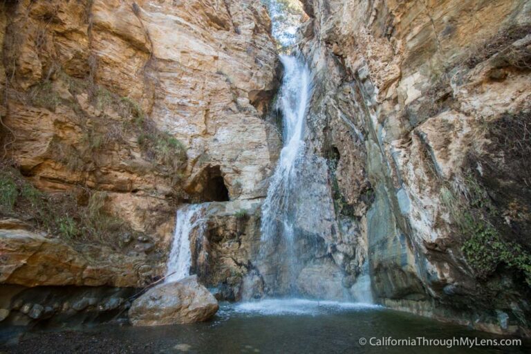
When you get past this uphill section, you will be looking down on the waterfall and can make your way along one of the many different spurs to get down close to it.

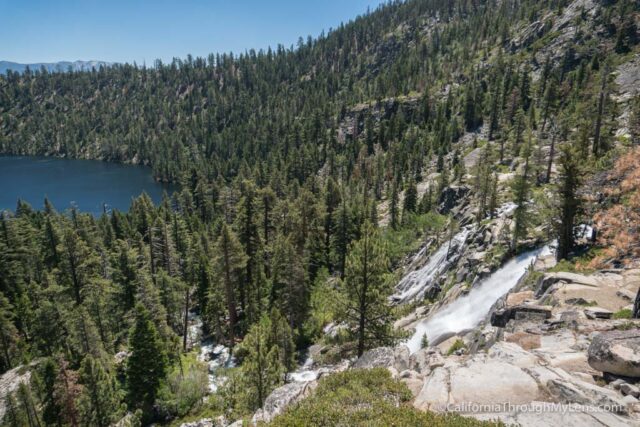
Unfortunately, there is no real front view of the falls, so you just have to take it in from this angle, but it is still impressive.

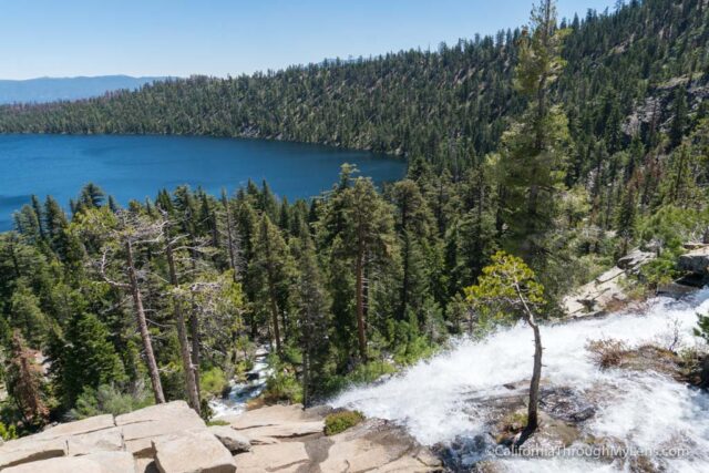
My wife and I walked around, trying to find different views, and the best was on the left side near the cliff, where you could see the flow better.

After hanging out for 20 minutes in the shade, we made the uphill hike back on the rock steps. If you have a chance, check out this waterfall soon. 2017 was a fantastic year for waterfalls with all of the snowmelt, and this is no exception. Let me know what you think in the comments and check out more activities in Tahoe here.

Filed Under: Northern California, Waterfalls Tagged With: El Dorado County, South Lake Tahoe

Interested in supporting this blog?

This blog is simply a hobby and labor of love for me. If you have enjoyed the posts consider sharing it with your friends. I want as many people as possible to explore this state and you can help by letting them know about all of the great spots!

Join the Newsletter

Subscribe for the four day welcome series and to get the latest content every month.

    We won’t send you spam. Unsubscribe at any time.

    About JoshMc

    Thanks for checking out the blog, I am happy to be sharing my adventures with you! You can get to know me by reading my about me, which includes a video and additional information on the site, myself and my full disclosure. Also, follow along on Twitter here or read all of my posts on this blog here.

    Primary Sidebar

    About

    Josh from California Through My Lens I'm a travel junkie strapped down to one state, focused on seeing as much of it as I can and encouraging others to do the same. More about me.

    Popular Posts

    The Big List of Strange, Fun & Unique Attractions in Southern California
    Pacific Coast Highway: Where to Stop on Your Road Trip
    Top Hiking Trails in Southern California
    Fun Stops on the Drive from Los Angeles to Las Vegas
    24 Things to do in Downtown LA
    17 Things to do in Lake Tahoe
    Donner Pass, Summit Tunnel Hike: Old Abandoned Railroad

    Categories

    Other Resources


    Footer

    Search the site

    Additional Information

    Privacy Policy

    About Us

    Copyright © 2021 · Metro Pro on Genesis Framework · WordPress · Log in

    Coronavirus January 2021 Update: Please note that some information in the posts may have changed and some places may be closed.