Inspiration Point & Seven Falls Hike in Santa Barbara
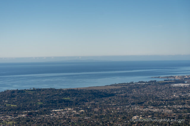
Inspiration Point is the most popular hiking trail in Santa Barbara as it leads to a fantastic view out over the city, coastline, and the Channel Islands. The hike is moderate at 3.5 miles round trip and around 1,000 feet of elevation gain. The trail is exposed to the sun pretty much the entire way to the viewpoint, so I wouldn’t recommend it in the summer heat, but the rest of the year, it is an excellent spot for a nice hike in the city. You can also extend the trail with a visit to Seven Falls or even Bubb’s Peak. Here is all the information if you want to check it out.
Details
- 3.5 miles (Another .5-.75 if you go to Seven Falls)
- 1,000 feet of elevation gain, more if you go to Seven Falls
- Online it says you need an adventure pass, but I am not sure if that is true. I displayed my national parks pass, which is good for many national forests (double-check this before doing it, as I may have just gotten lucky)
- Location: 1454-1498 Tunnel Rd, Santa Barbara, CA 93105 (approx location)
Getting There
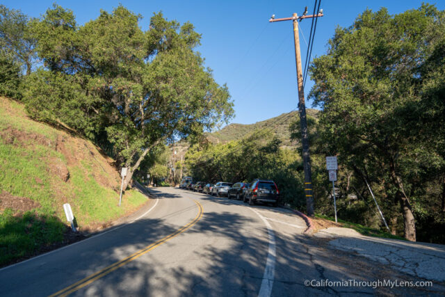
The trailhead for Inspiration Point is located in the mountains above Santa Barbara. You can find the trailhead location directly in Google Maps, which will direct you there. The parking situation here is rough, and there are only 10-12 spots max along the road near the trailhead. If you can’t get one of those, you may have to walk an extra half mile to get to the trailhead, as the remaining options are pretty far down the road. Get here early if you want to find a spot, especially on the weekends.
Inspiration Point Trail
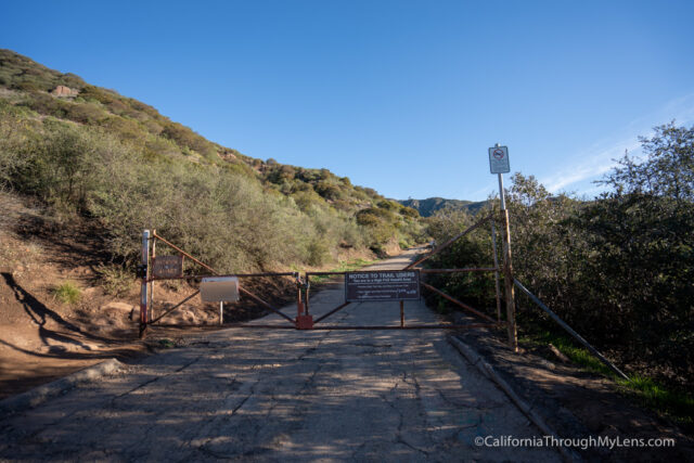
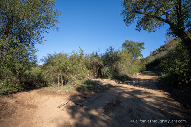
After parking, proceed up the road to the official trailhead, noted by the large metal gate that blocks vehicle access.
You will proceed around this gate and start the trail towards Inspiration Point.
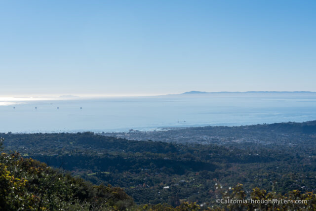
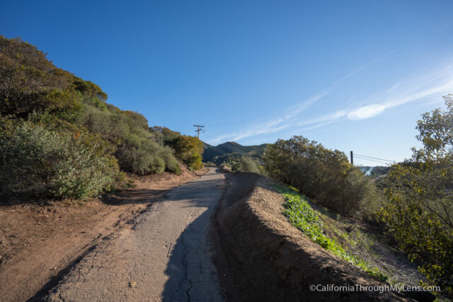
The first mile or so of the trail is along a wide dirt road and is pretty uneventful.
There is no shade on this section, but there are great views of the ocean and the Channel Islands.
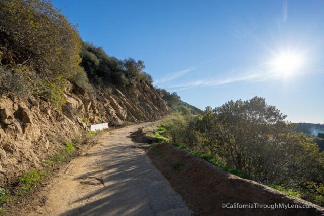
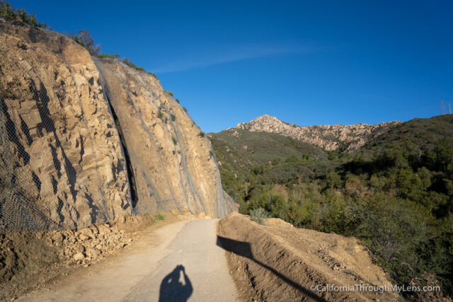
The road bends around as it continues back into the mountains.
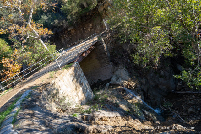
Eventually, you will reach a bridge with a creek crossing and what looks like a small water processing area that is all gated up.
Continuing on, you will reach a sign with a map that shows the area’s hiking trail. There is also a split here where you will stay left.
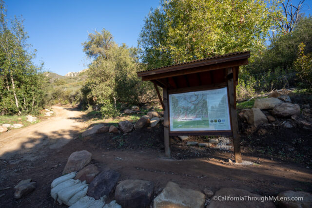
There is another split three minutes away, where you will stay left again and head onto a single track.
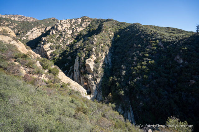
The single track winds around until you get a view of the canyon down below you.
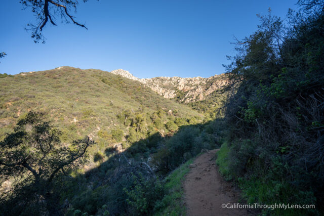
The trail descends here to the creek, and it was flowing pretty well when I was there.
This is also the split for Seven Falls (more on that later).
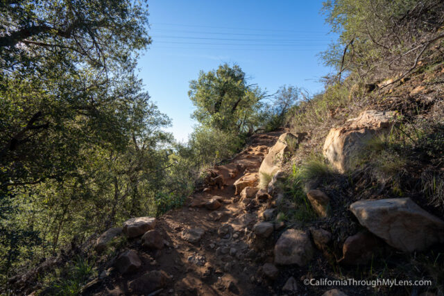
Crossing over the creek, you will start heading up, where most of the elevation comes in.
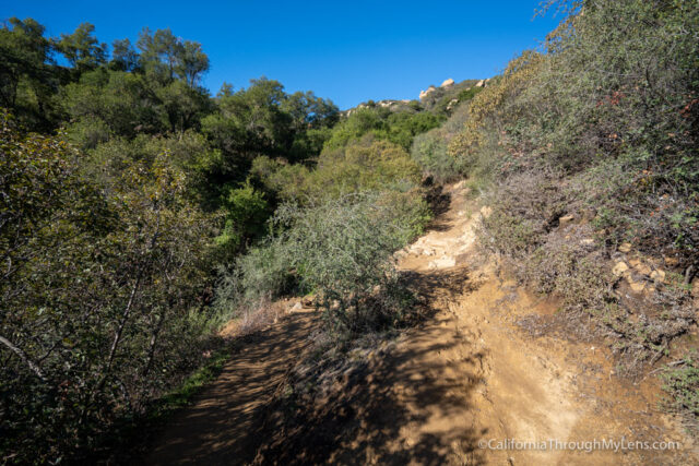
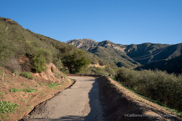
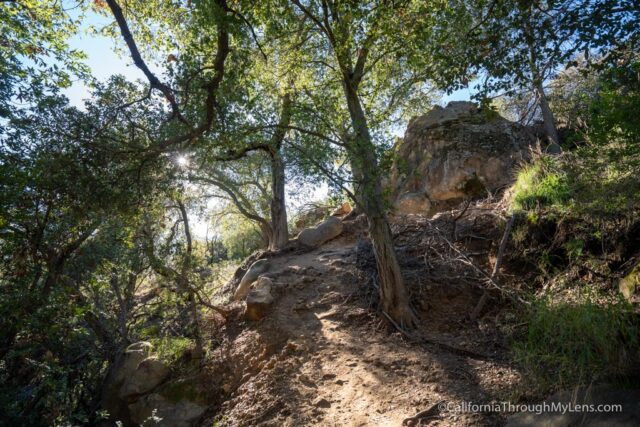
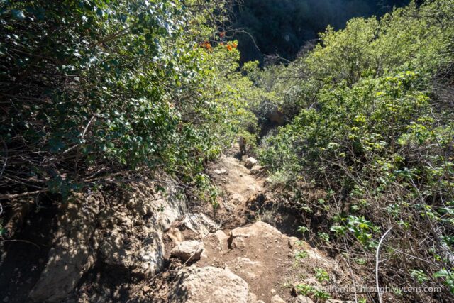
As you head up, the trail goes in and out of shaded areas on a series of switchbacks.
As you gain elevation, you will get some great views of the coast again.

Eventually, the trail reaches some electrical towers that you will go under to reach Inspiration Point.
Inspiration Point
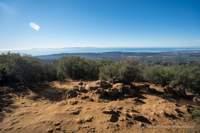
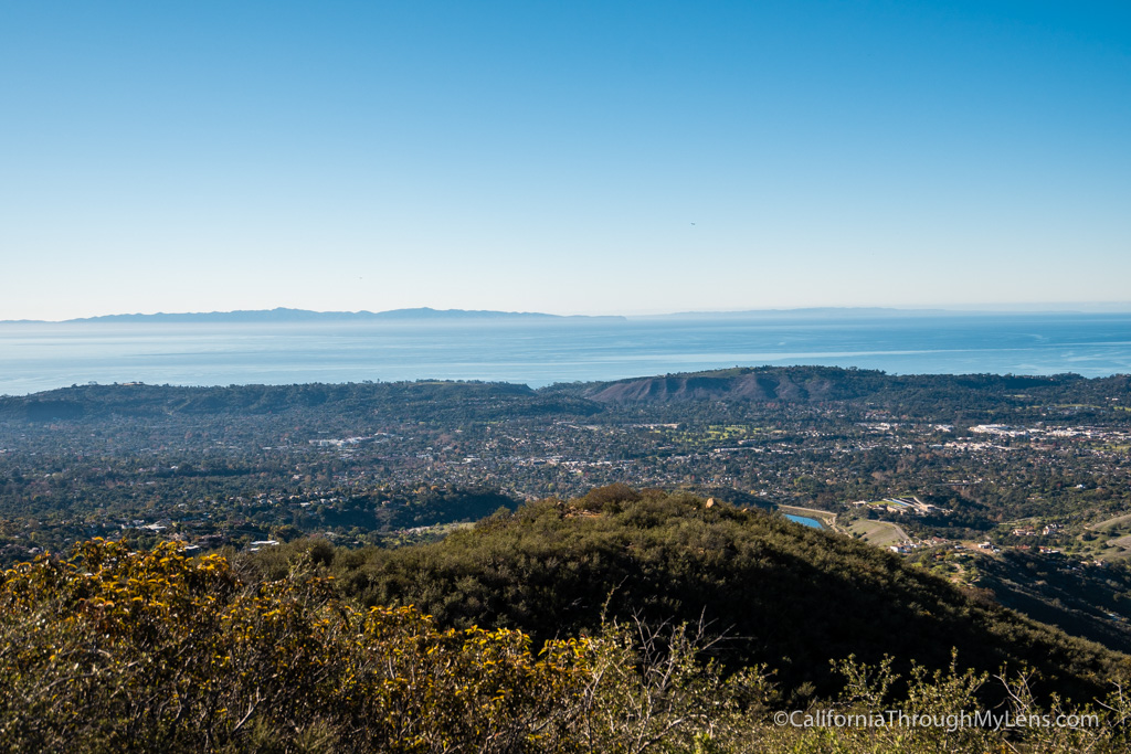
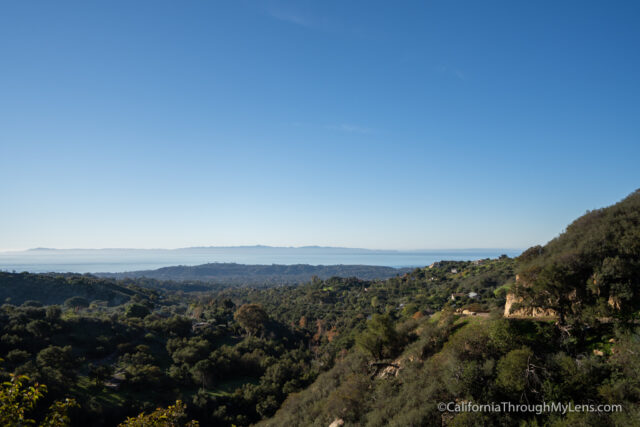
As you cross over a small dirt road, you will officially be at Inspiration Point.
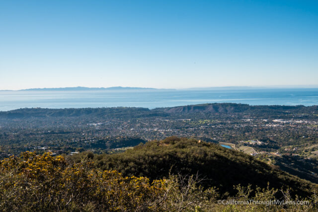
The dirt clearing has a few rocks but not much else, other than the stunning view out over the city and coastline in front of you.
This view is basically 180 degrees of unobstructed stunning coastline. You can see up Pacific Coast Highway in one direction and down to Sterns Wharf in the other. The Channel Islands and the oil rigs that dot the landscape are in the distance.
It is a stunning view and well worth the effort it took to get up here. I stayed for 15 minutes, just soaking it in and having a snack before heading back down to find the trail for Seven Falls.
Seven Falls
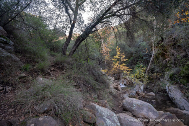
After getting back to the creek, I decided to try and find Seven Falls. I had a GPS track to follow, and you do not want to try and find it without one. The trail is unmarked, and it would be easy to get lost.

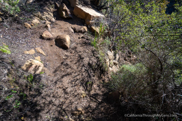
You can see two trails heading up from the creek; the one to the left is the most straightforward. Almost immediately, the trail heads up with many rocks in the path that make you gain elevation quickly. The trail is narrow and steep as you hike out of the canyon.
You will want your GPS track downloaded to note where the trail splits down to the falls.
When you find the split, note that it is very steep with loose dirt.

The path is so steep that someone installed a rope to help you not lose your balance on the way down.
If you take it slow, you will be fine, but if you don’t like this type of hiking, you want to stay away from Seven Falls.
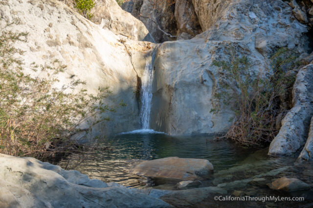
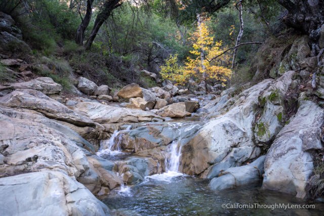
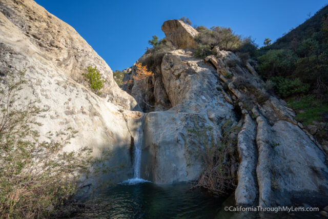
At the bottom of the trail, you will see the first waterfall. This is the largest of the falls and is around 15-20 feet tall. It is beautiful as it cascades over the rock into the small pool below.
I scrambled up the rock to the right of the waterfall to get a view of the small falls behind it.
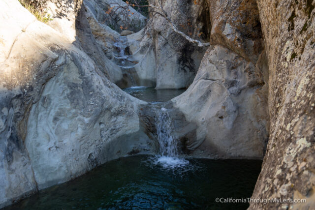
These are only a few feet each, but it is fun to see them cascading down in succession.
After hanging out for a little while, I started the strenuous hike back out to the trail. Again, take your time as it is steep, then it is just following the main path back to your car. I spent a few hours hiking Inspiration Point and Seven Falls in this area, and I loved this beautiful part of Santa Barbara. Check it out if you get a chance, and let me know what you think in the comments.