Hiking to the San Jacinto Summit from the Tram
In 2011, a couple of friends and I set out to hike to the San Jacinto Summit from where the tram drops you off. Without much research, we went into it thinking this would be a pretty straightforward hike, as the tram drops you off at 8,500 feet, and the summit is only 10,500. However, this hike is actually pretty difficult, but it is rewarding to finish and provides stunning views. The hike itself comes out to be around 12 miles round trip, that plus the already high elevation is what makes the hike challenging. Not knowing what we were getting into, we set out early in the morning, paid our 25 bucks to ride the tram, and started our journey to the summit, read on for the full review. Since 2011 I have done this hike many more times, and I will say that it is not that difficult if you are prepared. I was not prepared when I did it in 2011.
Details
- 12 miles
- 2,300 feet of elevation
- Hike starts from where the tram drops off
Video
Here is a video I made of a recent trip (2019), or read on for my recap from 2011.
The Tram
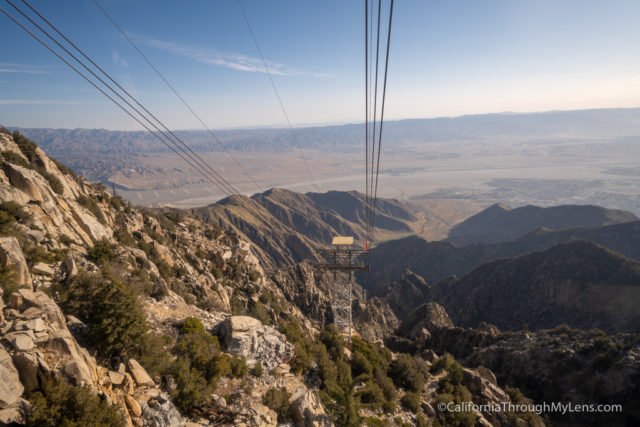
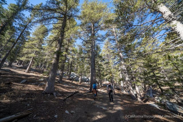
The Palm Springs Aerial Tram is one of the top destinations in the desert and takes you up almost 8,000 feet in elevation. The tram ride is beautiful, and I highly recommended taking it even if you don’t want to hike to the summit. There are other trails you can do there as well, like this one. It takes you from the barren desert below to the forest above, complete with trees, meadows, and small streams. The sheer contrast is worth the price of admission, and where the tram lets off, there is a store and a restaurant. If you are heading for the summit, though, this is where the trail starts.

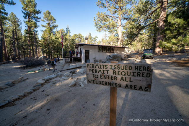
After descending down the cement walkway, you will be at the official start of the trail and can fill out the free permit that you must have with you as you make your way to the summit.
This hike is full of beautiful views and lush landscapes. We saw people having a picnic in one of the meadows, trying to boulder some of the rocks and even wading in the streams. This beauty helps to take your mind off the long trail that is ahead of you and gives you a lot of unique places where you can stop and rest before heading on.
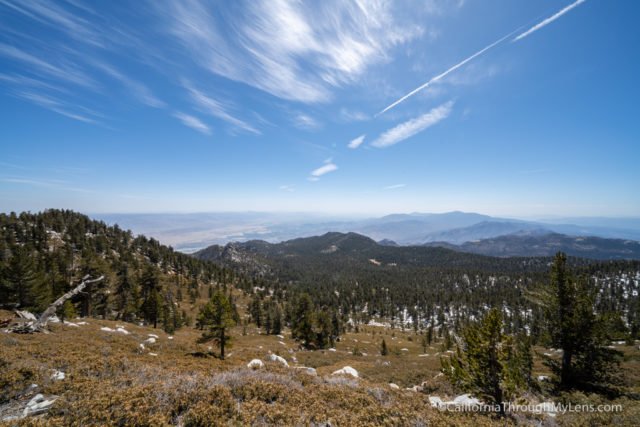
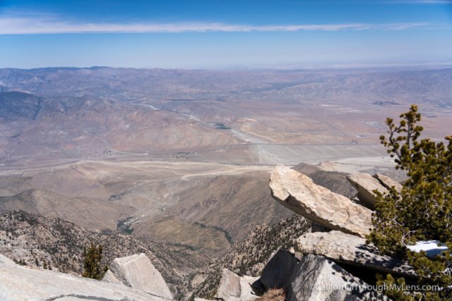
After a couple of hours of walking, we made it out of the forest area and started the summit push. Right before the elevation begins to increase on you, there is an excellent vista point that has lots of rocks you can relax at, and that helps give you an appreciation for what you have accomplished so far.
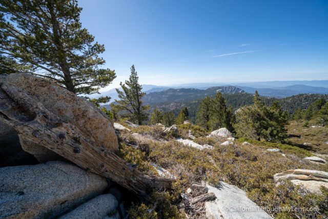
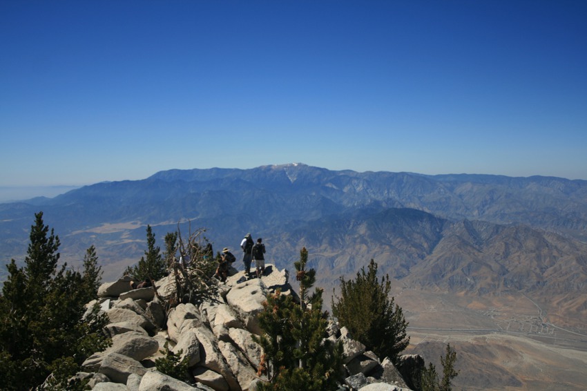
If it is a clear day, you can see many of the neighboring summits from this location, as well as the vast expanse of the desert below.
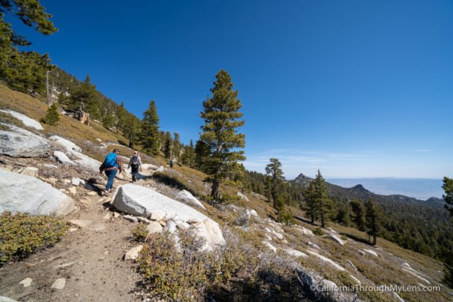
After this short stop, the next push is the toughest. The elevation rises a lot, and if you have not hiked in elevations over 10,000 feet before, it is tough to catch your breath fully. All of this adds to the difficulty but also adds to the accomplishment you feel when you make it to the summit.
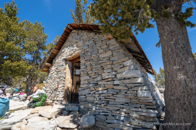
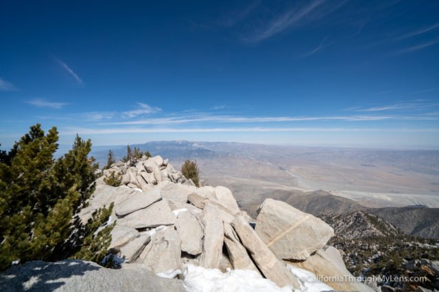
You pass many switchbacks, before seeing a little hut that means you are right below the peak. If you head around to the front side, there are a lot of rocks that you can climb on that make it look like you are suspended out on a ledge. In actuality, it is a drop but not as insane as it seems.
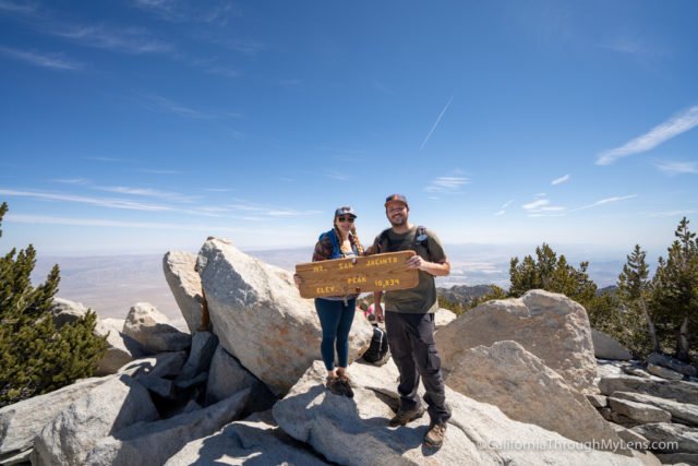
From there, you can climb over similar boulders for about 50 feet before reaching the actual summit of the mountain. We took at least 25 minutes to relax and take in the views, and many people were up there doing the same thing. While this hike is only 12 miles, it feels like a huge accomplishment when you see the views that you are presented with.

Just remember when you make it to the summit, you still have a good 6-mile walk to get back. Some people think that the hike is over, but you have to push your body to put in another 6 miles of walking. I wouldn’t recommend doing this hike to the summit if you are not at least somewhat prepared for it.
It is possible, but you will have a lot more fun if you put some time in at the gym before heading out to accomplish it. It is fantastic to be able to live in Southern California, where one day you can kayak at the beach, the next you can get a hot dog at Pinks and still the next you can climb the summit of San Jacinto.

Let me know if you have done this summit or any of the other neighboring ones. I would love to hear about it in the comments.
Read this post