Badwater Basin in Death Valley: Lowest Point the USA
Death Valley National Park is home to the lowest point in North America, the Badwater Basin. This salt flat sits at 282 feet below sea level and is the most popular attraction in the park. No trip to the area would be complete without a stop there and it is located right in the heart of the Death Valley National Park. Here is all the information.
Details
- Short flat walk
- Very popular so parking can fill up
- Will be incredibly hot in the summer
- This information is from my trip in 2011, 2014 and 2020
Getting There
Badwater Basin is located on the south end of the park; it is in the direction you would come if you came up from the town of Baker. With only one main road that goes through the park from that direction, it is pretty hard to miss. Some signs direct you to it from Furnace Creek if you go that way as well. This area is very popular, so be sure to note that if you go on a busy weekend.
History
The sign near the parking lot says that the area was named Badwater because a traveler was coming through and saw that there was water for his mule to drink. However, because the water is so full of salt, the animal refused to drink it, and thus the name Badwater was born. A little more history on the area is as follows:
“Badwater Basin in Death Valley National Park is the lowest point in North America, with an elevation of 282 ft below sea level. At Badwater, significant rainstorms flood the valley bottom periodically, covering the salt pan with a thin sheet of standing water. Each newly-formed lake does not last long though, because the 1.9 inches of average rainfall is overwhelmed by a 150-inch annual evaporation rate. This means that even a 12-foot-deep, 30-mile-long lake would dry up in a single year.”
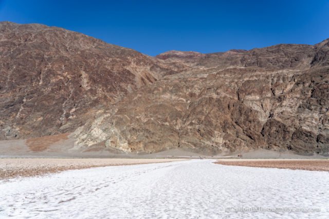
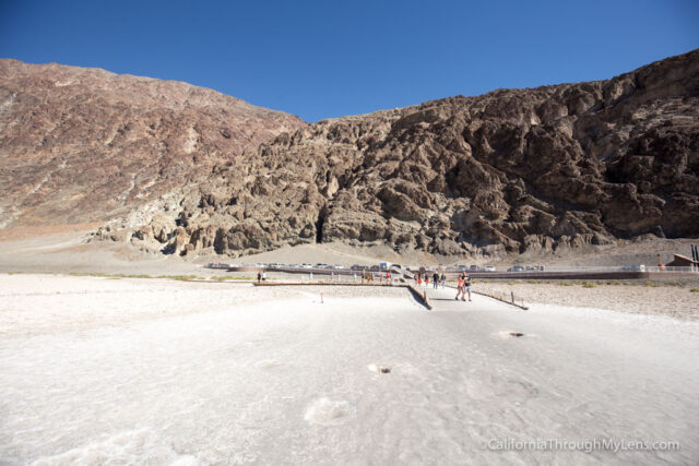
From the parking lot, you can see the sea level sign that is located 280 feet above you on the adjacent mountain. It puts in perspective how low you are when you see it compared to the mountain. You can make it out in the middle of the below photo.

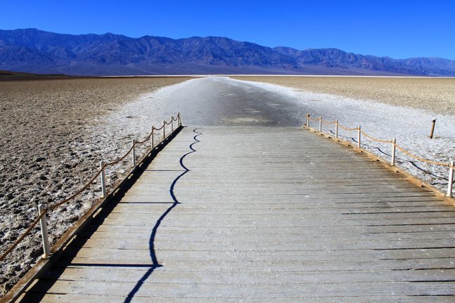
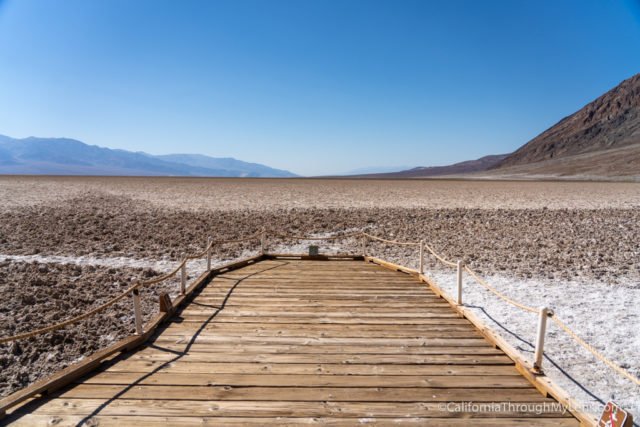
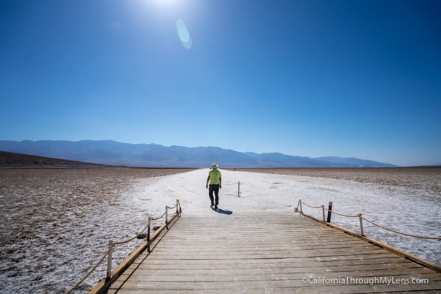
After checking out the sea level sign, you can start to head down to the boardwalk, which leads to the pool and the salt flats.

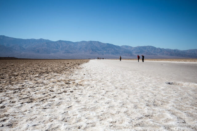
As soon as you walk out on the platform, you are immediately greeted with a huge lake of what looks like snow. Since it is the desert, it is not snow but is the leftover salt from the evaporated water. These salt flats make for a truly unique experience, as you can see them for as far as the eye can see.
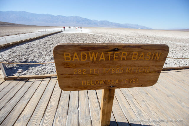
Be sure to check out the Badwater sign and pool before heading out on the salt.

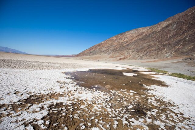
The Badwater pool was a small collection of water at this time of the year and often nonexistent during the hot summer months. Like in the story at the beginning of the post, this water is so high in salt content that almost nothing can live there.
After checking that out, you can walk out onto the salt flats. The salt itself is 5 miles long, so most people do not walk all the way across.

Be careful when you are walking as some of it can be brittle and break. As soon as you get to the large concentration of salt, you can start to see the individual crystals that form with the life cycle of rain and evaporation.

It is fascinating, and the area seems to stretch on and on, especially when you turn around and see how far you came.

From there, you can continue to explore the salt flats or head back. Here is a little video that I made to show what it looks like when you are out on the salt.
Badwater Basin is a truly unique place to stop. You don’t need a lot of time here, but it is worth checking out. You have probably never been this low or seen such a large concentration of salt in your life. Let me know what you think in the comments.