Coronavirus April 2021 Update: Please note that some information in the posts may have changed and some places may be closed.
  • Skip to primary navigation
  • Skip to main content
  • Skip to primary sidebar
  • Skip to footer

California Through My Lens

California Travel, Food, Hiking & Road Trips

  • Start Here
  • Explore
    • Beaches
    • Bizarre
    • Caves
    • Food
    • Hikes
    • Historical Structures
    • Natural Wonders
    • Waterfalls
  • Drive
    • El Camino Real
    • Highway 395
    • LA to Las Vegas
    • Pacific Coast Highway
    • Route 66
  • National Parks
    • Channel Islands
    • Death Valley
    • Joshua Tree
    • Lassen Volcanic
    • Pinnacles
    • Redwoods
    • Sequoia & Kings Canyon
    • Yosemite
  • Cities
    • Los Angeles
    • Palm Springs
    • Sacramento
    • San Diego
    • San Francisco
  • Resources
    • Day Trip Ideas
    • Road Trip eBooks
    • Hotels
    • My Favorite Travel Products
    • Travel Videos
  • Browse By …
    • Map Of Locations
    • Cities
    • Counties
    • National Parks
    • State Parks

Bird Rock Trail in Point Lobos State Natural Reserve

Last Modified: May 1, 2020

2shares
  • Share
  • Tweet

Point Lobos State Natural Reserve is by far one of my favorite state parks in all of California. The majestic section of coastline it protects is some of the best in the area, even comparable to Big Sur to the south. I got a chance to do the Bird Rock Trail and Cypress Grove when I was in the park, read all about the Bird Rock Trail below.

Bird Rock Trail-16

Details

  • 1-mile round trip
  • $10 a car to enter the park
  • 50 feet of elevation gain
  • Wheelchair user accessible
  • This information is from my visit in 2016

Getting There

Bird Rock Trail-1

Point Lobos is located off Highway 1, just south of Carmel. After entering the park, you will be given a map that will show you where to park for the trailhead. The parking lot holds about a dozen cars.

The Trail

Bird Rock Trail-2

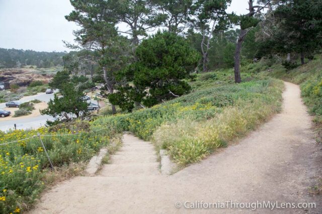
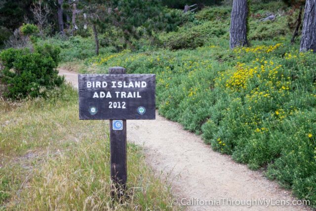
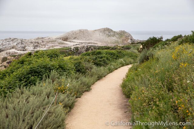
The hike begins by taking you up a small hill and from there hugs the coastline for the entirety of the walk.

Bird Rock Trail-3

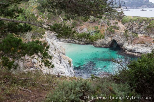
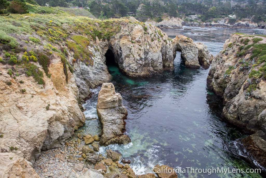
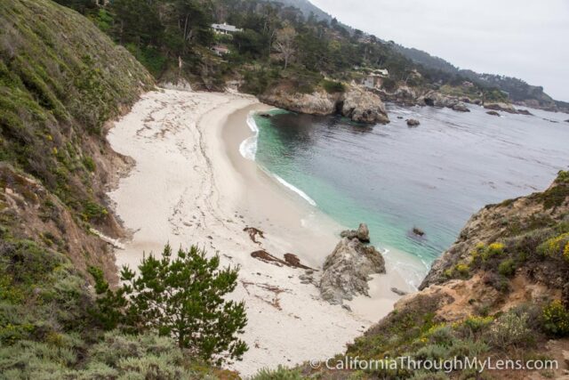
It then provides views of China Cove below, which is a picturesque cove that you need to see yourself.

Bird Rock Trail-4

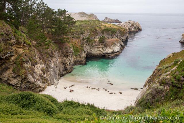
China Cove is a breeding area for sea lions, so it was closed off when I went. You could even see sea lions sitting below on the sand, which was cool.

Bird Rock Trail-19

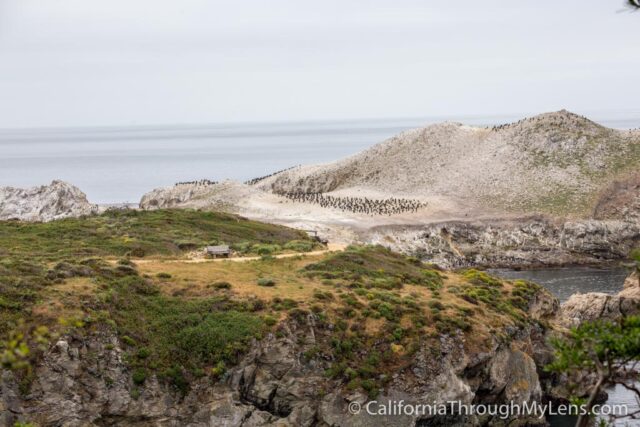
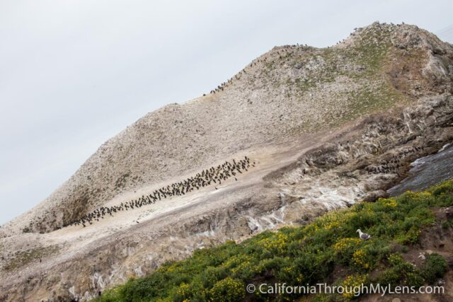
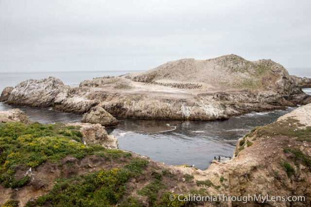
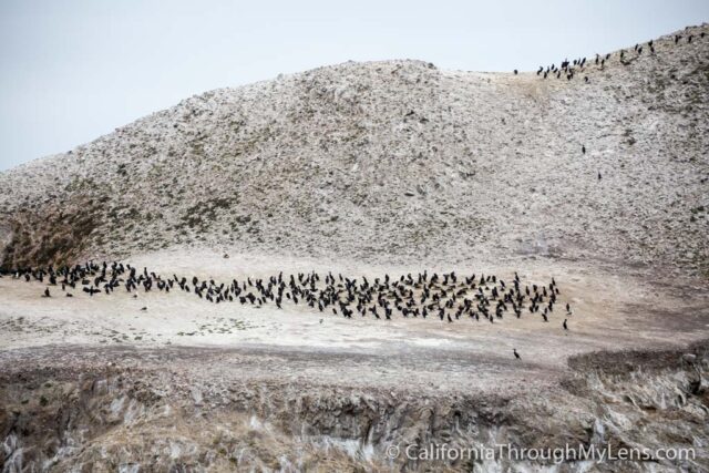
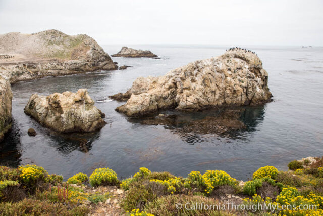
From here, you can also see bird rock in the distance; it is the massive rock out in the water with hundreds of birds sitting on it. This is the destination for the hike.

Bird Rock Trail-6

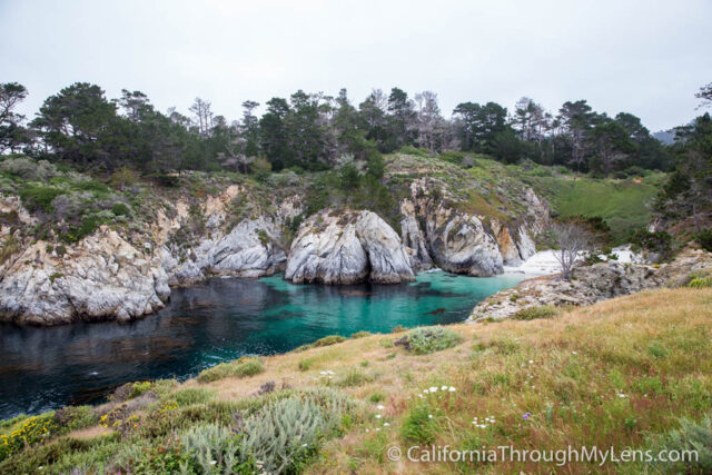
The trail then bends around a small hill and shows you Gibson Beach below you, another beach you can walk down too.

Bird Rock Trail-7

It then heads around to Pelican Point, which is the ultimate end goal of the trail.

Bird Rock Trail-8

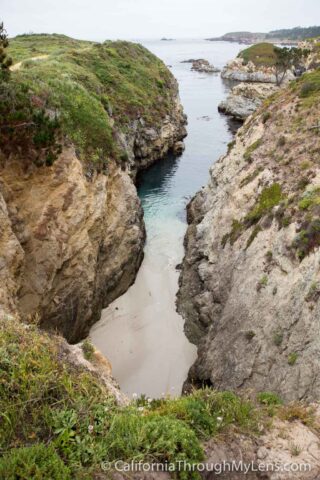
Lastly, there is another small cove that you will pass here, and that provides another excellent photo opportunity.

Bird Rock Trail-9

The trail then ends at the lookout point for bird rock, which is a flat area that provides a magnificent 180-degree view of the coast and the birds.

Bird Rock Trail-11

I found this spot to be awesome as there were so many birds, and they were all collected on a few small rocks.

Bird Rock Trail-15

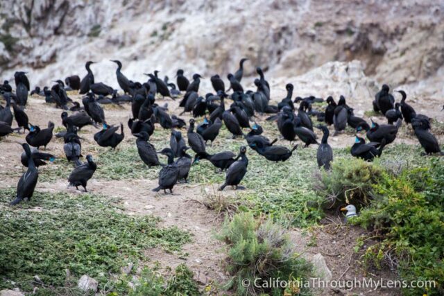
I especially liked the seagulls that looked like they were infiltrating the other black birds in the image above.

Bird Rock Trail-12

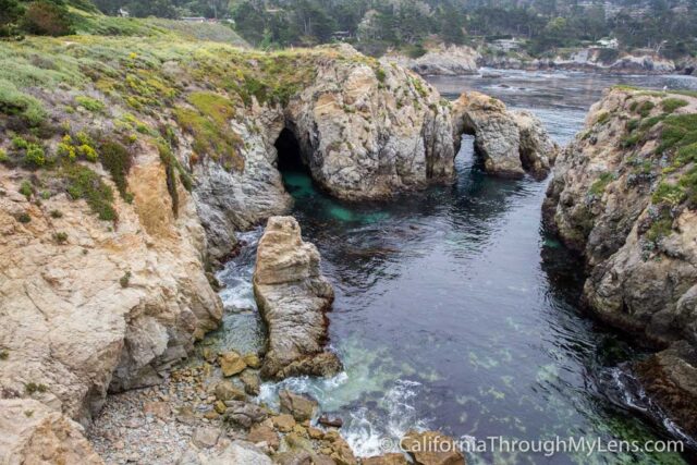
There is also a rock arch in the water to the left of you that you can see as well. It is stunning and another great photo spot.

Bird Rock Trail-13

After that, you will head back the way you came, but make sure to take your time as this truly is a great wildlife viewing area.

Bird Rock Trail-10

As you can see, Point Lobos is fantastic, and this is only one of the many trails. I can’t wait to go back and explore more, let me know what your favorite trail is in the comments below.

Filed Under: Hikes, Northern California, State Parks, Wildlife Tagged With: Carmel, Monterey County

Interested in supporting this blog?

This blog is simply a hobby and labor of love for me. If you have enjoyed the posts consider sharing it with your friends. I want as many people as possible to explore this state and you can help by letting them know about all of the great spots!

Join the Newsletter

Subscribe for the four day welcome series and to get the latest content every month.

    We won’t send you spam. Unsubscribe at any time.

    About JoshMc

    Thanks for checking out the blog, I am happy to be sharing my adventures with you! You can get to know me by reading my about me, which includes a video and additional information on the site, myself and my full disclosure. Also, follow along on Twitter here or read all of my posts on this blog here.

    Primary Sidebar

    About

    Josh from California Through My Lens My name is Josh, and for the last 10 years, I have been exploring as much of California as I possibly can. This site is a collection of those adventures to encourage you to get out and explore California for yourself. More about me.

    Popular Posts

    The Big List of Strange, Fun & Unique Attractions in Southern California
    Pacific Coast Highway: Where to Stop on Your Road Trip
    Top Hiking Trails in Southern California
    Fun Stops on the Drive from Los Angeles to Las Vegas
    24 Things to do in Downtown LA
    17 Things to do in Lake Tahoe
    Donner Pass, Summit Tunnel Hike: Old Abandoned Railroad

    Categories

    Other Resources


    Footer

    Search the site

    Additional Information

    Privacy Policy

    About Us

    Copyright California Through My Lens, LLC © 2021