• Skip to primary navigation
  • Skip to main content
  • Skip to primary sidebar
  • Skip to footer

California Through My Lens

California Travel, Food, Hiking & Road Trips

  • Start Here
  • Explore
    • Beaches
    • Bizarre
    • Caves
    • Food
    • Hikes
    • Historical Structures
    • Natural Wonders
    • Waterfalls
  • Drive
    • El Camino Real
    • Highway 395
    • LA to Las Vegas
    • Pacific Coast Highway
    • Route 66
  • National Parks
    • Channel Islands
    • Death Valley
    • Joshua Tree
    • Lassen Volcanic
    • Pinnacles
    • Redwoods
    • Sequoia & Kings Canyon
    • Yosemite
  • Cities
    • Los Angeles
    • Palm Springs
    • Sacramento
    • San Diego
    • San Francisco
  • Resources
    • Day Trip Ideas
    • Road Trip eBooks
    • Hotels
    • My Favorite Travel Products
    • Travel Videos
  • Browse By …
    • Map Of Locations
    • Cities
    • Counties
    • National Parks
    • State Parks

Donner Memorial State Park: Donner Camp Trail

Last Modified: February 17, 2020

5shares
  • Share
  • Tweet

One of the more tragic parts of America’s westward expansion is the story of the Donner party and their fateful trip over the Sierras. Located in what is now the town of Truckee, there is both a museum and an interpretive trail (in different areas of Truckee), known as the Donner Camp Trail, which gives you a glimpse into the infamous journey. Here is all the information if you want to see it for yourself.

Donner Camp Trail 13

Details

  • Half mile walking trail
  • Dogs allowed on a leash
  • Information from my visit in 2015
  • Getting there: Go north on Highway 89, about 3 miles past I-80 and you will see it on the right

History

Taken from here:

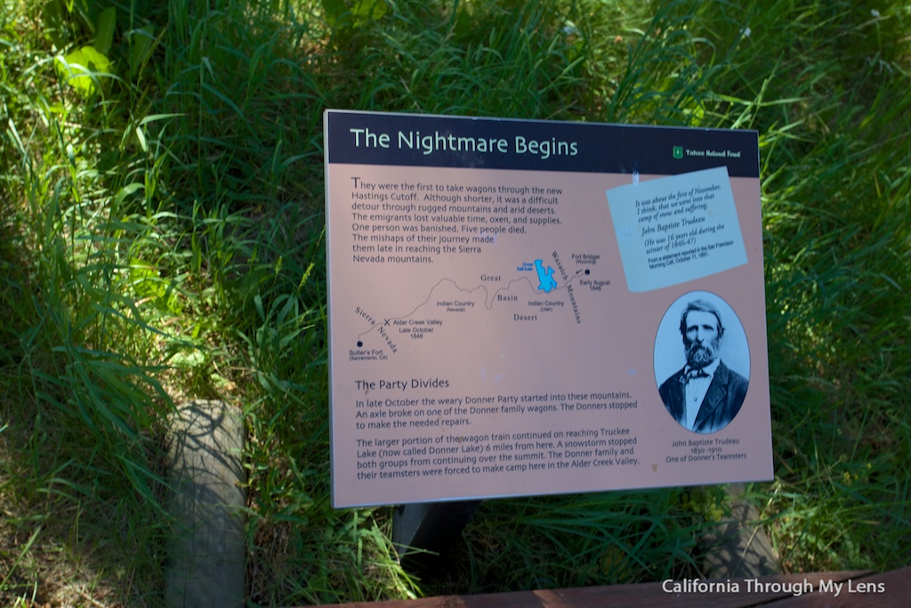
In April 1846, a group of Midwestern families left Independence, Missouri, bound for California. Their wagon train rolled over the Great Plains and through the Rockies but was seriously delayed when a “shortcut” leading southwest was anything but that. A breakdown in civilized behavior followed: the emigrants quarreled constantly; one man killed another; an older man was left on the trail to die. 

Donner Camp Trail 17

An early and severe snowstorm that prevented passage over the High Sierra forced the ill-fated party to spend the winter near present-day Truckee. Forty-one of the 89 would-be settlers perished. When their provisions and oxen were consumed, the desperate emigrants finally cannibalized their dead friends and relatives. 

The Trail

Donner Camp Trail 15

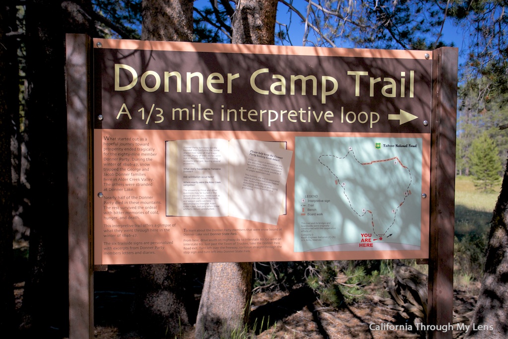
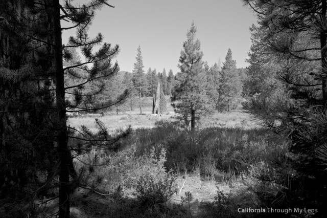
After arriving in the parking lot right off Highway 89, you will follow the signs to start the interpretive trail. This trail is completely flat the entire time and even has a few small wooden bridges to go over the creeks running through the area.

Donner Camp Trail 12

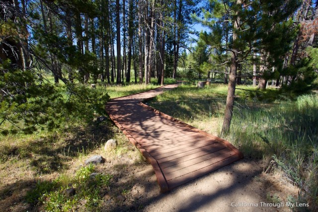
Along the trail, you will see five different signs that tell you both the story of the area and of the Donner Party.

Donner Camp Trail 10

I found this story to be very interesting as I had not heard a lot about the fabled expedition other than the cannibal part (whether true or not) that everyone seems to hear about. It was nice to be able to add background to that part of the story as well.

Donner Camp Trail 11

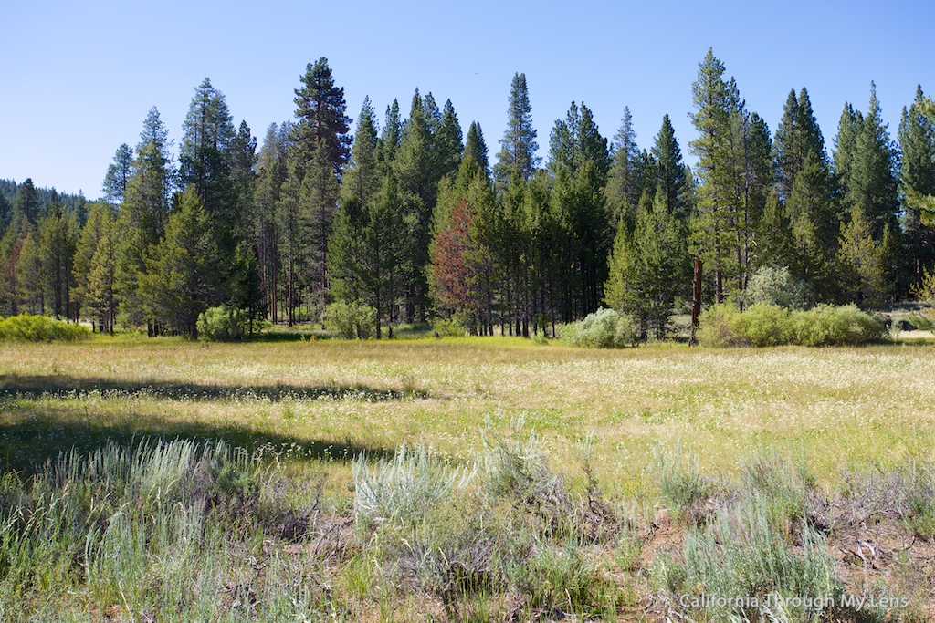
The area that you walk through is incredibly beautiful and has a lush forest with small grassy fields. It was beautiful in the summer, but I imagine it is pretty barren in the winter.

Donner Camp Trail 6

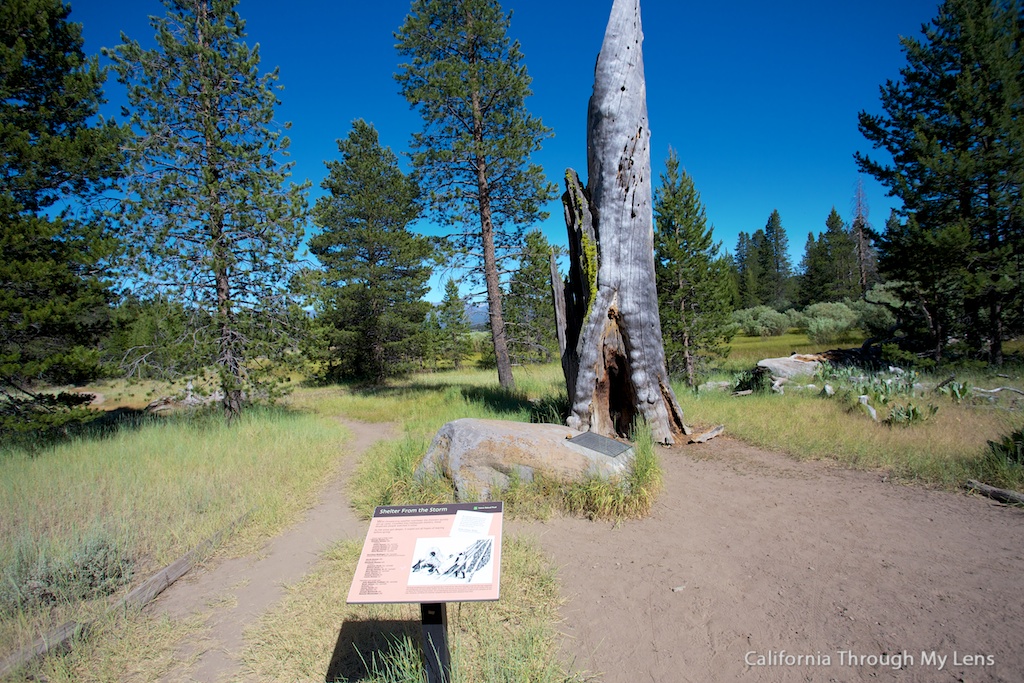
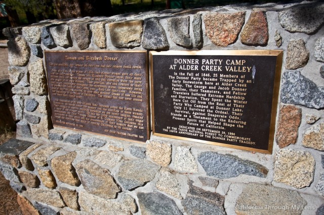
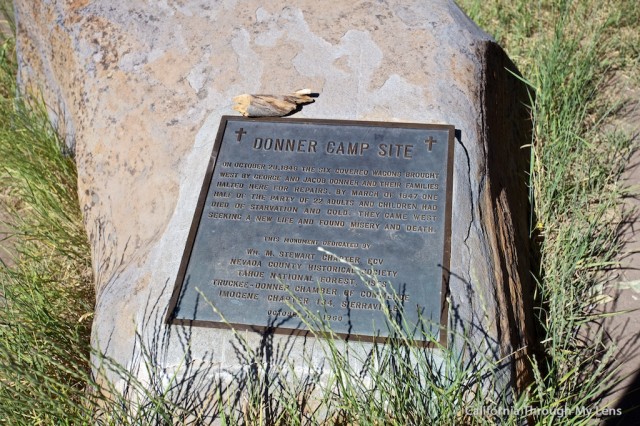
About halfway through the trail, you will see the plaque that is dedicated to the party itself, as it was their camp spot. It is under a massive dead tree.

Donner Camp Trail 7

As you continue along the path, the plaques start to tell you about the outcome of the “shortcut” that they took and the number of people who they lost. It is a pretty depressing story, to say the least, but there were a decent amount of people that did survive the ordeal.

Donner Camp Trail 5

All in all, this small park is a great way to understand the struggles and hardships of westward expansion in the 1800’s. It is a great place to see on a road trip as it will give a more human element to the famous story. It shouldn’t take more than 15-30 minutes to see the whole site. Let me know in the comments if you have been.

Get Directions

Filed Under: Historical Structures, Northern California, State Parks Tagged With: Nevada County, North Lake Tahoe, Truckee

Interested in supporting this blog?

This blog is simply a hobby and labor of love for me. If you have enjoyed the posts consider sharing it with your friends. I want as many people as possible to explore this state and you can help by letting them know about all of the great spots!

Join the Newsletter

Subscribe for the four day welcome series and to get the latest content every month.

    We won’t send you spam. Unsubscribe at any time.

    About JoshMc

    Thanks for checking out the blog, I am happy to be sharing my adventures with you! You can get to know me by reading my about me, which includes a video and additional information on the site, myself and my full disclosure. Also, follow along on Twitter here or read all of my posts on this blog here.

    Primary Sidebar

    About

    Josh from California Through My Lens I'm a travel junkie strapped down to one state, focused on seeing as much of it as I can and encouraging others to do the same. More about me.

    Popular Posts

    The Big List of Strange, Fun & Unique Attractions in Southern California
    Pacific Coast Highway: Where to Stop on Your Road Trip
    Top Hiking Trails in Southern California
    Fun Stops on the Drive from Los Angeles to Las Vegas
    24 Things to do in Downtown LA
    17 Things to do in Lake Tahoe
    Donner Pass, Summit Tunnel Hike: Old Abandoned Railroad

    Categories

    Other Resources


    Footer

    Search the site

    Additional Information

    Privacy Policy

    About Us

    Copyright © 2021 · Metro Pro on Genesis Framework · WordPress · Log in

    Coronavirus February 2021 Update: Please note that some information in the posts may have changed and some places may be closed.