• Skip to primary navigation
  • Skip to main content
  • Skip to primary sidebar
  • Skip to footer

California Through My Lens

California Travel, Food, Hiking & Road Trips

  • Start Here
  • Explore
    • Beaches
    • Bizarre
    • Caves
    • Food
    • Hikes
    • Historical Structures
    • Natural Wonders
    • Waterfalls
  • Drive
    • El Camino Real
    • Highway 395
    • LA to Las Vegas
    • Pacific Coast Highway
    • Route 66
  • National Parks
    • Channel Islands
    • Death Valley
    • Joshua Tree
    • Lassen Volcanic
    • Pinnacles
    • Redwoods
    • Sequoia & Kings Canyon
    • Yosemite
  • Cities
    • Los Angeles
    • Palm Springs
    • Sacramento
    • San Diego
    • San Francisco
  • Resources
    • Day Trip Ideas
    • Road Trip eBooks
    • Hotels
    • My Favorite Travel Products
    • Travel Videos
  • Browse By …
    • Map Of Locations
    • Cities
    • Counties
    • National Parks
    • State Parks

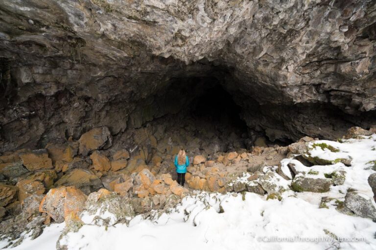
Gaviota Wind Caves Hike on Highway 101

Last Modified: December 20, 2019

18shares
  • Share
  • Tweet

I have driven up to San Luis Obispo many times and always enjoy the stretch of coast that starts from Santa Barbara and ends as you turn inland near Gaviota. On a recent drive though, I decided I should stop there and see what the state park had to offer. The trail I chose to try went up to the caves that you can see from the highway. They are carved out by the way the wind moves through that area and are known as the Gaviota wind caves. It was a challenging and fun hike to a unique formation. Here is all the information.

Gaviota Wind Caves 27

Details

  • About 4 miles round trip
  • 600 feet of elevation
  • A lot of uphill
  • Free parking
  • I wrote this in 2015

As a caveat, this trail is not as easy as the stats make it sound. All of the elevation is in the last half mile, and if it is warm outside, bring a lot of water as there is no shade.

Gaviota Wind Caves 19

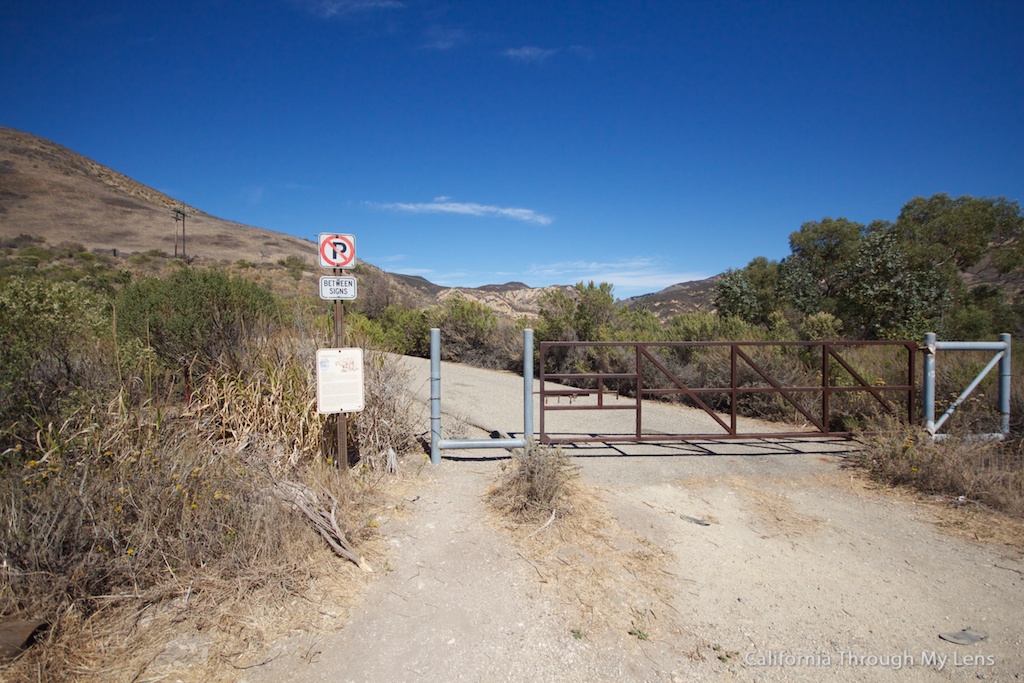
After exiting the road at Gaviota Campground, you will keep right to go up the hill from the campground entrance. When you reach the top of the hill, you will immediately park on the right-hand side next to the mountain lions sign and the above gate.

Gaviota Wind Caves 23

From here, you will walk the dirt road for about a mile and a half. As you are walking, you will see the above single track heading up into the hill by the caves.

Gaviota Wind Caves 2

As you get closer, you will see the spur for this trail and can start the steep ascent up into the hills. I say steep because this trail literally goes straight up. There are relatively no switchbacks, which makes you realize why switchbacks were invented as you are just going straight up a steep incline.

Gaviota Wind Caves 8

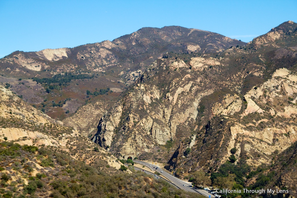
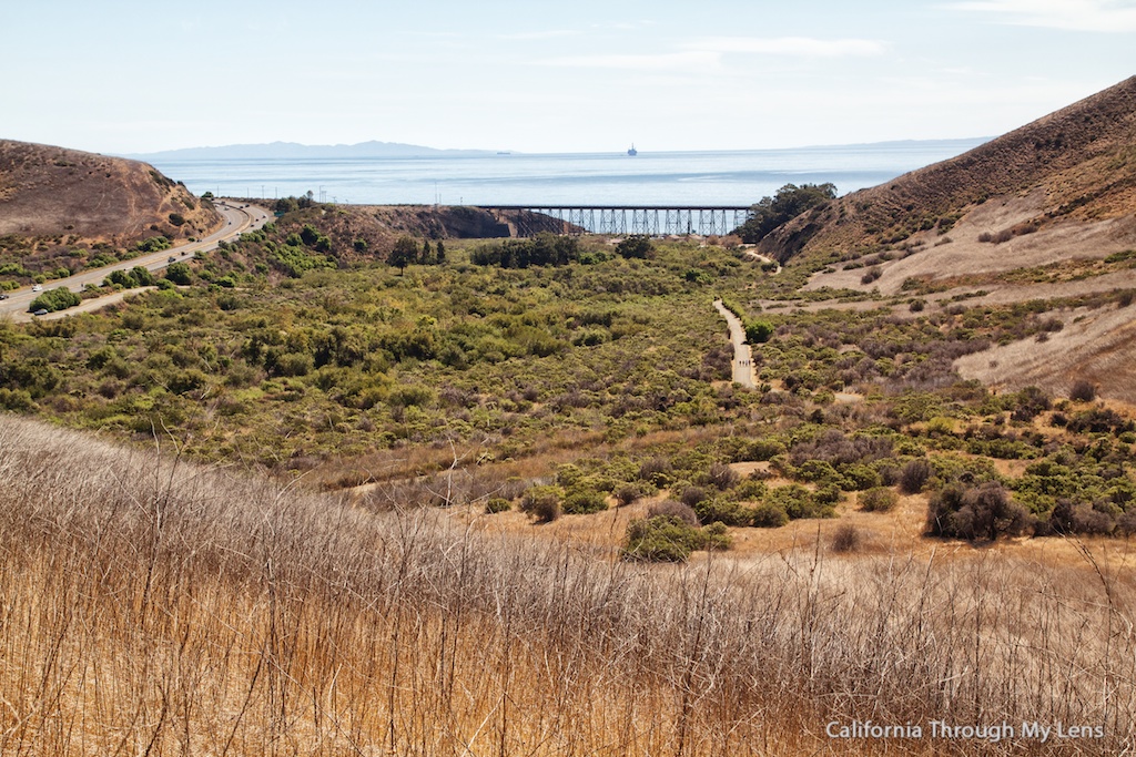
On top of the first small hill, you will have a beautiful view of the coast one way and the tunnel and highway the other. Continue climbing and you will get closer to the caves.

Gaviota Wind Caves 26

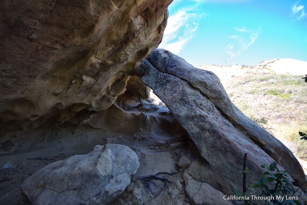
Once you get over the last hill and get close to the base of the caves, look to your left and check out the cave standing alone. This is one of the bigger and most intricate caves you will see and is also a great place for shade if you went on a hot day like us (as there is almost no shade on this trail).

Gaviota Wind Caves 17

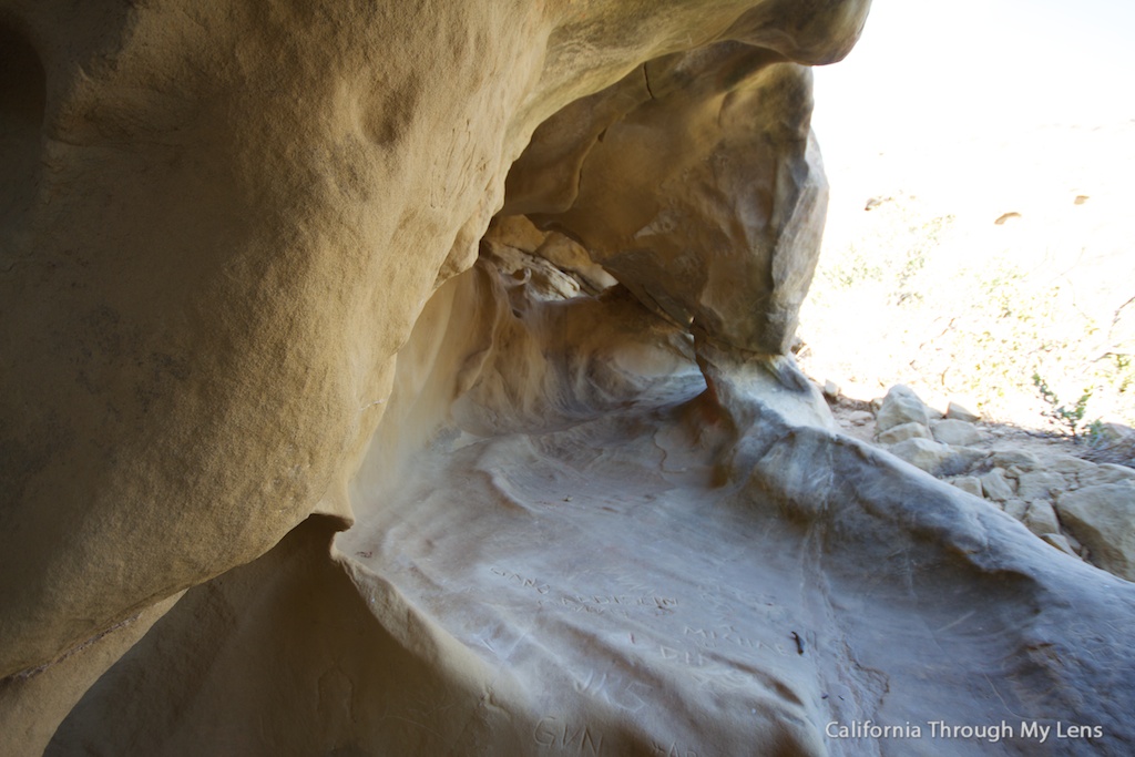
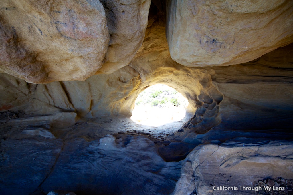
From here, you will continue up whichever trail is the most worn as there seems to be a lot, then push until you reach the top of the caves area. Walk around to the back, and you will see a perfectly worn wind cave that you can sit in and enjoy the below view from.

Gaviota Wind Caves 9

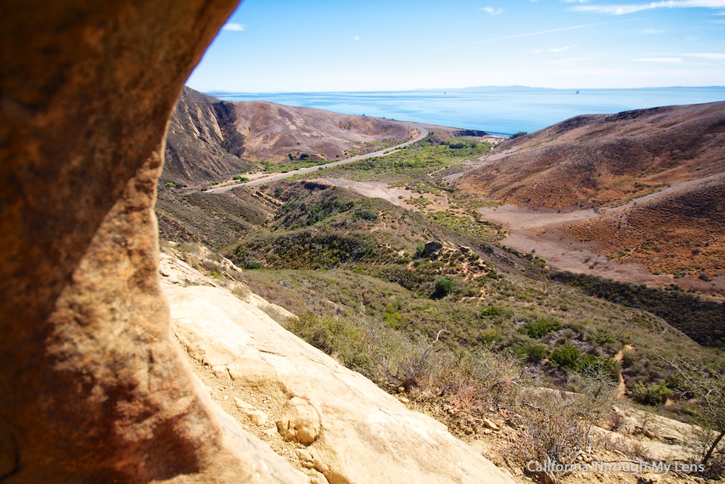
From here, continue to explore and take in the views of the coast if it is clear. There are plenty of small and large caves to explore.

Gaviota Wind Caves 3

On the way back down, I suggest cutting in towards the other caves at the base as there is a lot of unique stuff in this area. It is crazy to think these are made just by the wind and time. After that, proceed back the way you came and enjoy the coast all the way down.

Gaviota Wind Caves 16

Let me know what you think of this trail if you do it.

Filed Under: Caves, Central California, Hikes, Pacific Coast Highway Road Trip Stops Tagged With: featured, Goleta, Santa Barbara County

Interested in supporting this blog?

This blog is simply a hobby and labor of love for me. If you have enjoyed the posts consider sharing it with your friends. I want as many people as possible to explore this state and you can help by letting them know about all of the great spots!

Join the Newsletter

Subscribe for the four day welcome series and to get the latest content every month.

    We won’t send you spam. Unsubscribe at any time.

    About JoshMc

    Thanks for checking out the blog, I am happy to be sharing my adventures with you! You can get to know me by reading my about me, which includes a video and additional information on the site, myself and my full disclosure. Also, follow along on Twitter here or read all of my posts on this blog here.

    Primary Sidebar

    About

    Josh from California Through My Lens I'm a travel junkie strapped down to one state, focused on seeing as much of it as I can and encouraging others to do the same. More about me.

    Popular Posts

    The Big List of Strange, Fun & Unique Attractions in Southern California
    Pacific Coast Highway: Where to Stop on Your Road Trip
    Top Hiking Trails in Southern California
    Fun Stops on the Drive from Los Angeles to Las Vegas
    24 Things to do in Downtown LA
    17 Things to do in Lake Tahoe
    Donner Pass, Summit Tunnel Hike: Old Abandoned Railroad

    Categories

    Other Resources


    Footer

    Search the site

    Additional Information

    Privacy Policy

    About Us

    Copyright © 2021 · Metro Pro on Genesis Framework · WordPress · Log in

    Coronavirus January 2021 Update: Please note that some information in the posts may have changed and some places may be closed.