Little Lakes Valley Trail: Hiking to 8 Lakes Near Rock Creek
Little Lakes Valley is probably one of the most beautiful areas I have been to in the Eastern Sierra. This stunning valley full of dozens of lakes and surrounded by massive craggy peaks is the perfect example of what makes this part of California so amazing. This 8-mile round trip hike will take you to 8 lakes as you wind your way through the valley and see stunning views at each turn. While the parking area can be busy, it is worth the effort to plan a trip to this stunning area of California. Check it out, and let me know what you think in the comments.
Details
- 8 miles round trip
- 1,000 feet of elevation
- Trailhead location: Mosquito Flats near Rock Creek
- Information from my visit in 2021
Getting There
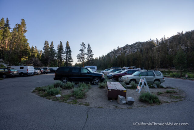
The trailhead for Little Lakes Valley is located in the Mosquito Flats area of Rock Creek. It is accessed from Highway 395 between Bishop and Mammoth by turning on Rock Creek Road and taking it all the way to the end. Eventually, the road becomes a one-lane road which you will take (watch out for cars going the opposite way) back to the trailhead. NOTE: This area is crazy busy, so get there early (before 7:30 AM), especially on summer weekends.
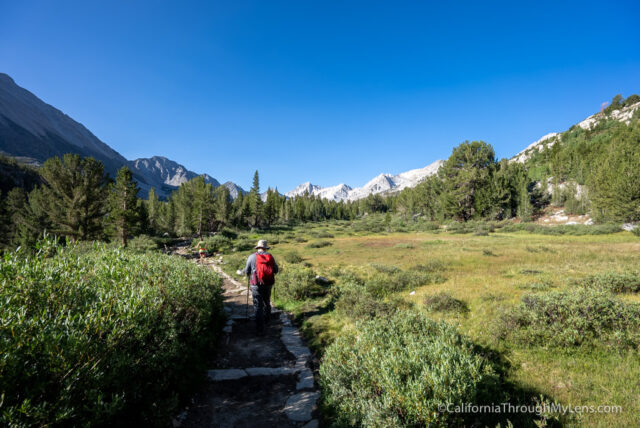
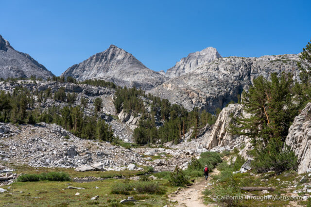
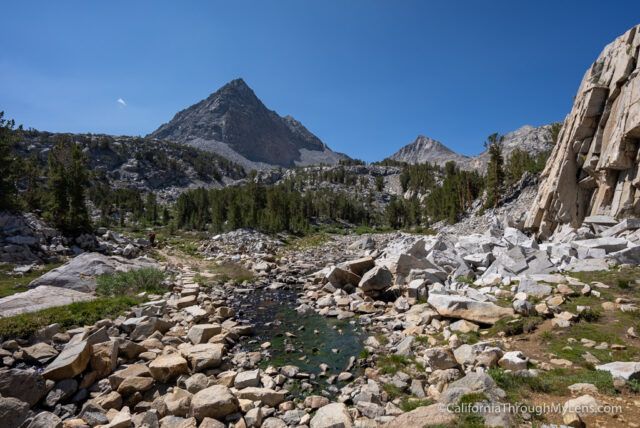
The Trail to Little Lakes Valley
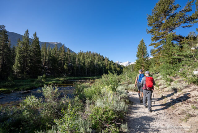
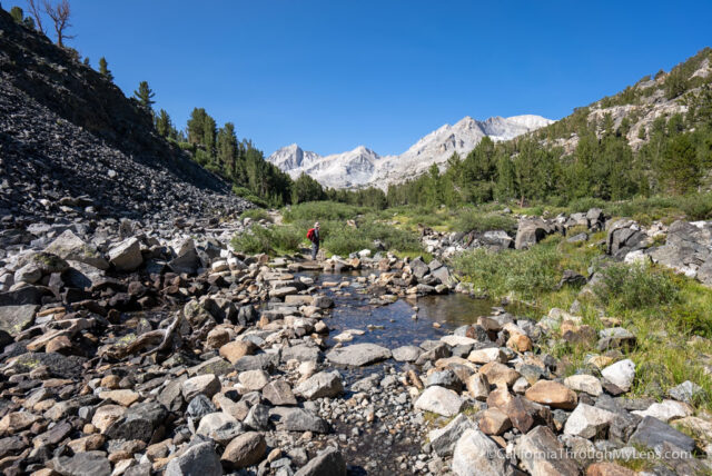
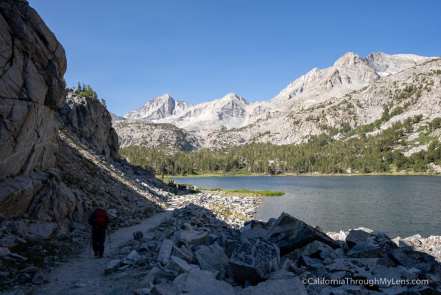
The trail starts at the end of the parking lot by walking past the bathrooms and picnic area. It starts by climbing gradually as you walk along a creek. Lots of people were fly fishing here when I went.
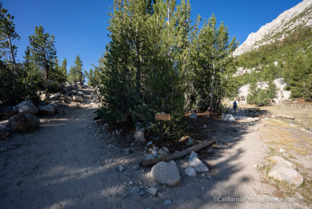
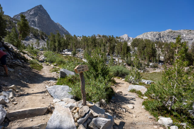
The trail then climbs a small hill before reaching a split for Little Lakes Valley and Mono Pass.
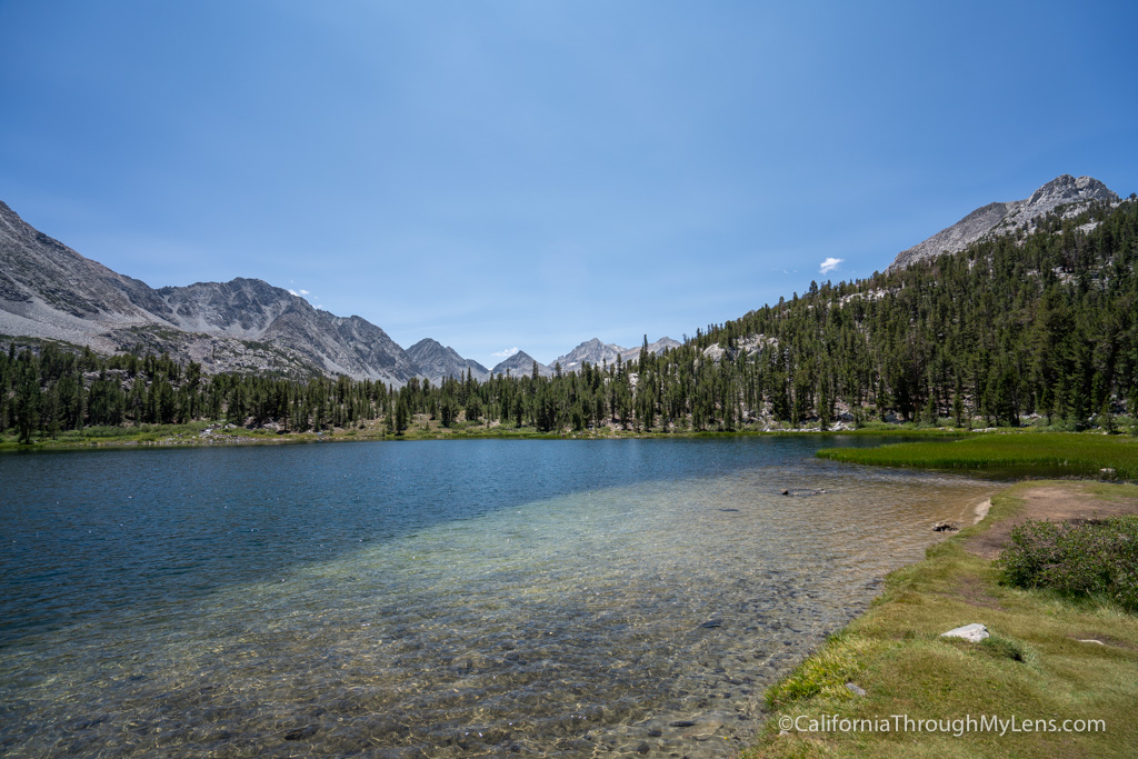
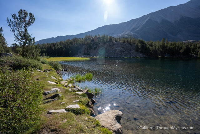
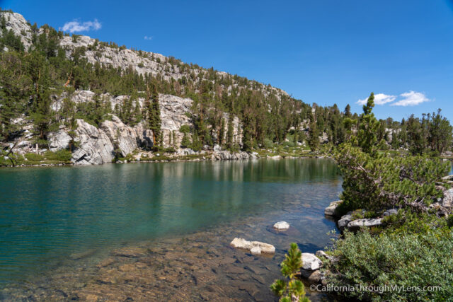
Keep left for Little Lakes Valley here, and look to the left to see your first lake, Mack Lake. Mack Lake is a beautiful example of what you will see on this trail, and it is one of 8 lakes you will pass on the hike. I recommend just hiking out to the end to see them all, then going back to whatever lake you liked best to relax at.
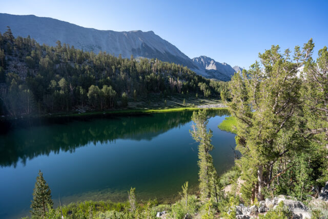
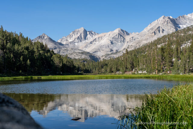
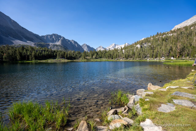
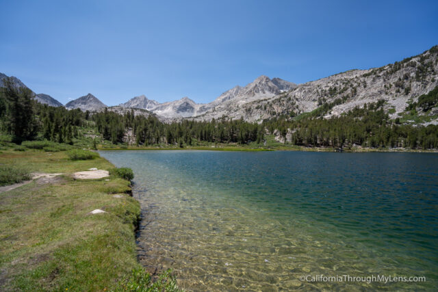
From Mack Lake, the trail heads downhill to the second lake, Marsh Lake.
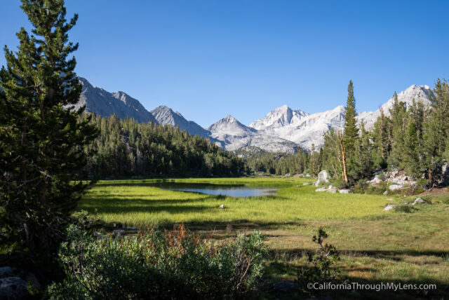
Marsh Lake was one of my favorites for photos as the reflections of the mountains in the distance were stunning. It wouldn’t be a good lake for swimming though.
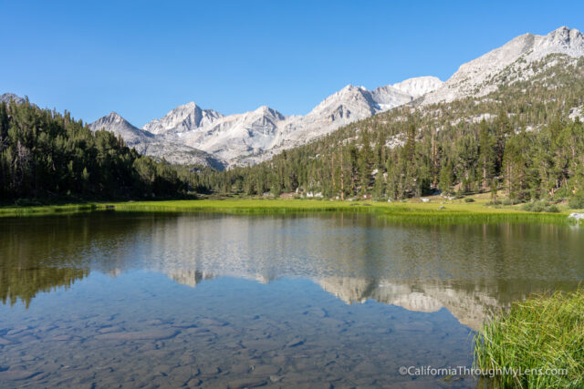
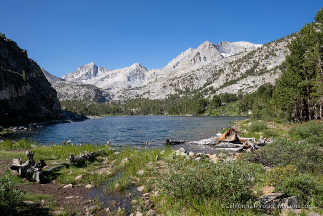
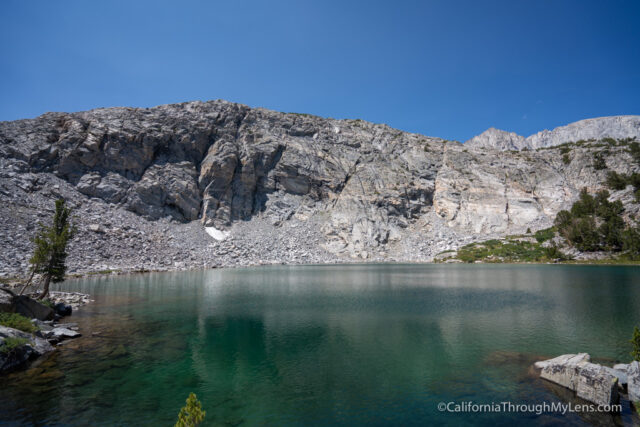
It is only a short walk from Marsh Lake till you see Heart Lake, my favorite of the lakes.
The approach to Heart Lake is amazing as you cross a bridge and make your way down to it.
This lake is stunning and has a nice sand shelf for walking out in the water. It is one of the most popular lakes, and there are always people there.
Leaving Heart Lake, you will make your way around it and get many different views as you continue the trail.
As you say goodbye to Heart Lake, you will hike uphill for a little bit till you get to an overlook for Box Lake.
This lake looked really nice, with clear water, but it didn’t have a great way down to it, so we just soaked it in and took a snack break on the rocks.
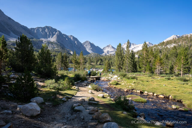
From Box Lake, you will head down towards a nice little meadow and creek before starting a small uphill climb.
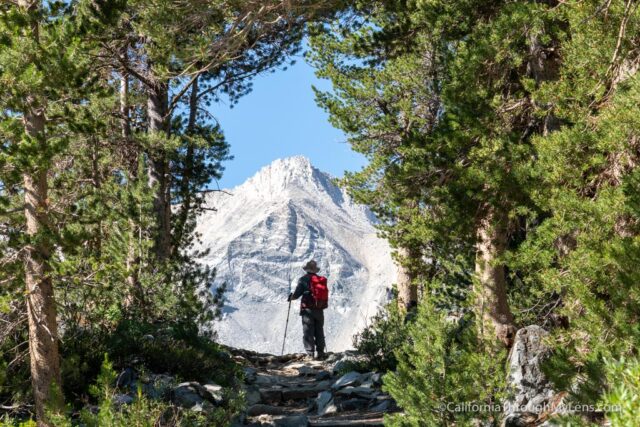
This climb gives way to an amazing little tree tunnel that perfectly frames one of the backcountry peaks.
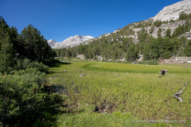
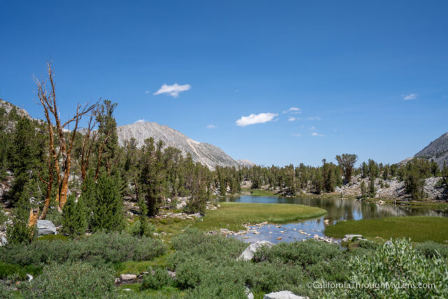
As you head through those trees, you will cross the water and walk along a meadow as you make your way to Long Lake.
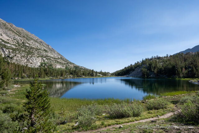
Long Lake is the longest of the lakes you walk along, haha. It is a great one to hang out at when you come back as well since it has lots of grass along the lake and lots of space, so you are not around other people. There were a lot of people fishing here too.
The trail goes alongside Long Lake, and just the trail itself is stunning, with the water on one side and massive peaks out in the distance.
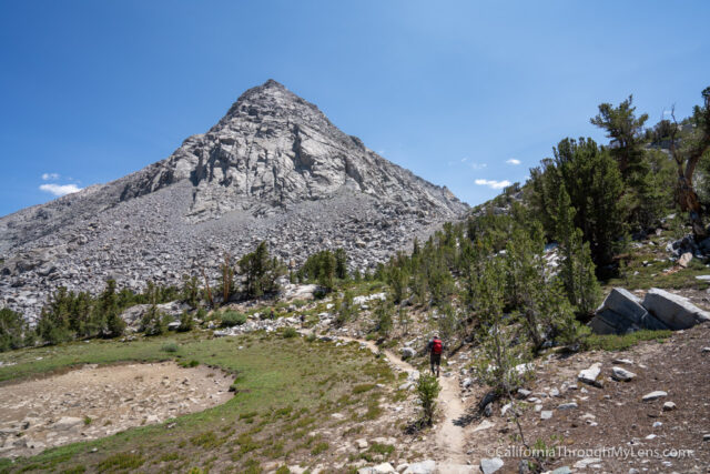
As you make it to the end of Long Lake, this is where the trail really starts to gain elevation. Remember, you are at over 10,500 feet, so it feels a lot harder than it is.

You will be walking uphill for a little while until you reach a split for Chickenfoot Lake and Gem Lakes.
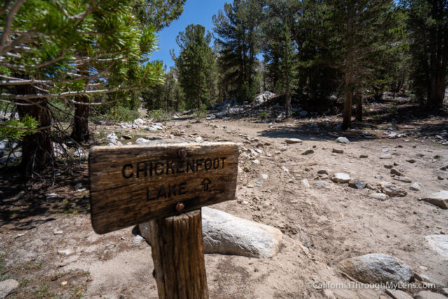
Gem Lake is the ultimate goal, but it is not really out of the way to go to Chickenfoot, so I recommend heading there and then connecting back with the trail.
Chickenfoot is another beautiful lake; it is well worth the extra effort to see it and the meadow/creek you walk along that feeds it.

Be sure to have an AllTrails download as the trail to connect back with the Gem Lake Trail is a little confusing.
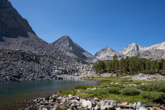
Once you are back on the main trail, it reaches a pretty stunning area of the Little Lakes Valley. Here, the mountains you have seen for most of the trail feel like they are towering above you since you are so close to them.
The trail continues with small ups and downs before it splits at the junction for Morgan Pass and Gem Lakes. We headed to Gem Lakes, which was the end goal for this hike.
The last portion of the trail is pretty much flat, and it has great views over meadows, small creeks, and other smaller lakes.
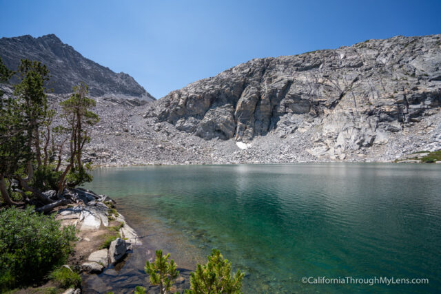
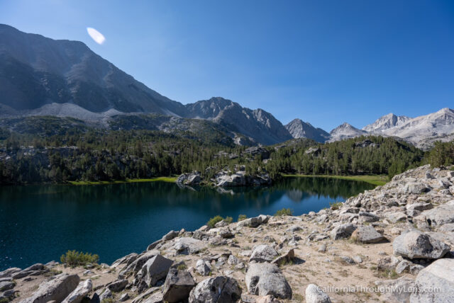
Eventually, you will reach Gem Lake, one of the most beautiful lakes on the trail. This lake sits near 11,000 feet and even had small patches of snow melting to feed it.
The lake is stunning from every angle, and it is a great place to sit and relax while you soak it all in.
I put my feet in the lake as well, but it was freezing cold, so I did not jump in.
After relaxing for a while, we started the trail back and headed towards Heart Lake. This was the easiest to swim at, so we jumped in the water when we made it back, culminating our time in the Little Lakes Valley.
Honestly, this is one of the best hikes in California, and I highly recommend it. The amount of amazing views you see in only 8 miles is hard to beat and something you will never forget. Check it out, and let me know what you think in the comments.