Hiking the Panorama Trail in Yosemite National Park
The Panorama Trail in Yosemite National Park is one of the park’s most beautiful trails with uninterrupted views of Half Dome and multiple waterfalls along the way. It’s a great example of what the park has to offer, and if you visit when the shuttle is available, then you can take the 8 mile hike downhill most of the way. Here is all the information.
Details
- 8 miles one way
- Descends over 3000 feet and 800 feet of incline one way
- It starts at Glacier Point and descends down to the valley. You must hike back up if you don’t have a second car to shuttle or take the park shuttle when it’s running
- Information from my hike in 2020
Getting There and Shuttle Information
This hike requires a shuttle or two cars if you don’t want to hike back up. There is a shuttle from the valley most years that will take you to Glacier Point. It was not running in 2020, so I had my mom drop me off at the top and meet me in Yosemite Valley when I did it. The trail starts at Glacier Point and ends at Happy Isles, where the Yosemite Valley shuttle picks up to take you to other valley locations.
The Trail
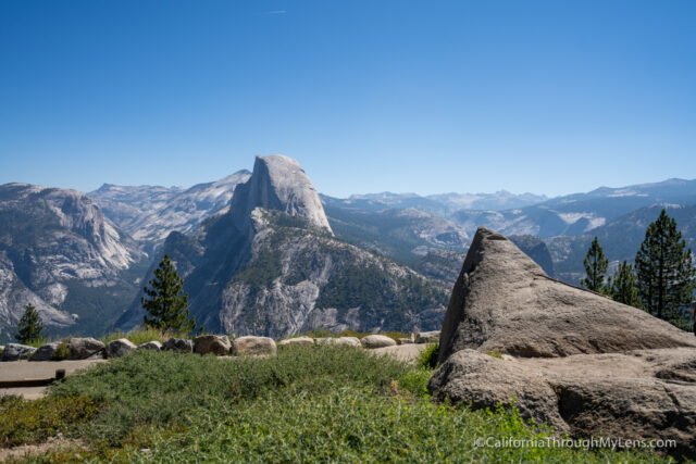
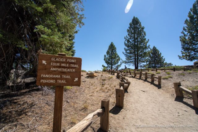
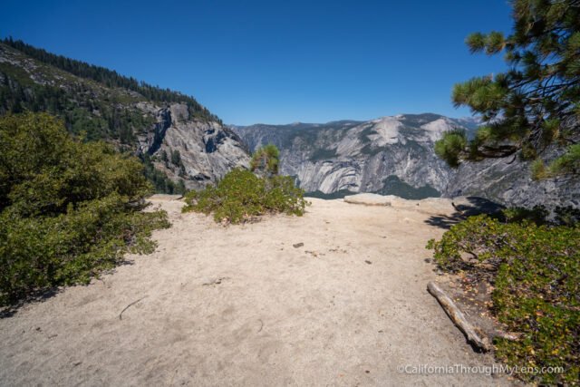
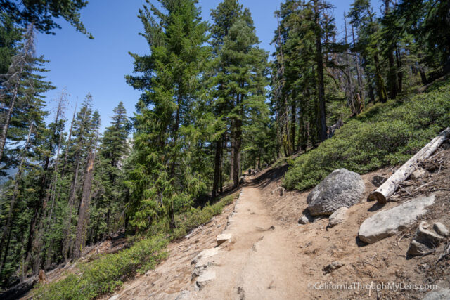
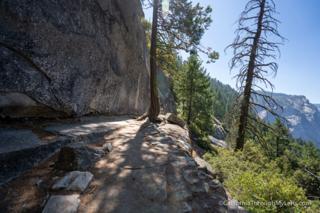
The trail begins at Glacier Point, which is a great area to explore and take photos before starting the hike. The trailhead is near the parking area, and it is well marked.
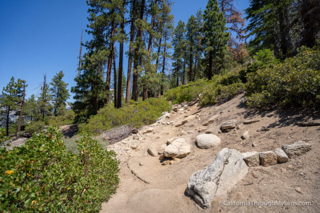
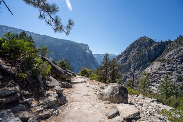
It descends right from the beginning on a set of downhill switchbacks that will take you down and across the mountain.
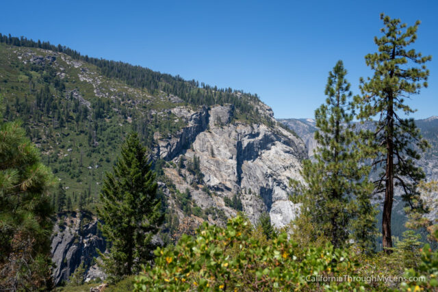
The trail is stunning here, which you may have read about in my Illiloutte Falls post here.
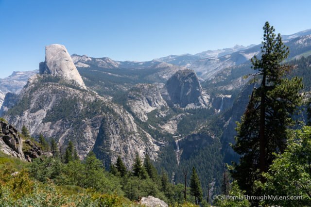
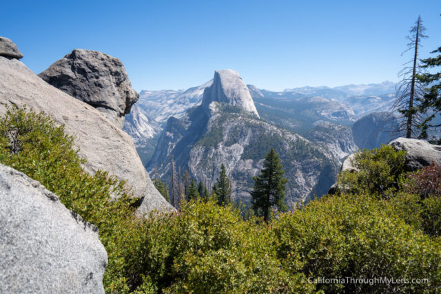
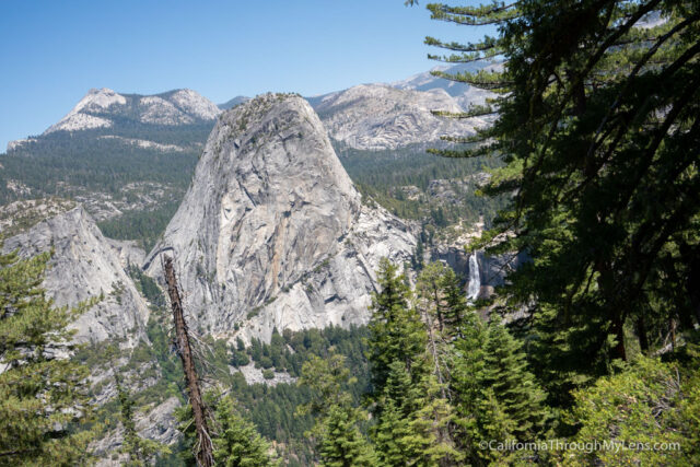
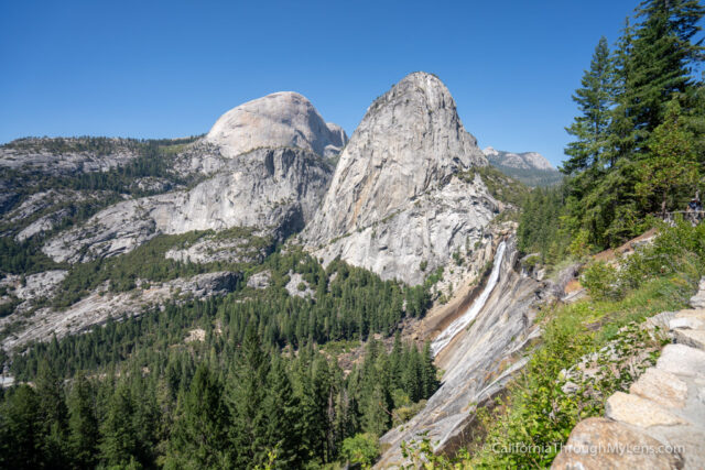
The views are of Half Dome and Vernal / Nevada Falls as you descend.
The trail then starts a steep decline on switchbacks to the overlook for Illiloutte Falls. The overlook here is very sketchy, so watch out and don’t get close to the edge.
This is the waterfall at the end of July, and you can see it in mid-June here.
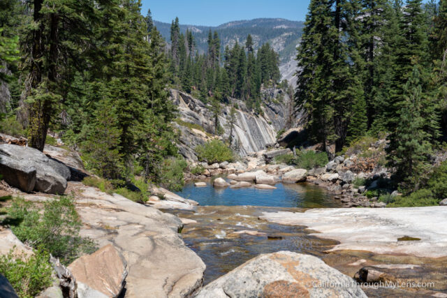
From the waterfall, the trail descends more to Illiloutte Creek.
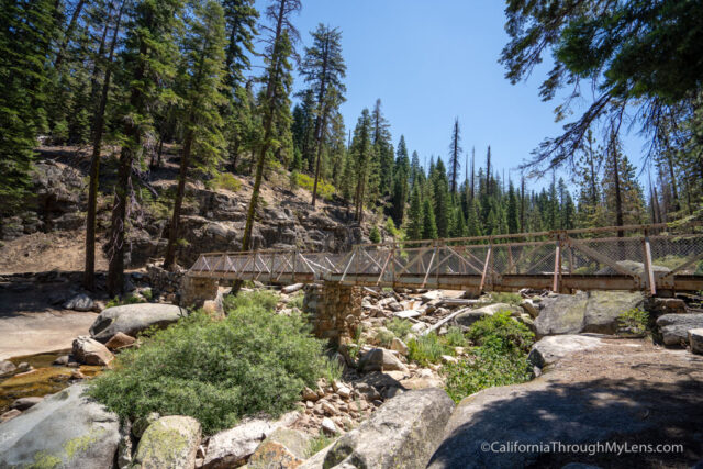
The creek is a popular spot for people to take a break on this trail and there is a cool bridge here that crosses the creek.
As soon as you cross the bridge, you will begin the uphill.
If you did this trail in the heat of summer as I did, then this is where you will be cursing it.
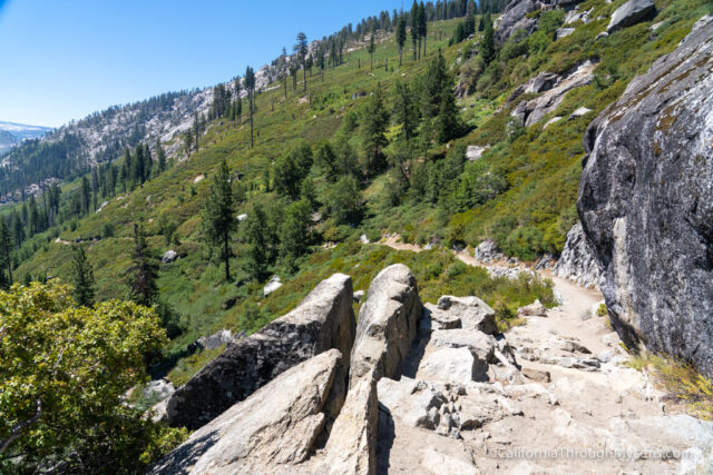
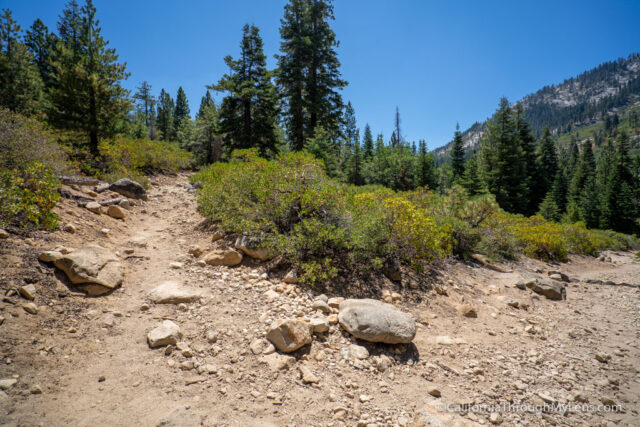
The switchbacks are very exposed here, and the trail climbs steadily.
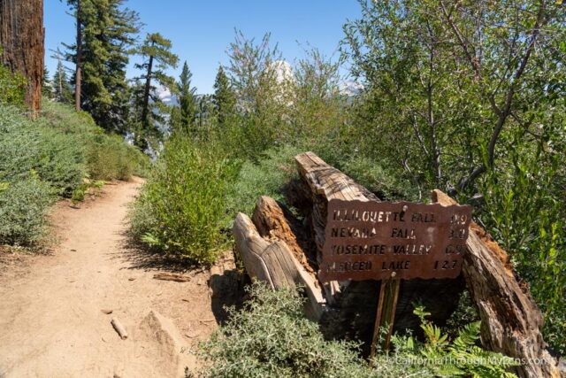
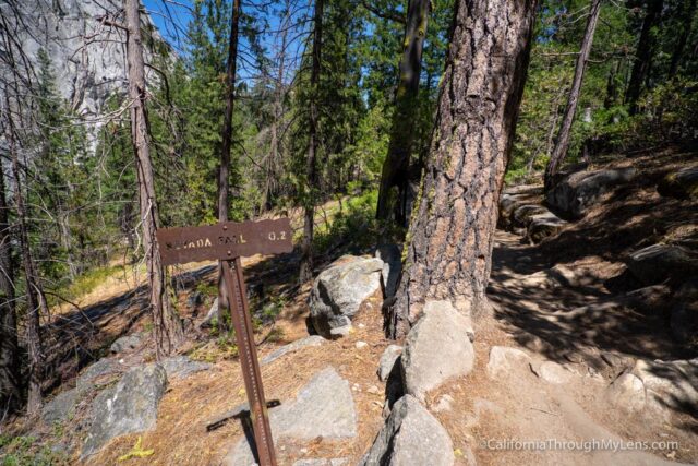
As you ascend, watch on the left for a small spur trail at about 2/3’s of a mile from the creek you crossed.
Panorama Point

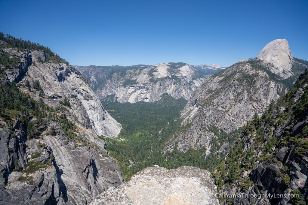
It is easy to miss, but this is the trail to Panorama Point. Panorama Point is a great overlook that has a massive view of Yosemite Valley with no waterfalls, which makes it unique. Again, you have to try hard to find the path to the point though.
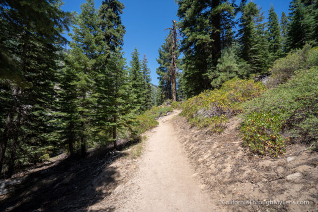
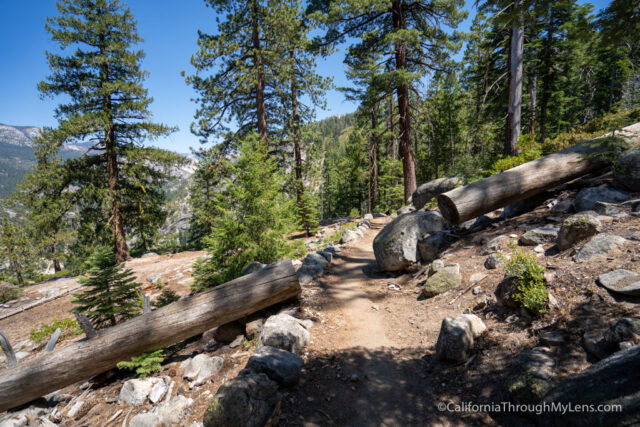
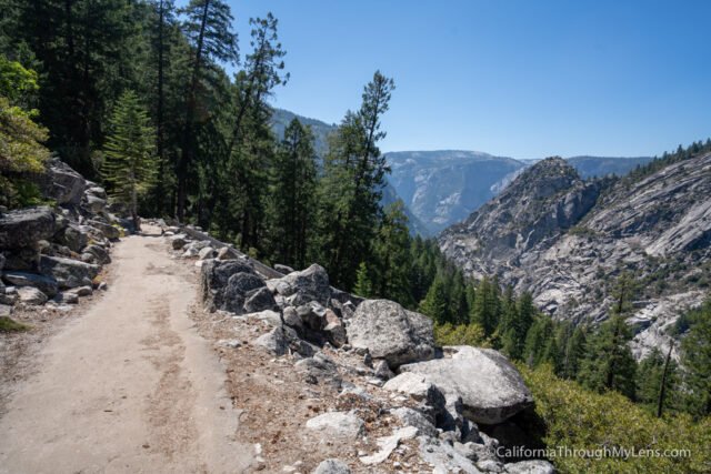
The trail then continues to ascend as you cross more switchbacks.
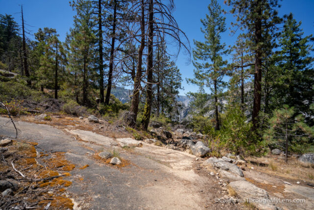
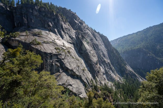
As you gain elevation, the views back towards Glacier Point and Yosemite Falls (if it’s flowing) are great.
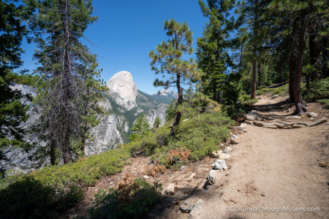
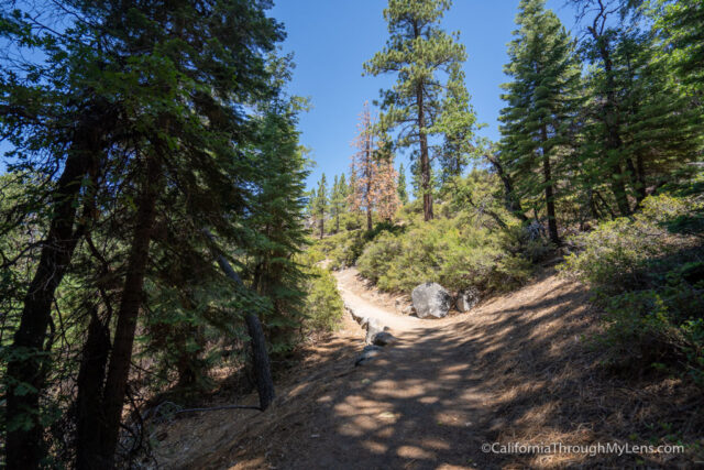
Eventually, you will top out, and the trail will flatten.
From here, the trail is about a mile of flat walking as you make your way towards Nevada Fall.
There are even a few views of the waterfall from here as well.
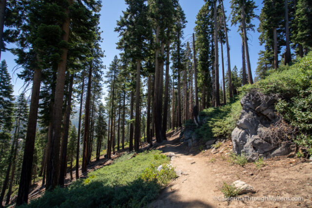
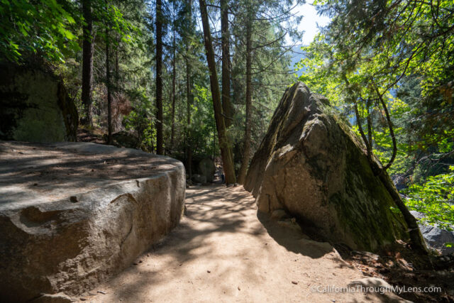
The trail then gets to a junction, and you will start a downhill hike through a forest.
This part is beautiful with lush trees and the sound of the waterfall in the distance.
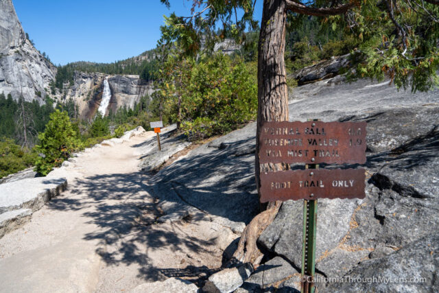
The trail then connects with the John Muir Trail, and you will follow it to Nevada Fall.
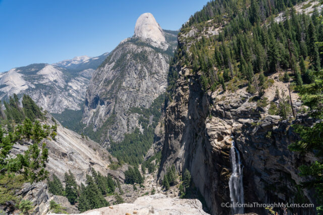
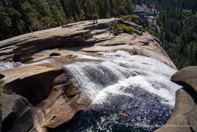
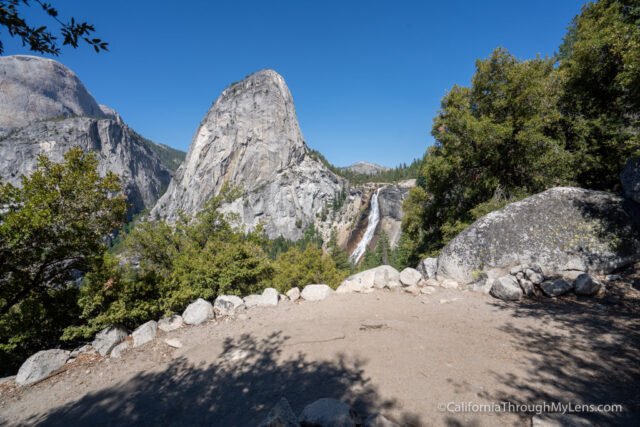
Nevada Fall
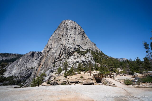
At Nevada Fall, you can soak in the water and the impressive overlook of the waterfall.
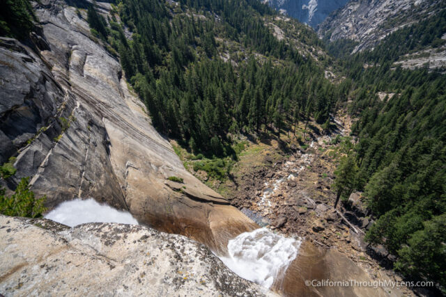
This is where I stopped and had lunch as I took it all in.
Usually, you can choose two ways to descend here, either the Mist Trail or the John Muir Trail. Unfortunately, because of the pandemic in 2020, I could only descend via the John Muir Trail, which is longer and a more gradual hike versus the steep stairs of the Mist Trail.

This closure made it so that I didn’t get to see Vernal Fall up close, which I was hoping for. I have been there many times though and you can read about the Mist Trail here if you are interested.
John Muir Trail
Many people may opt to take the John Muir Trail down anyways because it is a lot easier on the knees; the Mist Trail is notoriously steep.
The John Muir Trail has some great views of Nevada Fall as you descend.
It is pretty scenic in the first half mile or so, but then it goes into a forested area and rarely pokes its head out again.
Eventually, you will reach another split for a trial down to Vernal Fall. Again this was one way because of the pandemic, so I had to keep going down the John Muir Trail.
This is where the trail seems to take a long time.
There are a ton of switchbacks in this section, and it goes on and on.
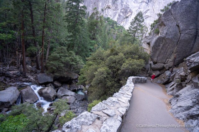
It will eventually reach the junction with the Mist Trail and begin to follow the creek and get a lot more scenic.
You walk along the creek for a little while before getting to the bridge, bathroom and water refill station. This is an excellent place for a break and to fill your water bottle. From here it is less than a mile to the valley.
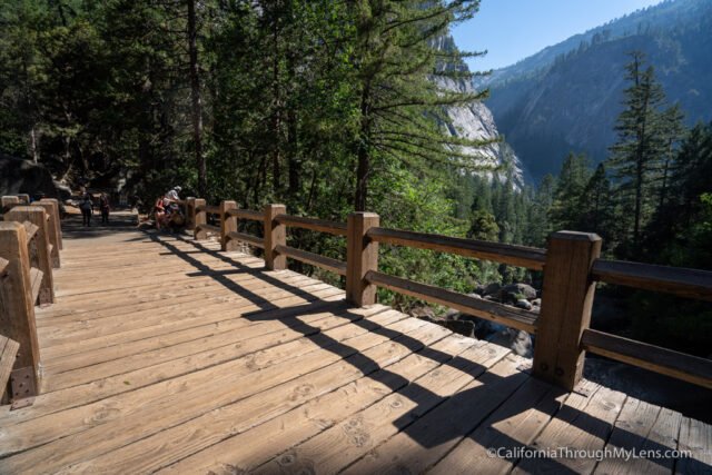
You will start by crossing the bridge, and you can get a view of Vernal Fall in the distance.

The trail then ascends one more time before starting a steep descent along a paved path.
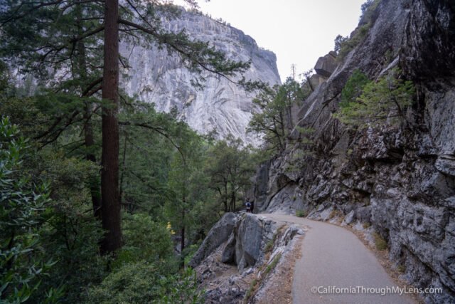
There are a lot of great views of the creek below you and the mountains all around you, many of which you were on top of as you hiked this trail.
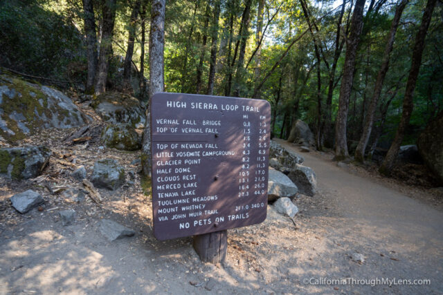
The trail concludes by making it to the creek and the sign that starts the John Muir Trail.
I took the opportunity to sit by the water and soak my feet after this long descent.
All in all, this was a beautiful trail and one of my favorites I have done in Yosemite. It would be better on a different year, when the trail was not one way, but either way, it is a fantastic way to experience some of the valley’s best spots. Check it out and let me know what you think in the comments.
Yosemite Valley, California