Trail Canyon Falls: A 40 Foot Waterfall in Angeles National Forest
Trail Canyon Falls is a somewhat popular trail on the west side of the Angeles National Forest that has a great waterfall. This 4 mile round trip hike is dog-friendly, with multiple stream crossings, and the payoff at the end is the waterfall nestled in a beautiful canyon. It does have a decent amount of elevation and a little scrambling to get down to the base of the falls though, so know that going in. Here is all the information.
Details
- 4 miles
- 800 feet of elevation
- Dog Friendly
- GPX track
- Display an Adventure Pass for parking
- Location: 19333 Gold Canyon Truck Trail, Sunland-Tujunga, CA 91040
- This information was from my visit in 2017
- Read all about my favorite California waterfalls here
Getting There
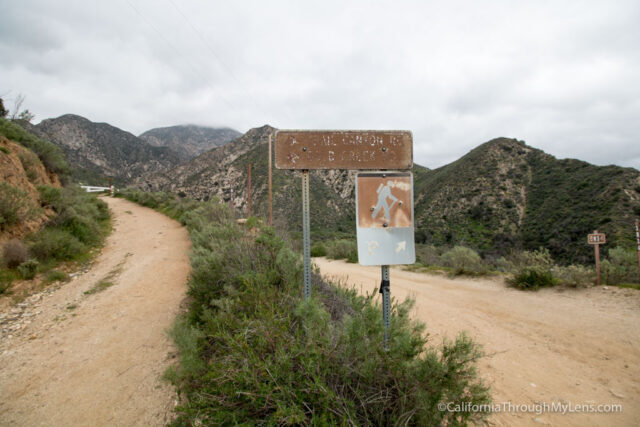
To get to the parking area for Trail Canyon Falls, I would recommend putting “Trail Canyon Falls” into Google Maps and following the directions to Big Tujunga Canyon Road. The GPS may tell you that you can turn off to the left on this road, which is incorrect as the dirt road is locked. You will park along the road (check signs) and display your Adventure Pass to start the hike. It may be that the dirt road is open sometimes, but I have never seen that on either of my times there.
The Trail
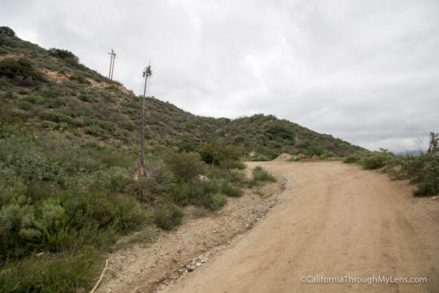
After parking alongside the road, you will walk back to the dirt road with the gate and head past it.
From here you will follow the dirt road for about a quarter of a mile as it gains elevation. At the split, head right (we went left first in the GPX track, but realized it was wrong).
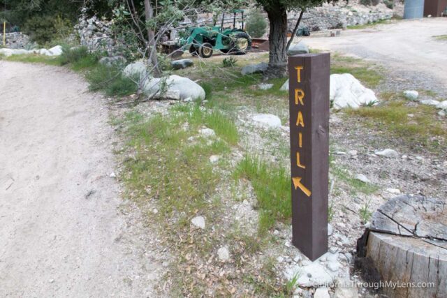
Heading down the dirt path will take you to the original parking area and a collection of cabins. This is the official start of the trail. Sign the register if you would like and then head out on the trail, which is marked with a sign.

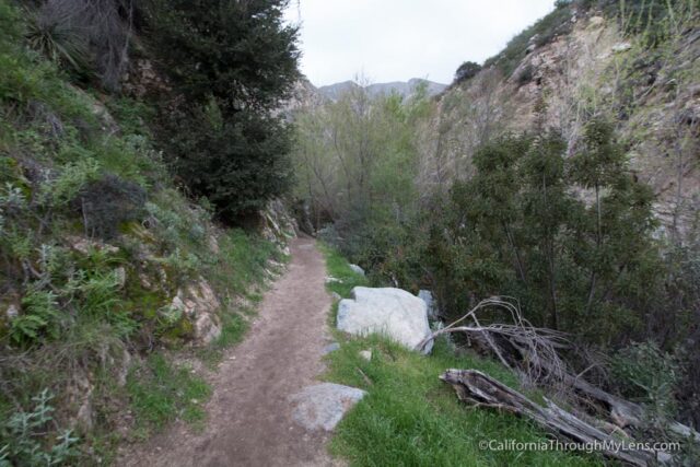
The trail from here follows the creek on an established dirt road as it makes its way past cabins and continues into the canyon.
Eventually, at a bend in the dirt road, it leaves the road and heads out on a single track, which you will be on most of the way.
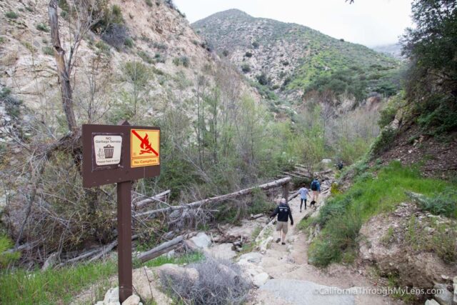
This spur crosses the water and then starts to head up and over a small hill. Continuing down the backside of the hill, you will reach the stream that will eventually lead you to the waterfall.
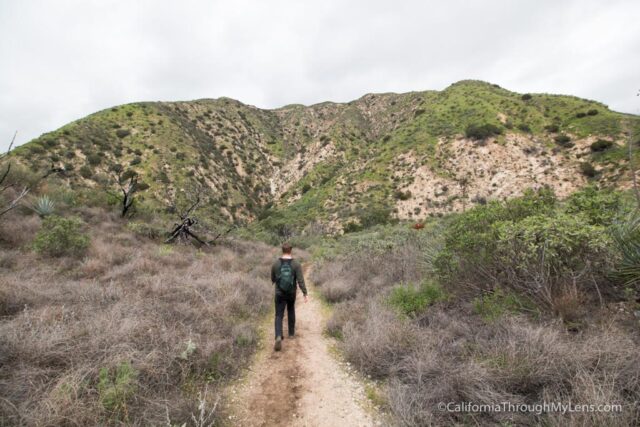
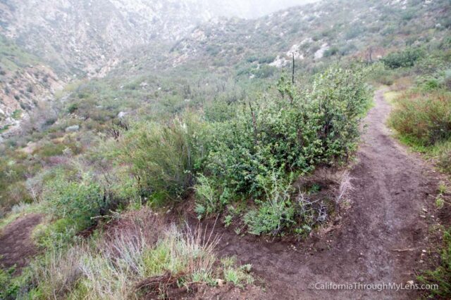
From here, you will follow the stream on a well-established path as it crosses back and forth over the water. Eventually, you will pass a shaded area with a few picnic tables before going out of the shade and starting the uphill portion.
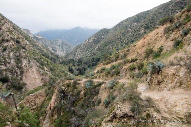
The trail then starts to climb the side of the mountain to your left, and this is where you will gain your elevation.
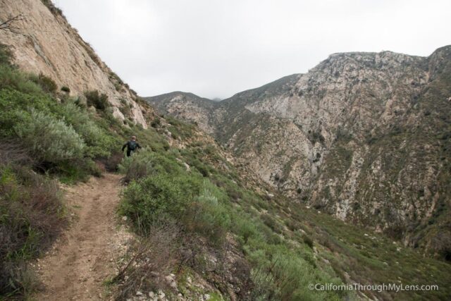
It is a well-established dirt path, but the drops on the right of you are steep into the canyon below. Take your time on this section as you continuing gaining elevation.
Eventually, you will round the hill and then round it again, and you will see the waterfall in front of you.

The trail is higher than the falls, so you are looking down at it when you round the corner.
Continuing along the trail, you will see a spur and can head down to the base of the falls or go another 50 feet to the top.
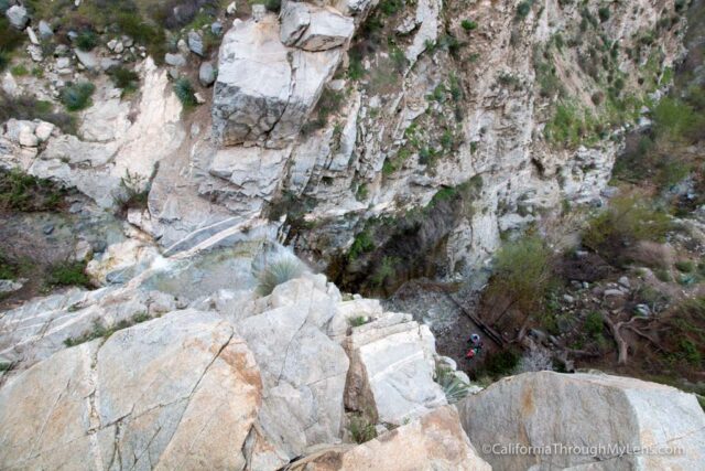
I went to the top first and looked down on the falls from the rocks. It was a pretty steep drop, so don’t get close to the edge. From here, I went back to the spur and started down it to the base of the falls.

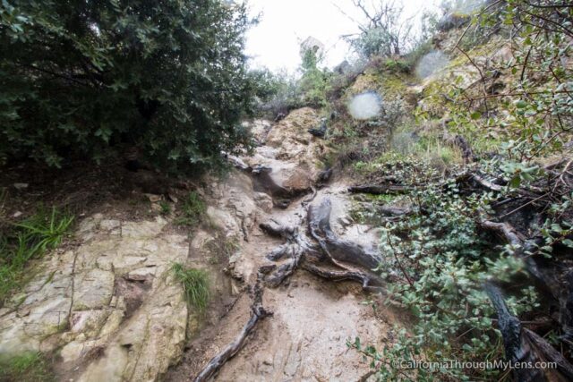
This section is steep, so take your time. There are branches to hold onto as you climb into the canyon, but it is slippery, so do not attempt it if you do not feel comfortable. Also, I would not bring a dog down here as it is too steep.
Once you make it into the canyon, it is about 50 feet to the base of the falls.
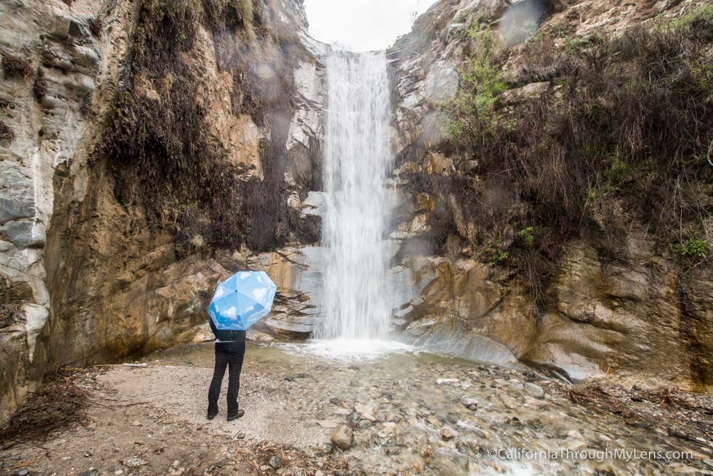
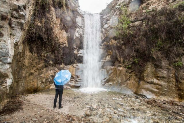
Trail Canyon Falls.
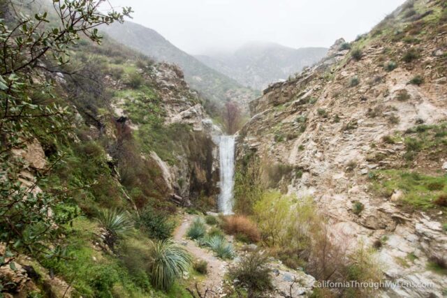
Trail Canyon Falls is an impressive 50-foot waterfall that cascades beautifully into the small pool below.

We went when it was raining, so we were the only people at the falls, but this is not normal as it gets busy on the weekends.

The area is impressive, even though it is not that large. We spent about 10 minutes here before getting out of the rain and climbing out of the canyon. Of course, be careful on the way out as well, it is slippery, and you will want to take your time.
The way back is mostly downhill, so it is a pleasant stroll through the beautiful canyon back to your car. This is an excellent four mile hike and one that I recommend you try, especially after a good storm. Let me know what you think in the comments below.