White Mountain Peak: Hiking California’s Third Highest Mountain
California is home to over a dozen 14’ers (peaks over 14,000 feet), with some of the most popular being Mt. Whitney and Mt. Shasta. If you are training for either of those two or if you just want to take down a 14,000 foot peak, then White Mountain is a good one to test your skills on. White Mountain is the third tallest peak in California, and it is widely known as the easiest of the California 14er’s. Don’t let that fool you though, this is still a tough hike with a good amount of miles and all of it at over 11,500 feet. Here is all the information.

Details
- 14 miles
- 3,000 feet of gain
- Must have high clearance vehicle to get to the trailhead
- The road is not paved in the winter
- This information was from my hike in 2018
Video
Here is a video I made of the trail.
Getting There
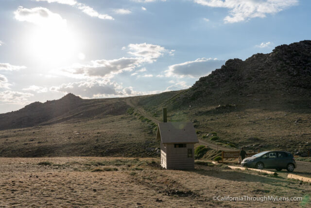
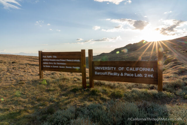
From Southern California, you will want to head north on Highway 395 to the town of Big Pine. Here you will follow signs for the Ancient Bristlecone Forest and will make your way up to 8,000 feet, where the forest starts. This is a long and windy road that takes a while to drive, but it is paved to the visitor center at least. From the visitor center, you will head out on a 16 mile dirt road that often requires high clearance and is very bumpy. These 16 miles could easily take an hour to drive.

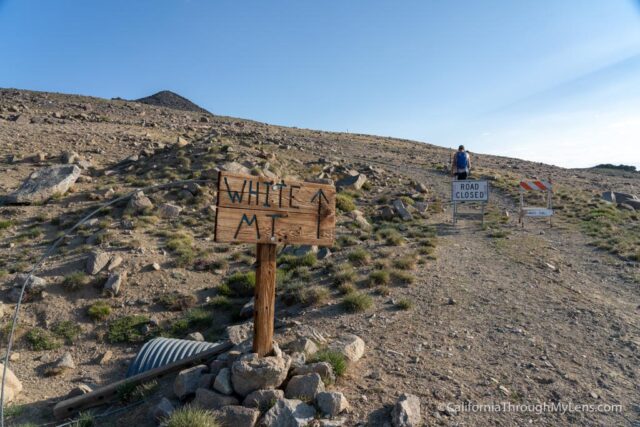
The road goes past the Patriarch Grove, and then it eventually ends at a locked gate, this is the trailhead and where you can camp the night before. There is also a pit toilet here and lots of parking. I have been told that you need to wrap your car for marmots in the spring, but I don’t know much about that, so do your research before you go as it is remote.
Also, when you are camping there, be sure to look up at the stars, they are fantastic from this vantage point.

The Trail
We slept there the night before and then got up at 6 AM to start the trail. I would recommend getting an early start as there is no shade on the entire trail.
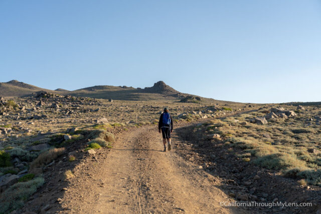
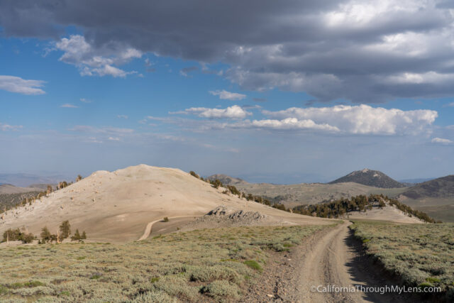
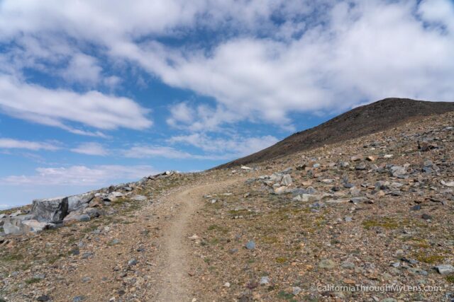
From the locked gate, it heads uphill for a steep start; then it is a gradual incline all the way to the research station at over 12,000 feet.
Barcroft Field Station
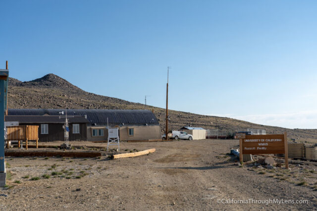
When you get to the research station, you are 2 miles from the trailhead and still have a 5.5 mile slog left.
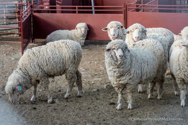
The research station is a cool place to stop and have a drink though, and there are sheep in the pens that you can see.
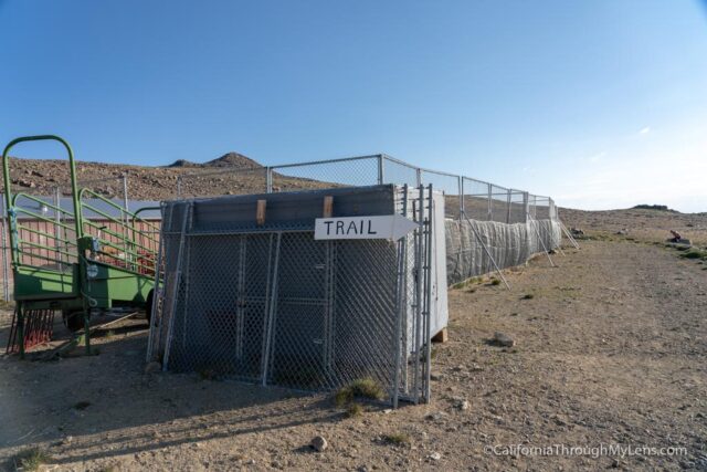
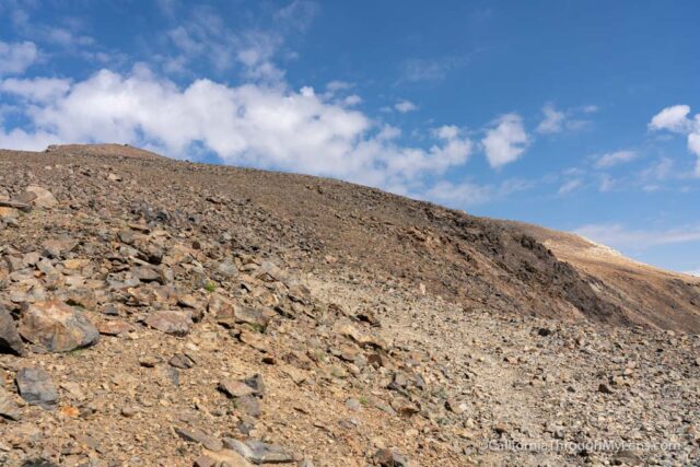
From here, the trail goes up on one of the steeper sections, still on a rough dirt road.
As you gain elevation over the research station, you will start to get some good views back the way you came.
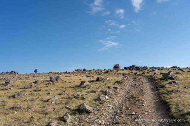
Eventually, you will reach the top of the small hill and will see the observatory.
Barcroft Observatory
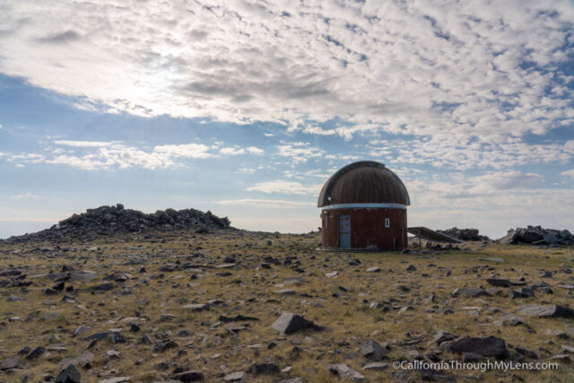
This is an interesting feature to see on a trail like this, and I am not sure what they are looking for here or what it is used for.

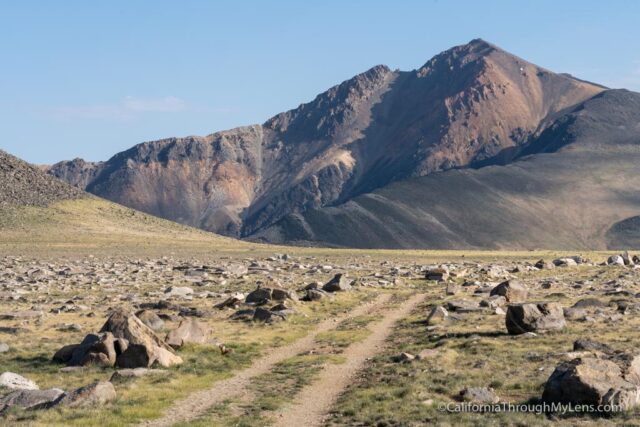
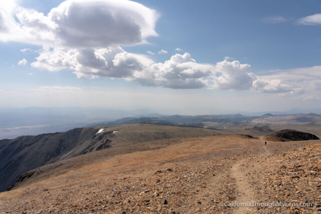
Here is also where you will get your first views of White Mountain. Note how far it still is and that you have to come all the way back to get to your car.
The next mile is pretty much all downhill, which is not fun on the return trip.
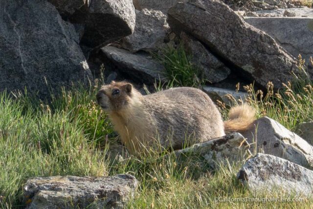
You have great views of the mountain the entire time and will probably see some marmots up here as well.
White Mountain Wilderness
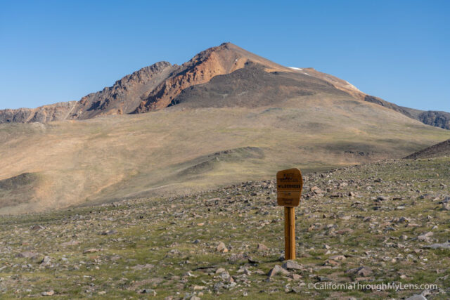
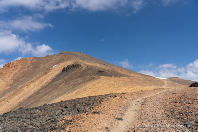
Eventually, the trail starts to go uphill again, and you will pass a sign for the White Mountain Wilderness.
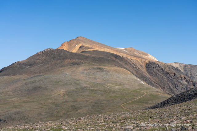
This is where I was starting to notice how small the summit hut was and how far we still had to go. You will begin to see the switchbacks carved into the side of the mountain as well, noting what is in store for you. There is another steep downhill here before you begin the switchbacks that take you to the summit.
Summit Push
I have been to 14,000 feet many times, but I was getting tired when I started the last part of the trail.
I took my time and counted my steps as I rounded each switchback.
The views get better and better, especially looking east as you head up.
Eventually, you will be able to see over the mountain you are on looking west as well, and the views will keep you motivated on to the summit.
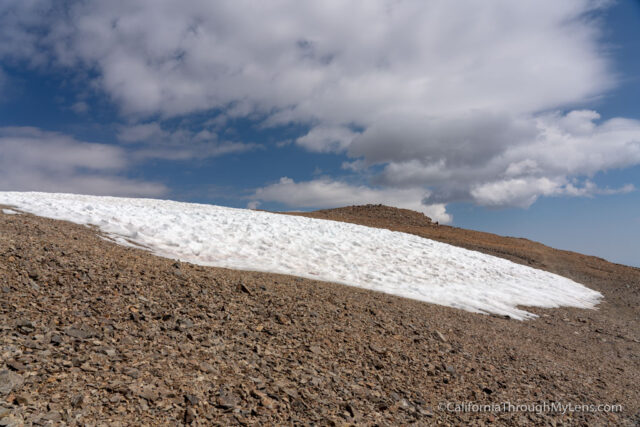
The last push took us around some snow that was still there in mid-July before heading up the final few switchbacks to the summit.
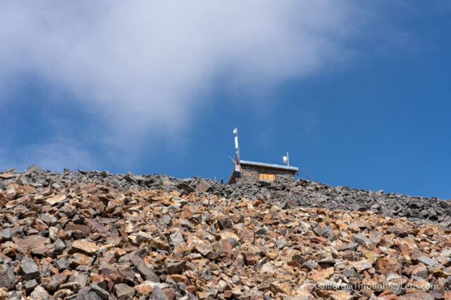
Summit
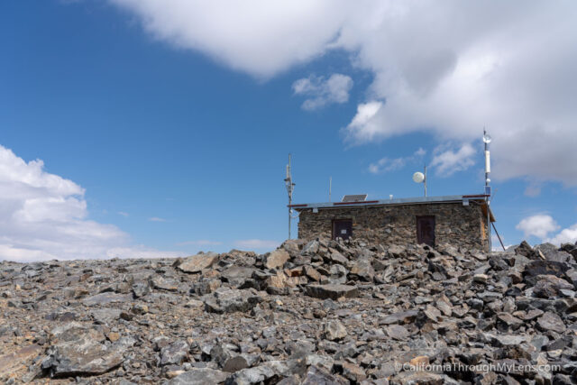
Once you finally get to the summit and see the hut in front of you, it is a great accomplishment to stand on the third tallest mountain in California.

I took some pictures with the wooden sign, signed the guestbook, and just relaxed up here before starting the trek down.

Remember, getting to the summit is only half the battle, and it is still a long slog back to the car. While this hike is not technical at all, I was still exhausted by the time I made it back. It is an excellent hike to do in California with great views and a beautiful, high summit. Check it out and let me know what you think of the hike in the comments.