• Skip to primary navigation
  • Skip to main content
  • Skip to primary sidebar
  • Skip to footer

California Through My Lens

California Travel, Food, Hiking & Road Trips

  • Start Here
  • Explore
    • Beaches
    • Bizarre
    • Caves
    • Food
    • Hikes
    • Historical Structures
    • Natural Wonders
    • Waterfalls
  • Drive
    • El Camino Real
    • Highway 395
    • LA to Las Vegas
    • Pacific Coast Highway
    • Route 66
  • National Parks
    • Channel Islands
    • Death Valley
    • Joshua Tree
    • Lassen Volcanic
    • Pinnacles
    • Redwoods
    • Sequoia & Kings Canyon
    • Yosemite
  • Cities
    • Los Angeles
    • Palm Springs
    • Sacramento
    • San Diego
    • San Francisco
  • Resources
    • Day Trip Ideas
    • Road Trip eBooks
    • Hotels
    • My Favorite Travel Products
    • Travel Videos
  • Browse By …
    • Map Of Locations
    • Cities
    • Counties
    • National Parks
    • State Parks

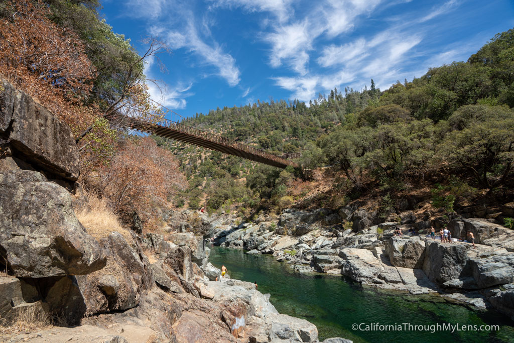
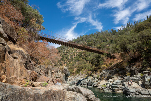
Yankee Jim’s Bridge in Colfax

Last Modified: September 7, 2020

5shares
  • Share
  • Tweet

Update August 2020: I have been told by many readers that this spot is now closed and parking is not allowed at the bridge anymore.

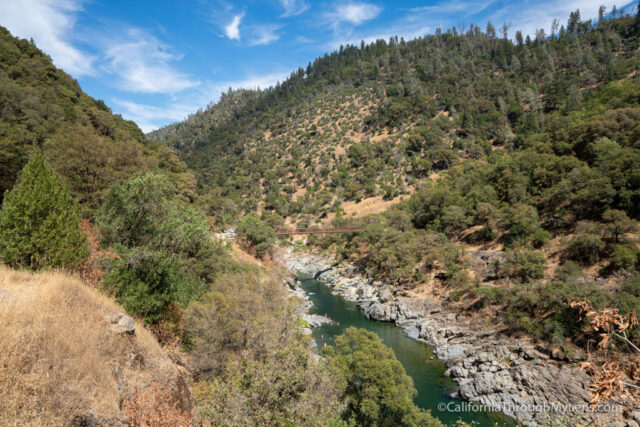
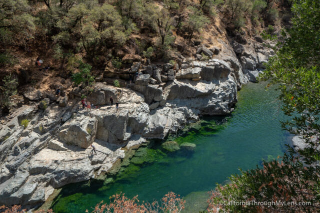
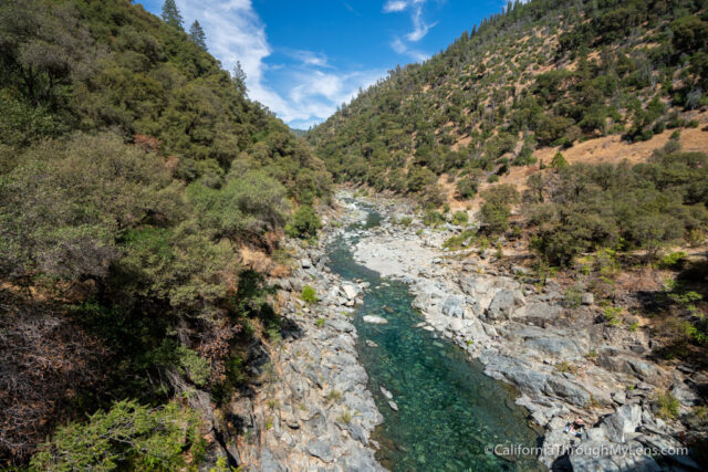
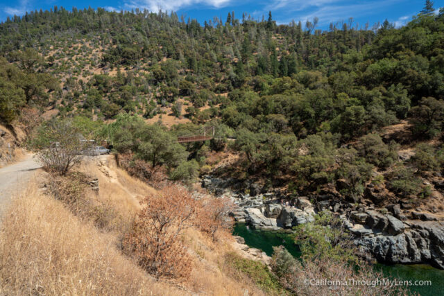
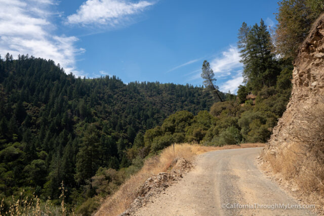
Yankee Jim’s Bridge is a suspension bridge in the city of Colfax that was built over 90 years ago, and that is a historic bridge with a great swimming hole below it. Just getting to the bridge is an adventure though with a 3 mile, mostly one lane dirt road that you must traverse to arrive at the bridge. If you like historic bridges like I do though, then you owe it to yourself to see Yankee Jim’s Bridge, especially since it is scheduled for demolition to make way for a safer bridge in the next year or so. Here is all the information. Update July 2020: Apparently this spot is now popular on social media (as of July 2020), which is leading lots of crowds here. If you go, know that there is VERY limited parking and a long almost one lane dirt road to get there. Also, make sure that you keep this area clean and take all your trash back with you if you visit.

Details

  • 3.5 miles on a one-lane dirt road
  • $10 to park if you want to swim below the bridge
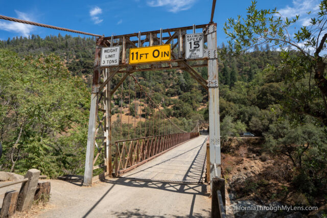
  • Make sure to note the bridge dimensions and weight restriction before taking your car over it.
  • This information is from my visit in 2018

Getting There

I would recommend pulling up directions to the bridge in Google Maps (before you go out there in case you lose reception) but plan on it taking at least 25 minutes to get there after getting off Highway 80.

The Bridge

After arriving and grabbing one of the half dozen or so parking spots, pay your fee (self-registration), then you can head down to the water or walk on the bridge itself.

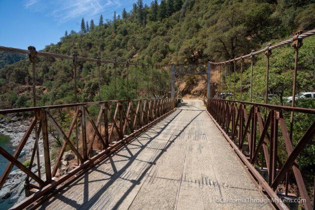
Before parking, I drove over the bridge twice, and it is a little sketchy with the way it sounds and feels like it is moving. This is worse when you are walking on it though, as you can really feel the sway.

If you walk on it, watch for cars as this bridge is only a little over one lane, so you will need to stand to the side for a car to pass.

After surviving driving over it, I headed down to the water.

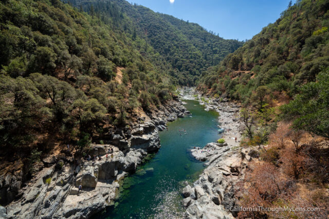
It was the last weekend of the summer, so there were a bunch of people hanging out and enjoying the water. It looked like a nice place to hang out, and I wish I would have been able to stay and swim.

I saw a lot of people cliff jumping while I was there as well; I would not recommend you do this though.

After exploring for a little bit, I headed back up the steep hill to where I parked and started heading back out.

All in all, this is an entertaining adventure in the Auburn area. If you have a half to full day, then take the dirt road trek and hang out by the swimming hole. Let me know what you think in the comments.

Filed Under: Historical Structures, Northern California Tagged With: Auburn, Placer County

Interested in supporting this blog?

This blog is simply a hobby and labor of love for me. If you have enjoyed the posts consider sharing it with your friends. I want as many people as possible to explore this state and you can help by letting them know about all of the great spots!

Join the Newsletter

Subscribe for the four day welcome series and to get the latest content every month.

    We won’t send you spam. Unsubscribe at any time.

    About JoshMc

    Thanks for checking out the blog, I am happy to be sharing my adventures with you! You can get to know me by reading my about me, which includes a video and additional information on the site, myself and my full disclosure. Also, follow along on Twitter here or read all of my posts on this blog here.

    Primary Sidebar

    About

    Josh from California Through My Lens I'm a travel junkie strapped down to one state, focused on seeing as much of it as I can and encouraging others to do the same. More about me.

    Popular Posts

    The Big List of Strange, Fun & Unique Attractions in Southern California
    Pacific Coast Highway: Where to Stop on Your Road Trip
    Top Hiking Trails in Southern California
    Fun Stops on the Drive from Los Angeles to Las Vegas
    24 Things to do in Downtown LA
    17 Things to do in Lake Tahoe
    Donner Pass, Summit Tunnel Hike: Old Abandoned Railroad

    Categories

    Other Resources


    Footer

    Search the site

    Additional Information

    Privacy Policy

    About Us

    Copyright © 2021 · Metro Pro on Genesis Framework · WordPress · Log in

    Coronavirus January 2021 Update: Please note that some information in the posts may have changed and some places may be closed.