Big Horn Mine and Vincent Cabin Hike: Old Abandoned Mine
The hike to the beautiful and rugged Big Horn Mine had been on my radar for a long time. I was able to complete it around October 2014, right before Southern California snow rolled in, and I have gone back many times since then. It is a great way to explore the backcountry and to take in a little history while you are at it and still one of my favorite Southern California hikes. See below for the review of the four-mile hike that leads you to an abandoned mine.
Details
- Parking Free with Adventure Pass
- 4 miles and 500 feet of elevation
- Old mine at the end and optional side hike to Vincent’s Cabin
- Need an Adventure Pass for parking
History
For the history of the mine, you can peruse this guide, but here is a little synopsis.
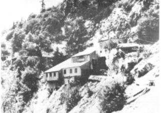
Local legend tells that Charles Tom Vincent originally discovered the mine when he was hunting bighorn sheep in the area. The mine itself started being created in 1895 and was to a depth of 300 feet and a distance of 1,200 feet in length. According to a couple of sources, over 100,000 dollars in gold was taken from the mine. After that time, the mine had varying owners over the years, one that created the wagon road that is used to hike to the mine currently.
Video
Here is a video from my most recent visit in 2019.
Getting There
The trailhead is located in the Vincent Gap Parking Area. You can get there by heading on Highway 2 past Wrightwood; you will go up and past the Grassy Hollow Visitors Center. The road then leads down to the Vincent Gap Parking Area on the left-hand side where you would park to hike Mt Baden Powell as well.
The Hike

The hike starts from the parking area mentioned above several miles past Mountain High ski resort. This is a general parking lot for many other hikes in the region, including Mt Baden-Powell. Be sure to take the dirt road trail heading left because there are no signs for this particular mine.
The trail winds around for a quarter of a mile before it divides into two trails: one down and the other forward. If you want to see Vincent’s Cabin, head to the left; however, I would recommend you take a GPS and a waypoint because there are no signs, and it is easy to miss. If you don’t want to see the cabin, then proceed on the right-hand trail. It will take you to Big Horn Mine.
Vincent’s Cabin
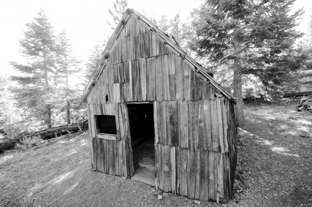
The cabin is a well-maintained piece of history, and it is worth trying to find. The building has been well kept and has a lot of the original tools still hanging near the fireplace. When we were there, we found a small piece of paper that told the history of this cabin. Look for that paper because it helped us to understand what we were standing in.
My memory is a little fuzzy, but I believe Vincent was a gold miner in Arizona, and when some people came to this mine he killed them because he heard they were stealing his gold. He and his friend fled Arizona because they were terrified, and they arrived here where he lived in this cabin and worked in Big Horn Mine.
The cabin is only one room, but it is fun to walk through and take pictures inside. After seeing the cabin, retrace your steps up the hill to the original fork in the road.
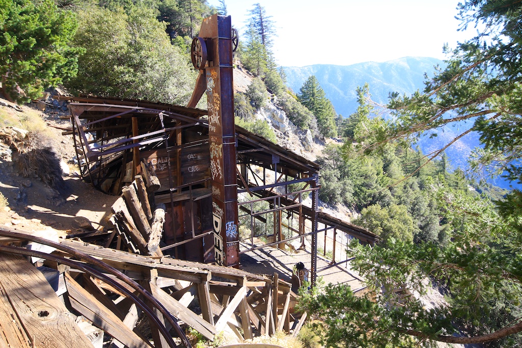
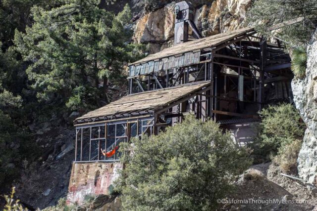
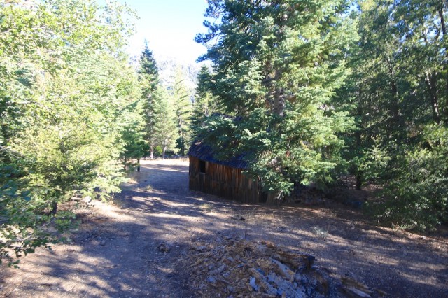
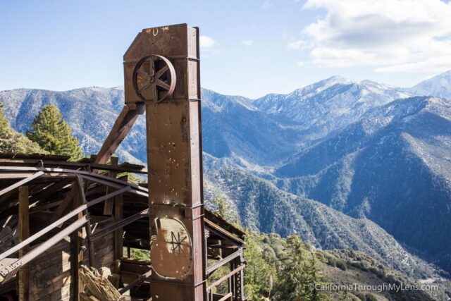
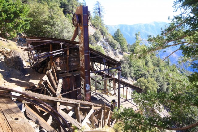
Big Horn Mine
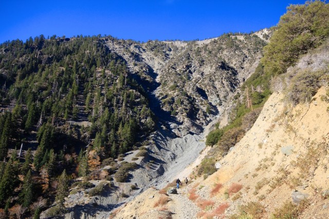
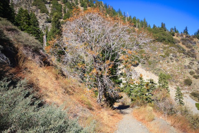
Continue walking down the main path for about 1.5 miles. You will be hugging the sides of the mountain and climbing upwards. The trail eventually empties into a beautiful vista, which shows the mountain on one side and the valley on the other.
Continue a little father, and you will pass a small mine outlet on your right-hand side. This is not Big Horn Mine — keep going! After you gain more elevation and round the bend you will see an open gate. Proceed through the gate to catch your first glimpse of the mine.
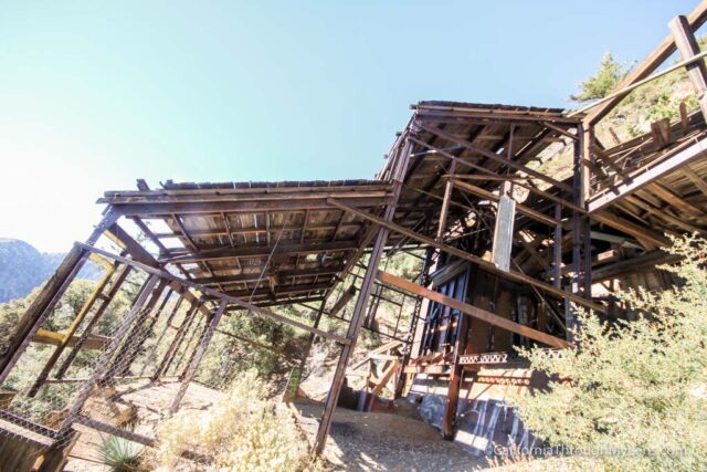
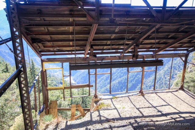
Feel free to explore the mine as much as you want. However, be very careful because the mine building is in disrepair, and much of the wood and planks could break with pressure.
This is a great place to admire the view and eat a packed lunch.
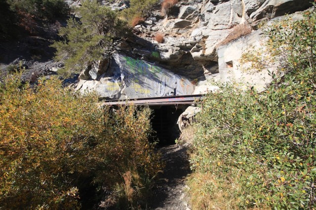
If you want to see the entrance of the mine, you will need to climb up the broken wood from where you are standing. Keep in mind steel bars are blocking the entrance to the tunnel though.
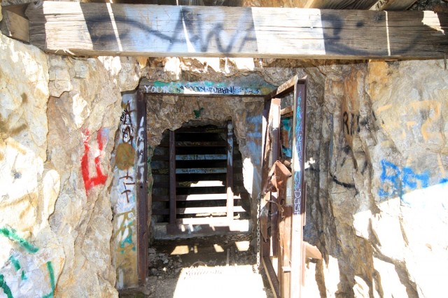
This is where the path is the most unsafe, and I would recommend only doing this if you are very careful. There is not much to see because the mine is completely closed off. However, you can get a beautiful view of the building from above if you do decide to risk the climb.
After you have finished looking around and enjoying the scenery, simply proceed back the way you came. When I was here, I saw at least 15 other people on the trail. This is also a good trail for older children because it is not too strenuous, and they can see the considerable mine building at the end. I would love to hear from you if you have been — let me know in the comments.