Hermit Falls in Santa Anita Canyon & Sturtevant Falls
The Santa Anita Canyon area in Los Angeles County is one of the premier hiking spots in the area with tons of trails. There is a long trail to the summit of Mt Wilson, the famous Sturtevant Falls, and the less popular but still impressive Hermit Falls. I finally got a chance to see Hermit Falls recently, and you can easily connect this hike to the main Sturtevant Falls trail so that you can see both. Here is all the information.
Details
- 3 miles to just Hermit Falls and back, 6 miles to add in Sturtevant Falls as well
- 400 feet of elevation gain
- Need an Adventure Pass for parking
- Location: Chantry Flat Rd, Arcadia, CA 91006
- This information was from my visit in 2017 and 2019
- Read all about my favorite California waterfalls here
Getting There
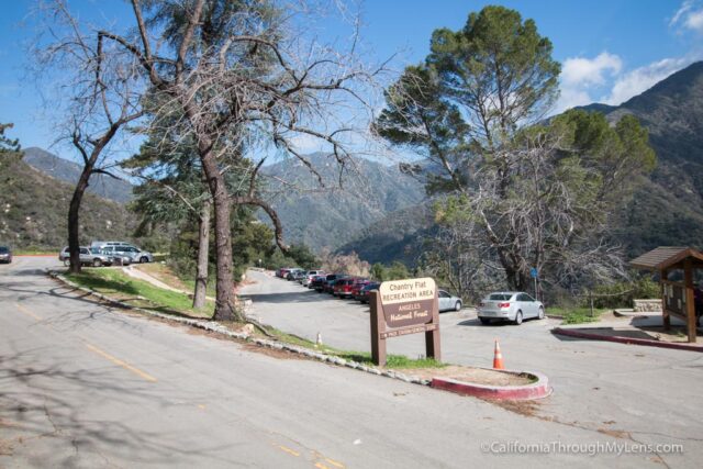
Santa Anita Canyon is located in the hills between Azusa and Pasadena, in the town of Arcadia. After getting off the freeway, you will proceed up into the mountains until the road deadends at the parking lot for the trail in the Chantry Flats Recreation Area. There is a good chance the parking lot will be full if you go on the weekends, but there is parking along the road as you head up as well. Be sure to display the Adventure Pass, so you don’t get a ticket.
The Hike
The hike begins on the paved road right next to the bathrooms, past the locked gate. Remember that all of this downhill on the way there and uphill on the way back.

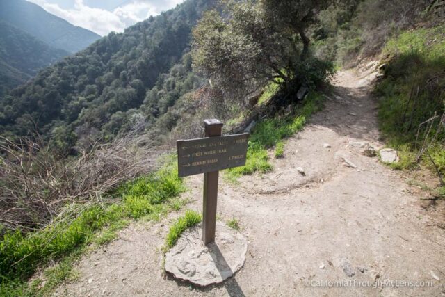
It continues down this trail for about a tenth of a mile before it reaches a spur on the right that heads off to Hermit Falls.

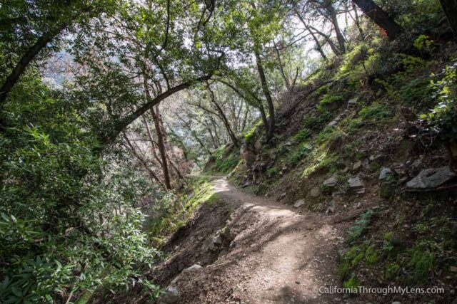
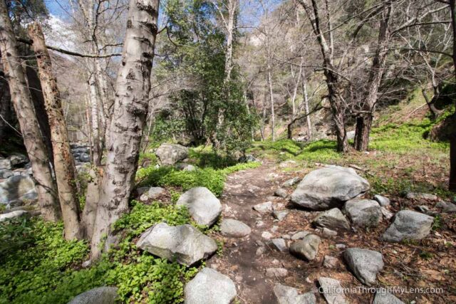
This trail is a single track that is heading down into the canyon on switchbacks. It is beautiful as the lush plant life creeps over the path providing shade.
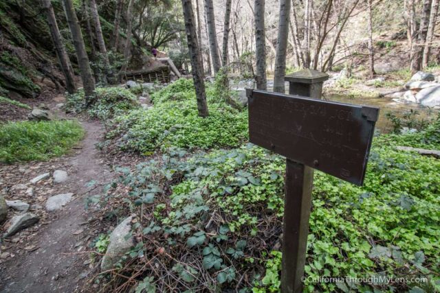
When you make it to the bottom of the switchbacks, you will be at the stream that you will need to cross. It is not difficult, but it does depend on how much water is present.
After crossing, you will see a sign that points you to Hermit Falls and lets you know it is three-quarters of a mile longer each way.
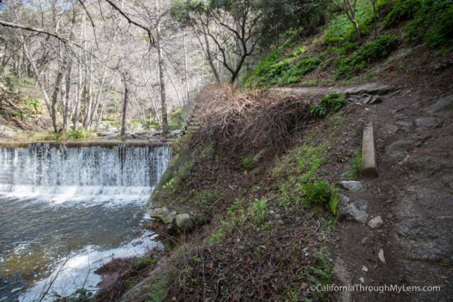
This trail then passes a few of the man-made waterfalls the area is famous for while it continues to follow the stream.
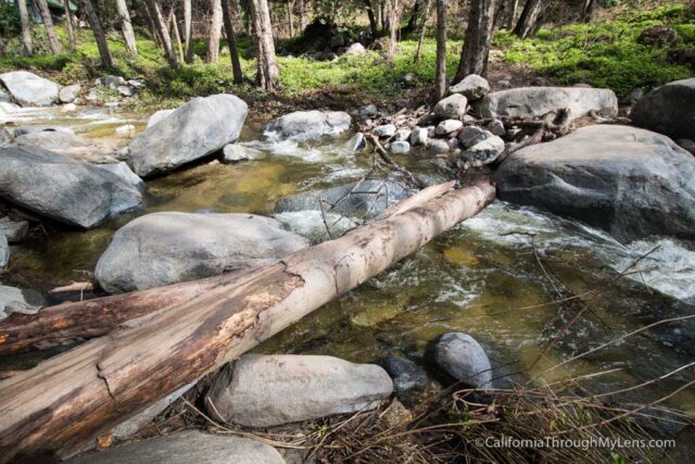
There are a couple more crossings that were not too difficult when I went before the trail starts to head up a gradual incline.

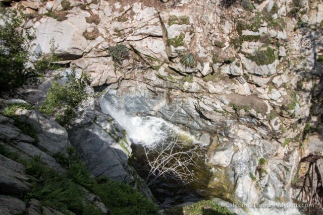
When you top out, you will head down again and will see the rocks near Hermit Falls in the distance.
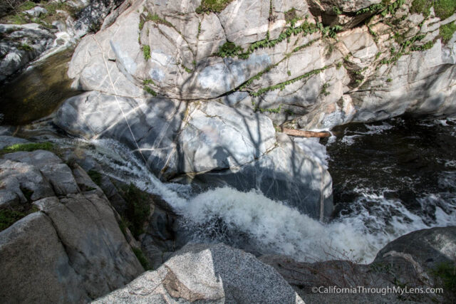
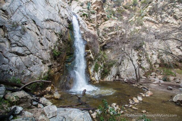
As you arrive, you will notice that this area is an extensive collection of granite rocks with the water flowing through an area it has dug out over centuries of flow.
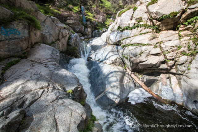
I went on this adventure in an unusually wet year, which made for a pretty impressive showing at the falls. There are multiple places to climb up on, which give you some great views of the area and the waterfall.
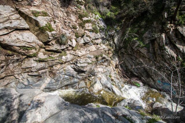
There was not any safe way to get down to the bottom because of the water flow from the wet year, so I just checked it out from above without proceeding down. If you want to do some climbing though, or if the rope that is usually there is present, then you may be able to make it to the base (be careful though!). After hanging out for a while, I headed back the way I came.

Continuing to Sturtevant Falls
If you want to check out Sturtevant Falls while you are down here (which you should), then when you reach the sign where you crossed the water for the first time, it will point you in the direction of Roberts Trail.
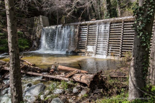
This short trail crosses the stream multiple times and goes past some of the areas man-made waterfalls.
When you pass your final water crossing, you will be back at the Roberts Bridge, where you will meet up with the main Sturtevant Falls Trail. From here, it is about one and a quarter miles to the falls, and I highly recommend you do it.
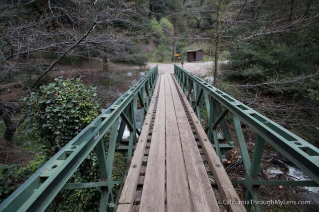
If you want to head back, then you will cross the Roberts Bridge and head up the cement path with the steep incline to your car. Alternatively, you could have just crossed the water back at the sign for Robert’s Trail and gone back up the switchbacks you originally came down.
Sturtevant Falls – Read more about it here.
All in all, this is a great trail close to Los Angeles that is especially amazing after a good rain. Be sure to check out both waterfalls if you make it to the area and let me know what you think in the comments.