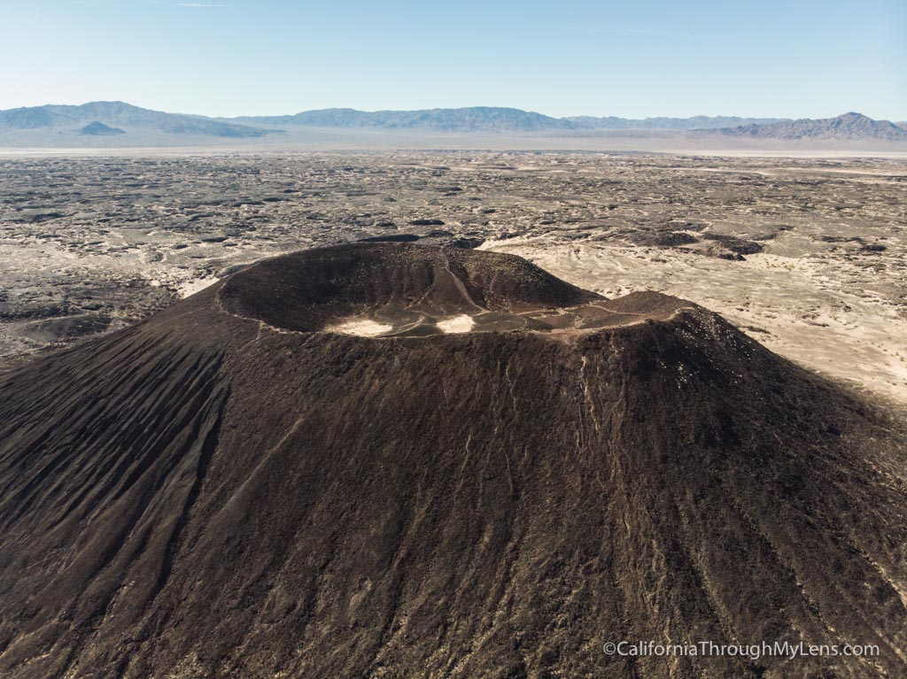
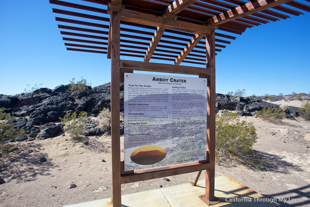
Amboy Crater: Hiking Through a Lava Field to a Volcano
I am a huge fan of both Route 66 and hiking, so when I heard about this unique hike on Route 66, I knew I had to get out there and do it. Located literally in the middle of nowhere, near the small town of Amboy, sits this massive volcano known as the Amboy Crater. You can hike all the way to the top of the crater and get vast views of the surrounding landscape. If this sounds like something you would be interested in, then read on for all the information.

Details
- 3 miles round trip
- 300 feet of elevation
- No shade
- Lots of uneven footing
- I wrote this in 2018
Video
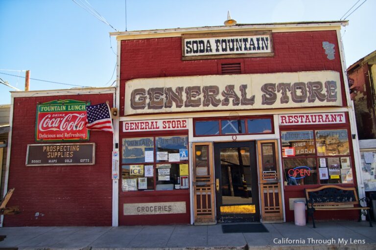
If you are heading to Amboy Crater, then you should stop at Amboy as well. There are a lot of historic Route 66 sights to see there, such as the famous motel and the cafe.
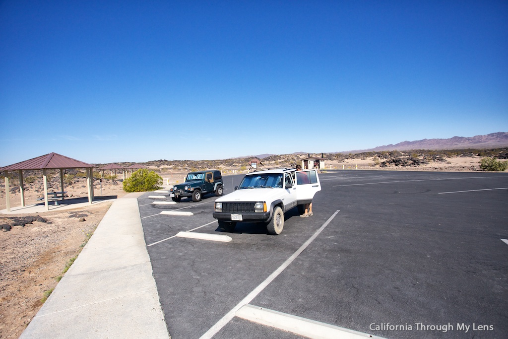
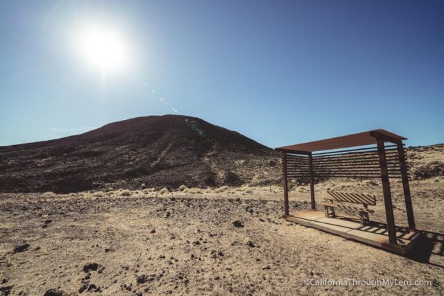
After that proceed about 2 miles down the road to the turnoff for the Amboy Crater (there is a sign for it), and park in the big parking lot with picnic tables and two pit toilets.
The Overlook
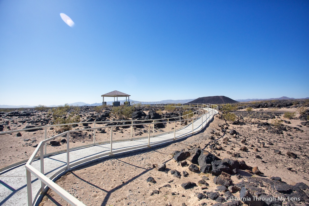
An excellent place to check out before the trail is the overlook that is on the left side of the parking lot. This area provides a great view of the crater and volcanic fields, and it is a good point of reference when you are up at the top of the crater.
The Trail

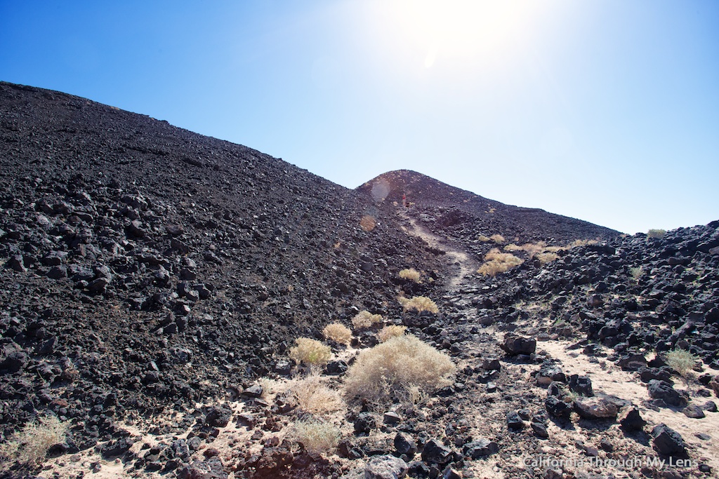
The trail is about 1.1 miles from the parking lot to the base of the crater. During that time, you will be going over the uneven rock for pretty much the entire hike.
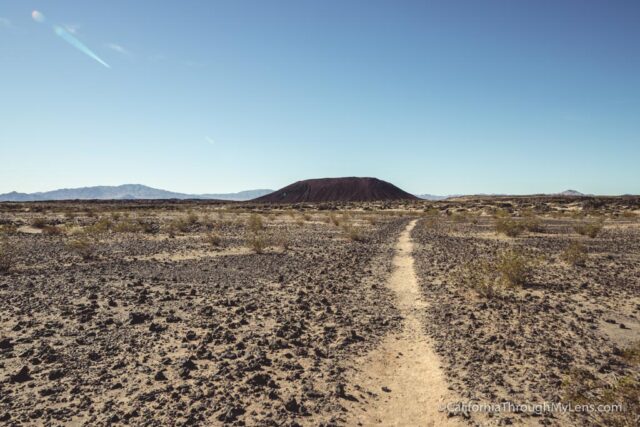
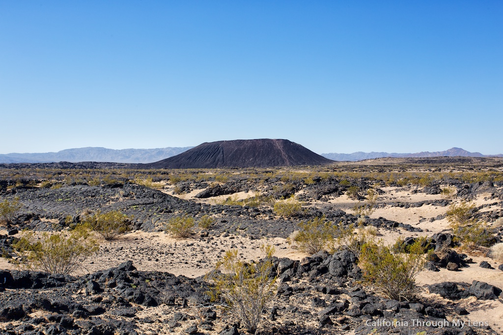
The trail goes up and down and through sand and lava fields as you approach.
Pay attention to the ground while walking as you can often see small lizards and bugs walking the harsh terrain. In the spring, it is also not strange to see a few wildflowers.
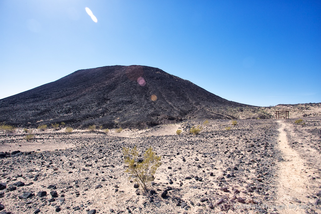
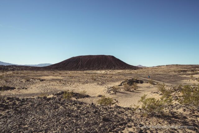
As you approach the crater, it gets less daunting as it appears much smaller up close then it does far away. There are a couple of scattered places to sit and relax, but there is no shade on the whole trail, so do not go in the summertime.
The trail proceeds around the back right of the crater, and this is where it starts to head up; up until this point, it has been flat.
The uphill is steep and uneven, but the first part is relatively short. When you get to the top of this, you will be inside the crater and can pick any of the four trails to get out the top.
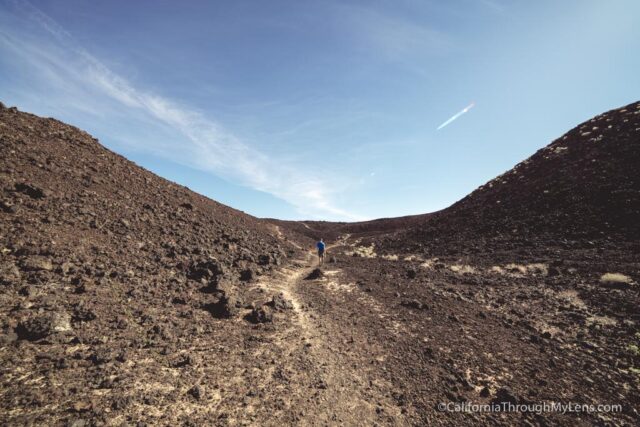
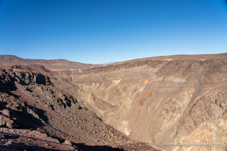
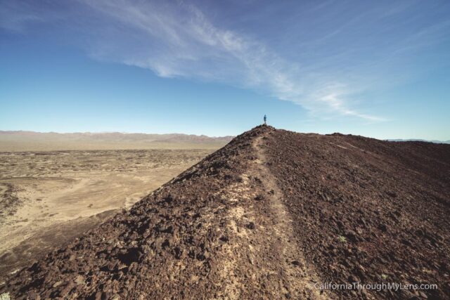
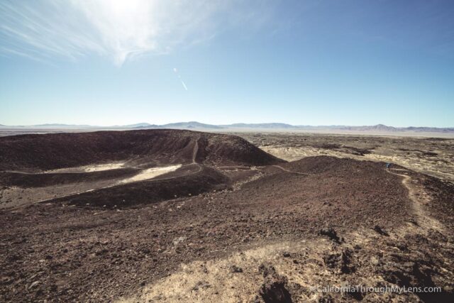
We proceeded up the left trail, which was very steep but quick and got out on the rim. The view from here is awe-inspiring. It is so massive and vast as there is nothing around you for miles.
From here, you can elect to walk back if you want, or you can walk along the rim of the crater (about .3 miles) as we did.

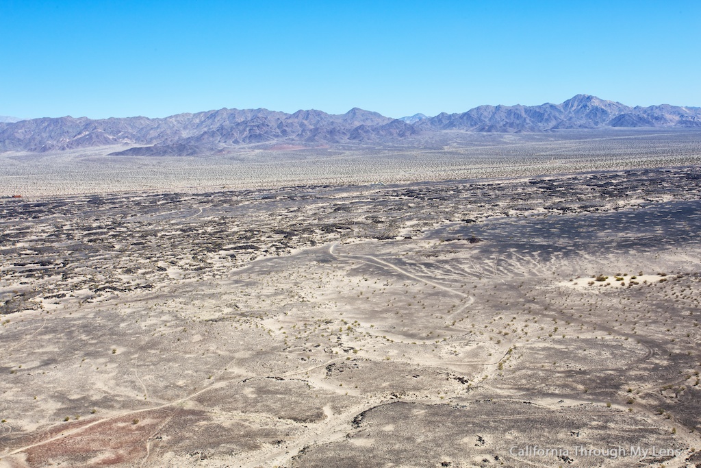
The right side of the crater is the most unusual as it overlooks the sea of lava rock from the eruption thousands of years ago. It is crazy how far it goes and would have been amazing to see back when it was active. Here are some of my favorite pictures:

After that, just head back down the way you came, but make sure to take your time as the ground can be slippery with all the loose rock. You can now check off, hike a volcano, from your bucket list.
Let me know if you have been and what you thought in the comments.
Amboy, California