Indio Hills Badlands Hike in the Coachella Valley
The Coachella Valley has some amazing hikes that offer you a glimpse of the otherworldly desert landscape. The hike through the Indio Hills Badlands is one of those as it takes you through a sandy wash and a few slot canyons as you make your way up to an awesome summit with vast views of the surrounding topography. Here is all the information on this hike if you want to do it.
Details
- 5 miles round trip (loop)
- 650 feet of elevation gain
- Free parking in the small lot
- Location: Golf Center Pkwy, Indio, CA 92203
Getting There
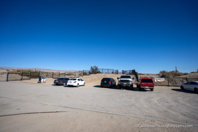
From most of Southern California, you will head east on the 10 Freeway out past Palm Springs to Indio. From there, you will get off at exit 144 for Golf Center Parkway and turn left. Take the road until it makes a sharp left, and you will see the small parking area in front of you before you turn. The lot can hold about a dozen cars and read the signs as some spots say no parking.
The Trail
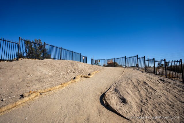
The trail leaves from the parking lot and heads over a canal alongside a golf course. This is the first trail I have ever seen that had a sign that said hikers should yield to golfers.

As you leave the golf course, you will start a small uphill section along a loose dirt ridge.
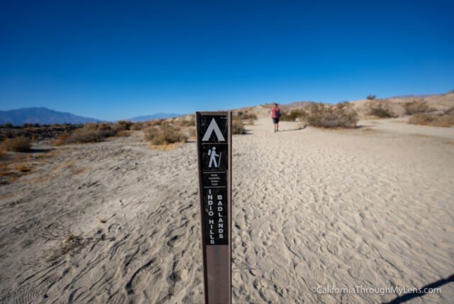
This will take you over the first hill and see back into the badlands area you are heading.
This first mile or so till you get to the badlands is relatively uneventful and a little boring.
Plus, you will be walking in the sand, which is never enjoyable to hike in. Believe me, though, it is worth pushing on to explore the badlands area.
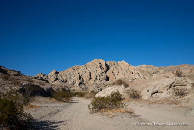
Eventually, the trail will get up close to the mountains and will split, with each path being part of the loop you do going through this canyon.
We headed to the left first, and I would recommend you follow the signs and do this as it is the most impressive section.
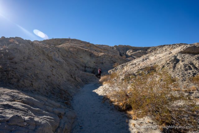
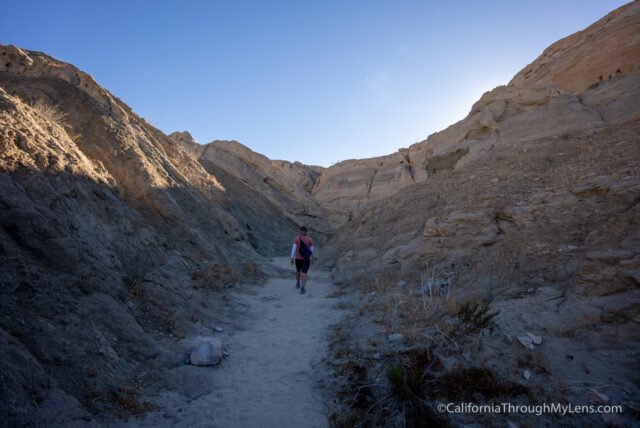
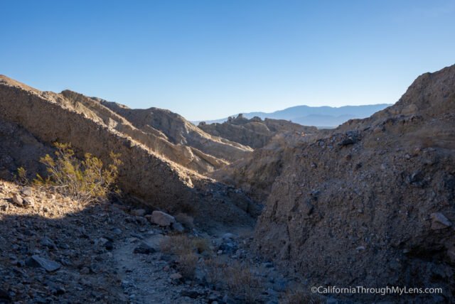
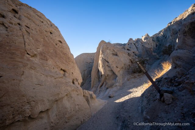
The trail to the left starts to head uphill again, but now you are surrounded by wind caves and a narrowing canyon.

It is a fun area to explore, and it continues to get better as you head on.
The trailhead up the first of two pushes in this section, with each push allowing you a better vantage point of the area.
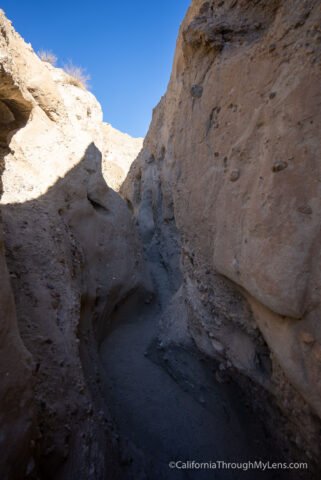
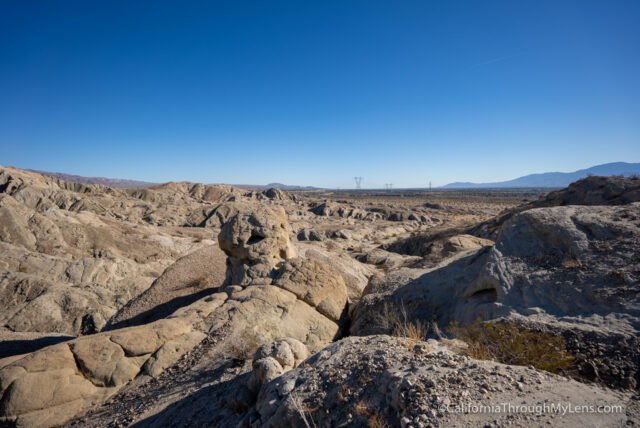
After the first push, the trail descends into some of the most narrow slot canyons. It was a blast going through this section, and it reminded me of the slot in Anza Borrego.
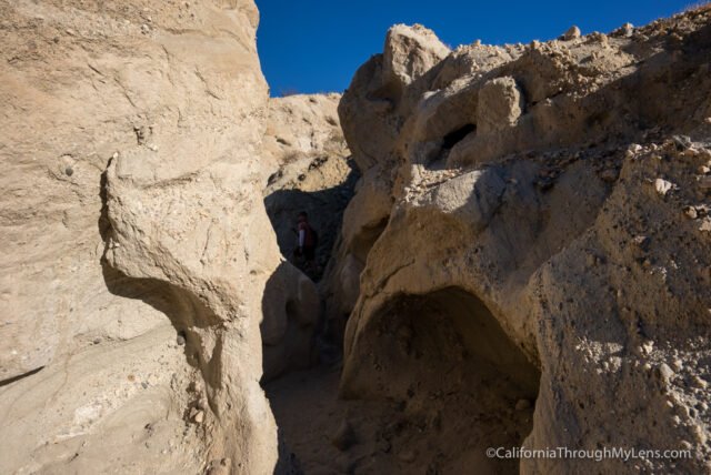
This area is easily the trail’s highlight, with large canyon walls and new rock formations to see at each bend.
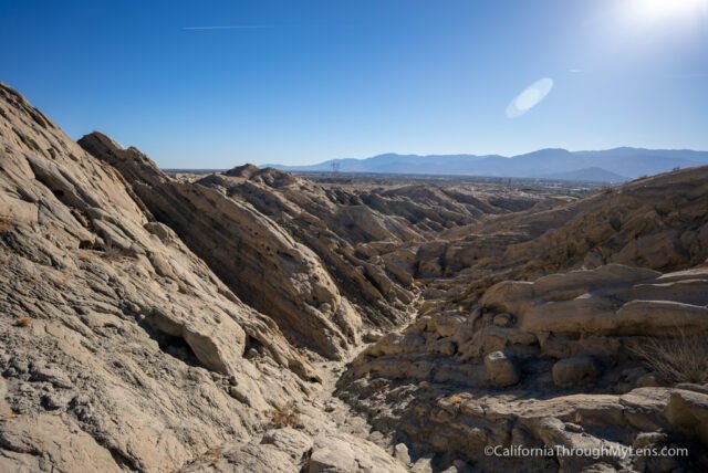
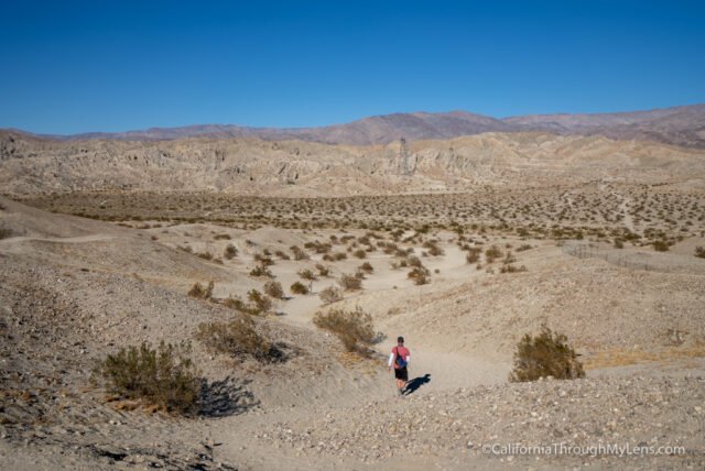
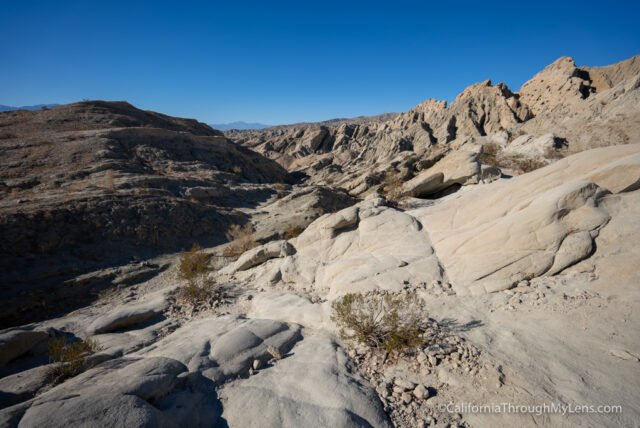
The trail continues to head back until the canyon widest, and you make your way around the backside of the mountain.
This area is not as fun as the part you went through, but it is still a unique landscape.
The trail then heads up one last time as you leave the canyon on a series of switchbacks.
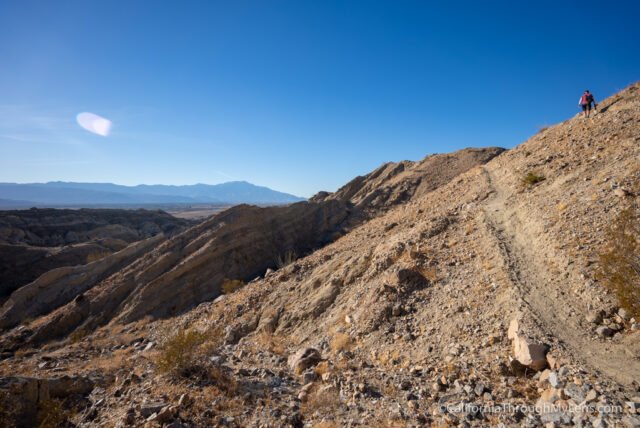
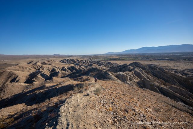
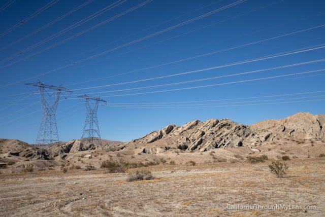
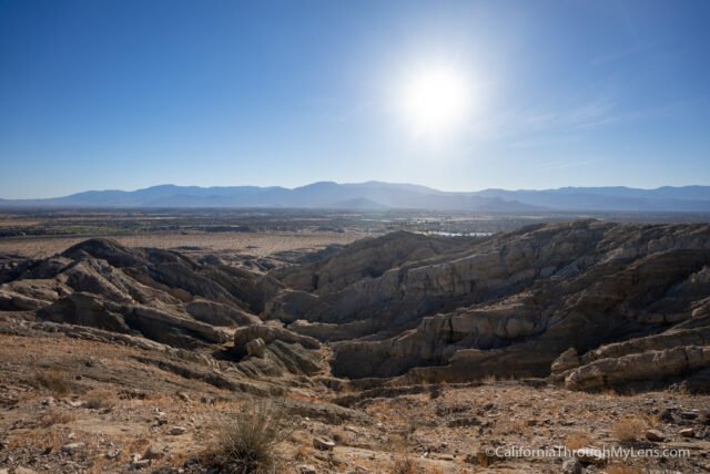
When you make it to the ridgeline and the high point, you will have a fantastic 360-degree view of the Coachella Valley.
It was amazing in both directions, but especially to the south, where you can see down through the badlands you just explored.
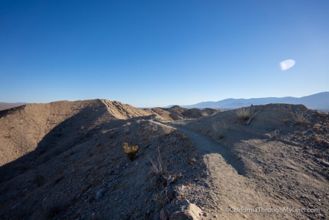
Since this is a loop trail, you don’t have to go back the way you came.
You will want to walk along the ridgeline and then begin the downhill walk back into the canyon on the other side.
This part of the trail is a little steep going down, but it has some great views.
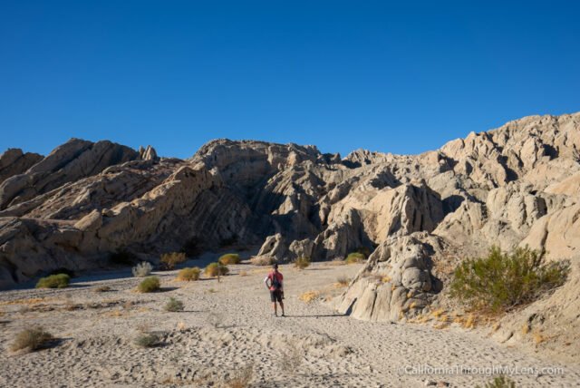
Eventually, it will flatten out, and you will be walking in another large canyon as you make your way back.
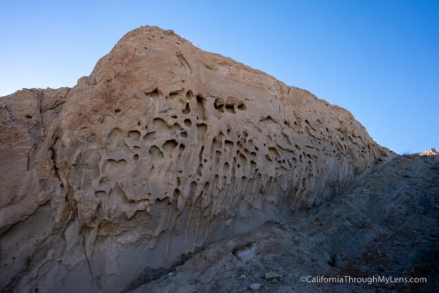
There are lots of fun rock formations to see and some wind caves that have made little holes in the rocks along the way.
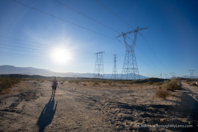
The trail will connect with the long sandy walk you came in on, and you can take that all the way back to where you started. All in all, this is a great hike in Southern California with a beautiful landscape you can explore. Just don’t do it when it is hot. Let me know what you think in the comments.
Indio, California