Hiking Near Lake Perris to Terri Peak
I am always looking for unique places to hike close to the Inland Empire, so the other day when I stumbled on Lake Perris, the small lake near Moreno Valley, I figured it should probably have a couple of decent trails to check out. There was not a lot of information on the trails, but I did see a map of Terri Peak, so we set out to see if we could climb it before a lunch at the epic Chicago style hot dogs place called Portillio’s situated nearby. Here is all the information.
Details
- Distance: 5 miles, out-and-back
- Total Elevation Gain: ~1000 ft
- Difficulty: Moderate
- I wrote this in 2015
Located about 4 miles off the 60 Freeway is the entrance to the often neglected Lake Perris. The price to enter was $5 for the car (as of 2014), and we paid our way in and looked for the trailhead. There are about four different peaks in the area, but Terri Peak is the one that you see on your right when driving in from the North entrance. After parking in the amphitheater parking lot, we set out to explore the peak.
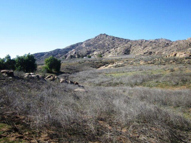
The hike is only about 5 miles round trip, but there is a loop as well if you go down the backside to the visitor center and then loop back to the parking lot. The trail is a well-traveled, wide dirt trail the entire way, but know that in the 2.5 miles to the summit, you will be doing 1,000 feet of elevation. It starts pretty gradually, then it has some good gains near the end.
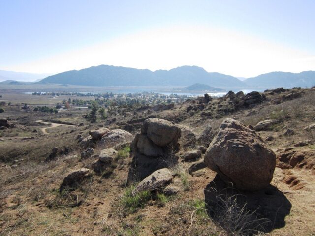
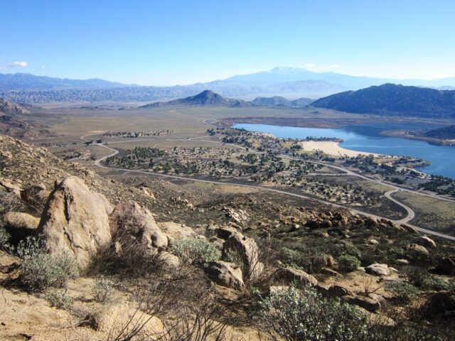
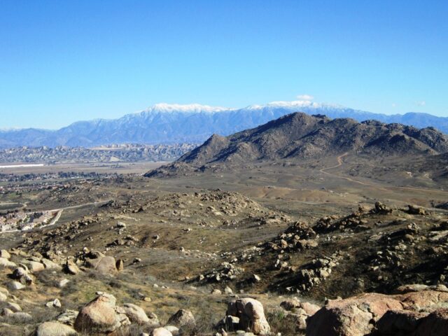
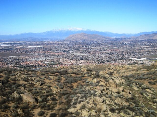
The trail is not well-marked either, but if you keep your trajectory going up towards the peak, you should be able to stay on target. As you gain elevation, you will see a lot of beautiful views behind you towards San Gorgonio.
On Saturday morning, when we were there, and we only saw one other person on the trail the entire time. It was a nice bit of solitude but be wary of the summertime as there is zero shade on the whole trail.
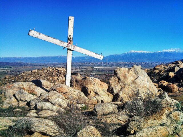
Once we were near the top, we saw a makeshift cross sitting there taking in the sun. I was not able to find any information about this cross, but it was a unique thing to see as we neared the summit. From here it is only about a quarter-mile to the top.
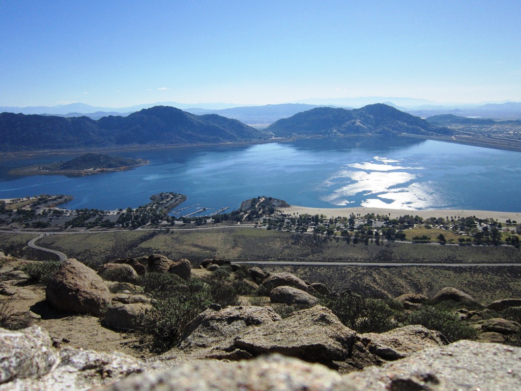
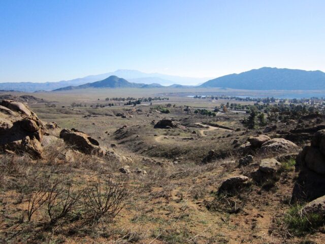
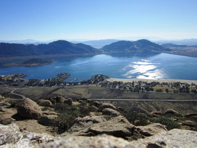
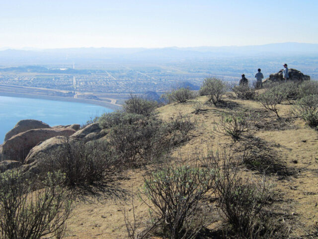
Once you top out at the summit, you are greeted by a fantastic view in all directions. Of course, there is the view over the lake, but even looking back towards the Inland Empire provides a nice vista over all the roads, homes, and Cucamonga Peak in the back.
The lake looked pretty peaceful this early in the morning with only a couple boaters out on it. I especially liked the view of the small island right in the middle of the lake from our summit vista point.
On the summit, there are a lot of big rocks to scramble on and a lot of places to sit and enjoy lunch. Unfortunately, there is some graffiti up here, but overall it is well maintained.
All and all, this is one of the better Inland Empire hikes. It has a decent amount of elevation gain and a stunning summit that you reach as well. If you haven’t done it, I would recommend checking it out. You can see the rest of the pictures below and get directions.
Directions