• Skip to primary navigation
  • Skip to main content
  • Skip to primary sidebar
  • Skip to footer

California Through My Lens

California Travel, Food, Hiking & Road Trips

  • Start Here
  • Explore
    • Beaches
    • Bizarre
    • Caves
    • Food
    • Hikes
    • Historical Structures
    • Natural Wonders
    • Waterfalls
  • Drive
    • El Camino Real
    • Highway 395
    • LA to Las Vegas
    • Pacific Coast Highway
    • Route 66
  • National Parks
    • Channel Islands
    • Death Valley
    • Joshua Tree
    • Lassen Volcanic
    • Pinnacles
    • Redwoods
    • Sequoia & Kings Canyon
    • Yosemite
  • Cities
    • Los Angeles
    • Palm Springs
    • Sacramento
    • San Diego
    • San Francisco
  • Resources
    • Day Trip Ideas
    • Road Trip eBooks
    • Hotels
    • My Favorite Travel Products
    • Travel Videos
  • Browse By …
    • Map Of Locations
    • Cities
    • Counties
    • National Parks
    • State Parks

Potem Creek Falls: A 60 Foot Waterfall Near Burney

Last Modified: May 11, 2020

381shares
  • Share
  • Tweet

Potem Creek Falls is one of those places with an amazing waterfall, but that is generally unknown to most people. Close to both the town of Redding and the mind-blowing MacArthur-Burney Falls, the 60 foot Potem Creek Falls is something that should be on your list to visit. Here is all the information so you can check it out yourself.

Details

  • Located 5 miles down a dirt road
  • .4 mile round trip hike
  • 150 feet of elevation
  • This information was from my visit in 2017
  • Read about all of the California waterfalls I have visited here

Getting There

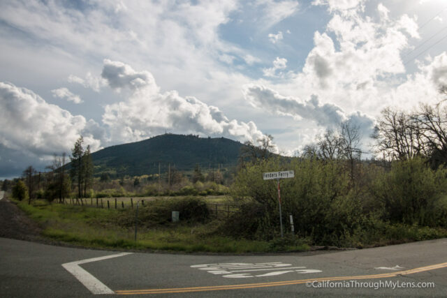
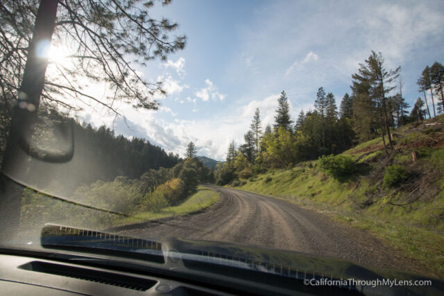
I would recommend using Google Maps and putting in Potem Creek Falls as that is what I used to get there, and the drive can be kind of confusing. You will be turning off Highway 299 onto Fenders Ferry Road and driving for about 3 miles before the road becomes dirt. The 5-mile dirt road was no problem for our 2WD car as it was well maintained but watch out after rainstorms, I am sure it can get pretty bumpy.

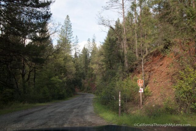
After about 4 miles, you will start to see a dam and bridge on your left through the trees, and you will be taking the above-pictured split in the road to the left.

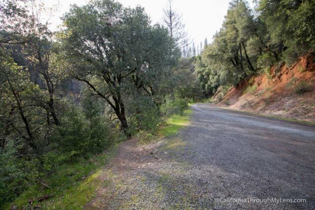
From here, you will cross over a bridge and go up a small hill to get to the trailhead. I mainly say to use Google Maps just so you know where the trailhead is; we stopped when it told us to, and there were no signs or anything for the trailhead. Since the waterfall was so close to the road though, we could hear it from where we parked.
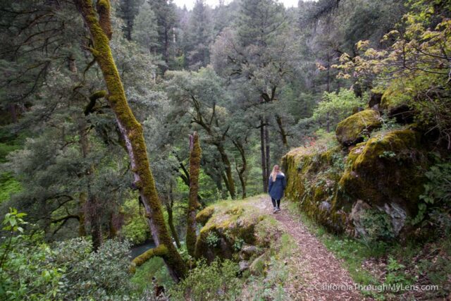
The Trail

Getting out of the car, we followed the small, worn single track down towards the sound of rushing water.

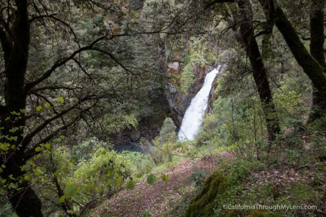
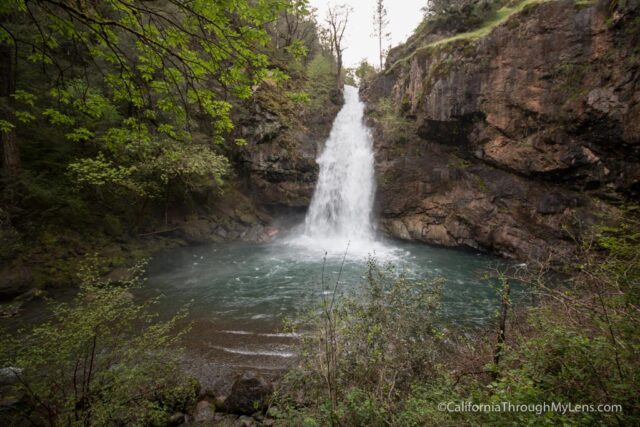
Almost immediately, we could see Potem Falls below us.

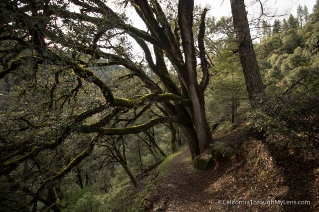
The trail is a series of three long switchbacks that take you all the way to the base.

It is a gradual trail, and it is suitable for most people.

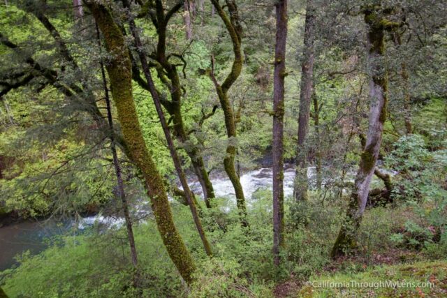
You will get views of the waterfall through the trees as you descend, and it is crazy how remote it feels as we saw no other people the entire time. *I am sure it does get busy during the summer though.
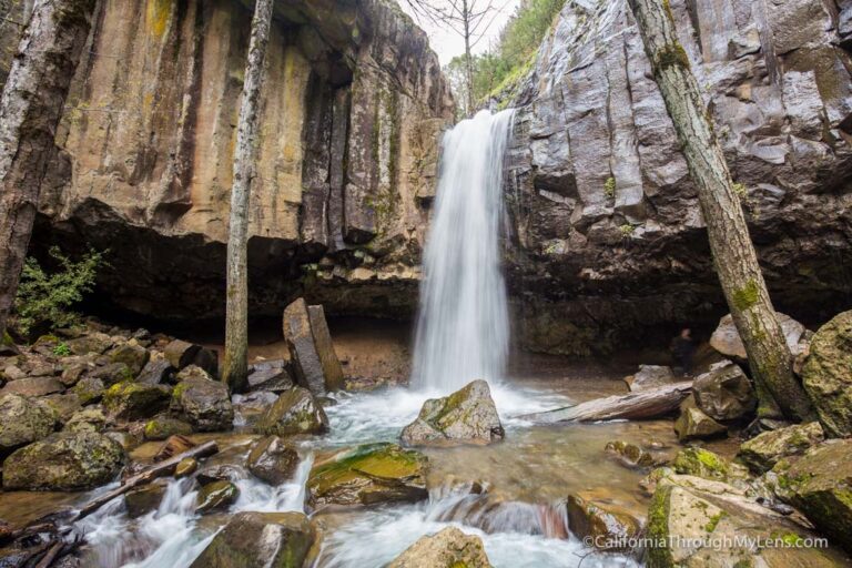
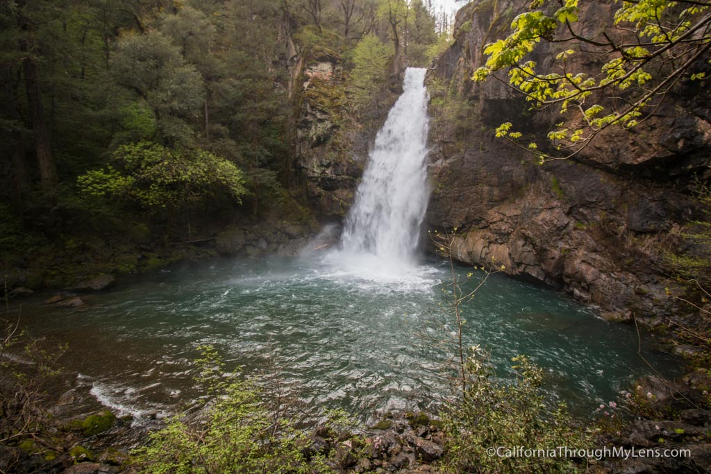
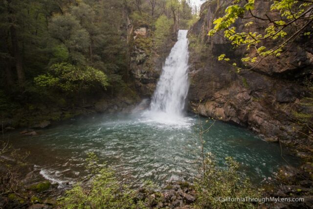
The Waterfall

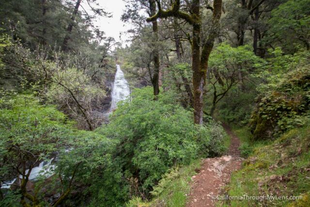
As we made the final bend, we could see the massive waterfall flowing in front of us.

Since 2017 had been such a fantastic year for rain, the waterfall was raging, and it was impressive to see.

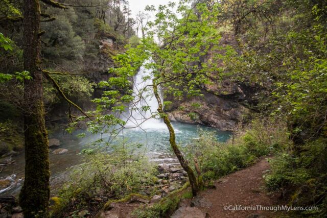
The trail ends at a small overlook, but you can make your way down another 15 or so feet to the water if you want to.

We were late getting here, and the sun was already going down, so we didn’t stay for long, but it was an impressive waterfall that I am glad I stumbled on.

Be sure to check out the other waterfalls in this area like Burney and Hatchet Creek if you visit and let me know what you think in the comments.

Filed Under: Northern California, Waterfalls Tagged With: Burney, Round Mountain, Shasta County

Interested in supporting this blog?

This blog is simply a hobby and labor of love for me. If you have enjoyed the posts consider sharing it with your friends. I want as many people as possible to explore this state and you can help by letting them know about all of the great spots!

Join the Newsletter

Subscribe for the four day welcome series and to get the latest content every month.

    We won’t send you spam. Unsubscribe at any time.

    About JoshMc

    Thanks for checking out the blog, I am happy to be sharing my adventures with you! You can get to know me by reading my about me, which includes a video and additional information on the site, myself and my full disclosure. Also, follow along on Twitter here or read all of my posts on this blog here.

    Primary Sidebar

    About

    Josh from California Through My Lens I'm a travel junkie strapped down to one state, focused on seeing as much of it as I can and encouraging others to do the same. More about me.

    Popular Posts

    The Big List of Strange, Fun & Unique Attractions in Southern California
    Pacific Coast Highway: Where to Stop on Your Road Trip
    Top Hiking Trails in Southern California
    Fun Stops on the Drive from Los Angeles to Las Vegas
    24 Things to do in Downtown LA
    17 Things to do in Lake Tahoe
    Donner Pass, Summit Tunnel Hike: Old Abandoned Railroad

    Categories

    Other Resources


    Footer

    Search the site

    Additional Information

    Privacy Policy

    About Us

    Copyright © 2021 · Metro Pro on Genesis Framework · WordPress · Log in

    Coronavirus January 2021 Update: Please note that some information in the posts may have changed and some places may be closed.