• Skip to primary navigation
  • Skip to main content
  • Skip to primary sidebar
  • Skip to footer

California Through My Lens

California Travel, Food, Hiking & Road Trips

  • Start Here
  • Explore
    • Beaches
    • Bizarre
    • Caves
    • Food
    • Hikes
    • Historical Structures
    • Natural Wonders
    • Waterfalls
  • Drive
    • El Camino Real
    • Highway 395
    • LA to Las Vegas
    • Pacific Coast Highway
    • Route 66
  • National Parks
    • Channel Islands
    • Death Valley
    • Joshua Tree
    • Lassen Volcanic
    • Pinnacles
    • Redwoods
    • Sequoia & Kings Canyon
    • Yosemite
  • Cities
    • Los Angeles
    • Palm Springs
    • Sacramento
    • San Diego
    • San Francisco
  • Resources
    • Day Trip Ideas
    • Road Trip eBooks
    • Hotels
    • My Favorite Travel Products
    • Travel Videos
  • Browse By …
    • Map Of Locations
    • Cities
    • Counties
    • National Parks
    • State Parks

Rock Springs Trail in Mojave National Preserve

Last Modified: December 23, 2019

3shares
  • Share
  • Tweet

Rock Springs is a short, historic trail in the Mojave National Preserve. This one-mile loop trail is located about 11 miles down Cedar Canyon Road (the dirt road through the center of the park). When we were there, the road was in excellent condition for a 2WD car. I can’t imagine that is always the case, so make sure to check before you commit to it if you do not have a high clearance car. This trail helps visitors to see the historical human side of this 1.6 million acre park, here is the info.

Details

  • 1 mile long
  • 200 feet of elevation gain
  • Lots of exploring to do
  • I wrote this in 2017

Rock Springs Trail 15

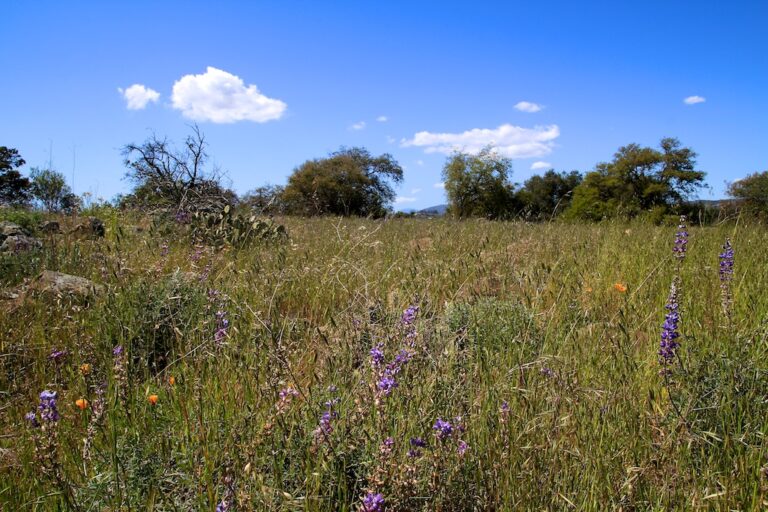
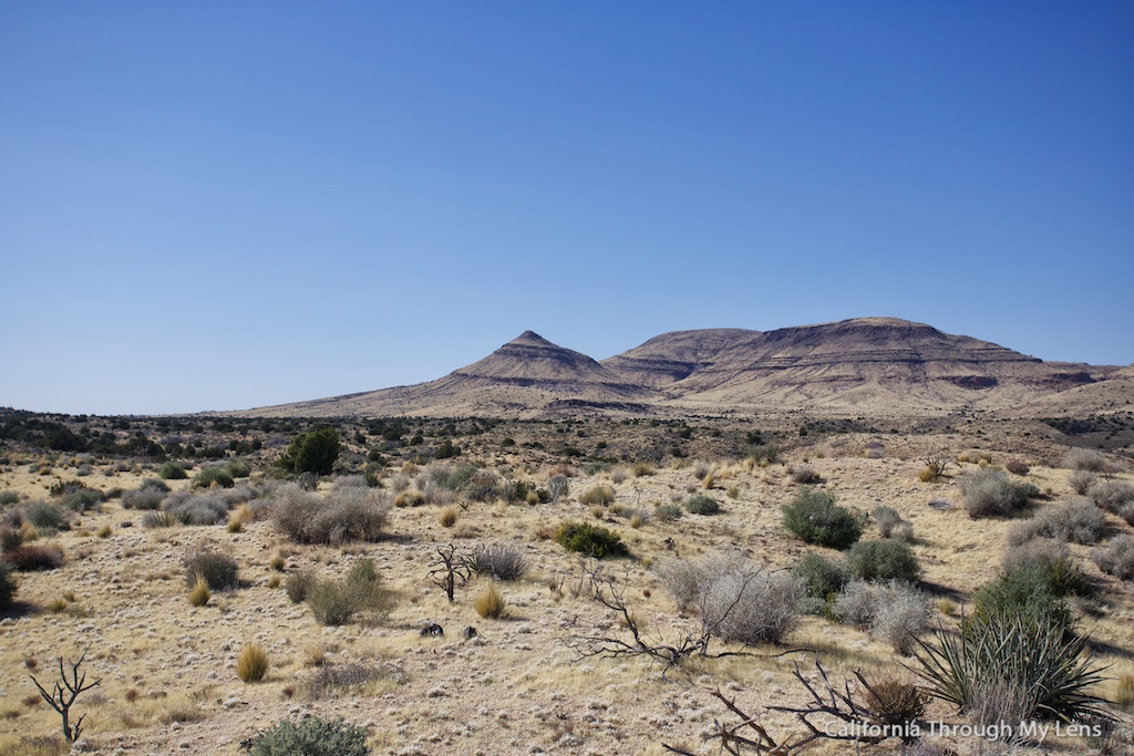
When you arrive, you will feel like you have left California and are now in the Australian Outback, it is green in some areas but overall has a terrain that is much like the plains.

Rock Springs Trail 19

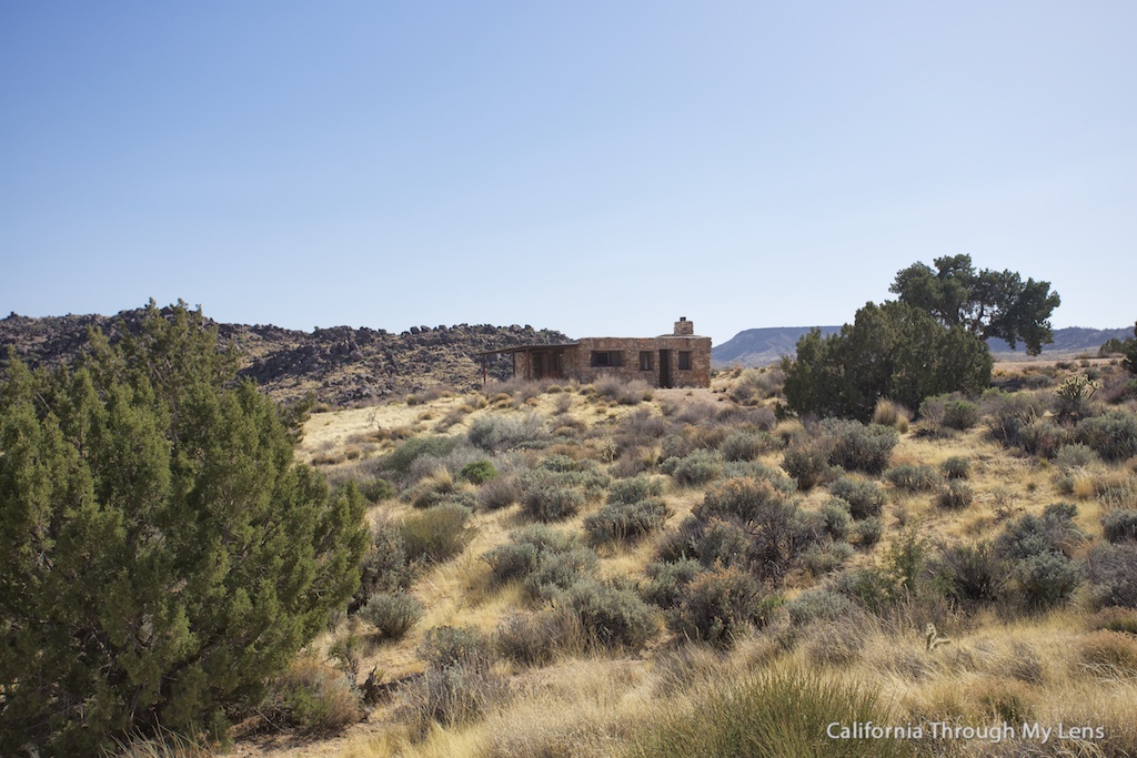
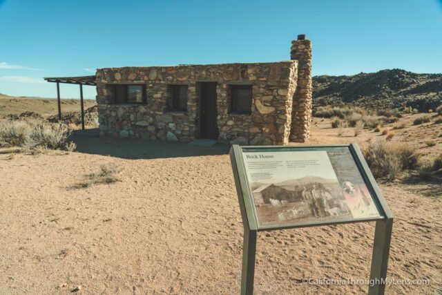
From the parking area, you can see the old stone house that is the start of the trail.

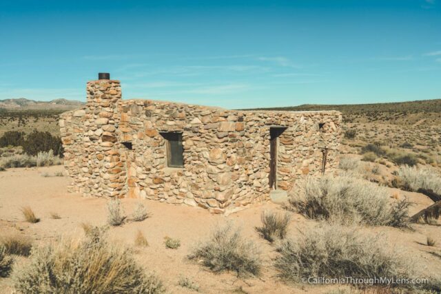
This stone house was built in the 1920s for a war veteran that had suffered from poison gas attacks in the war. Even though he was only supposed to live for a couple of years, he ended up staying in this house for over 30.

Rock Springs Trail 11

You cannot enter the house, but feel free to walk around it and admire the shape it is still in.

Rock Springs Trail 7

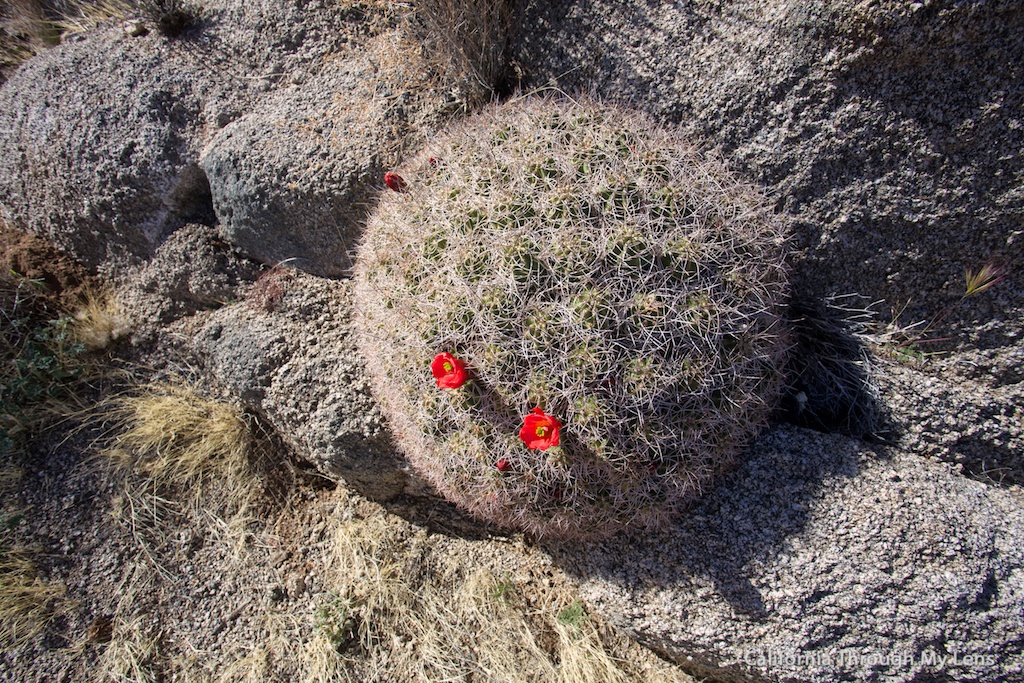
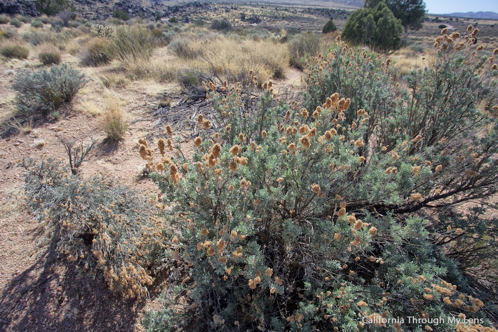
From here, you will start the trail and head down the hillside along a gradual descent. There are a lot of unique plants that you can see, especially if the wildflowers are in bloom.

Rock Springs Trail 13

About halfway down, you will also see the remains of some old mining claims as well. While there is not much to see, they are still a point of interest on this hike.

Rock Springs Trail 5

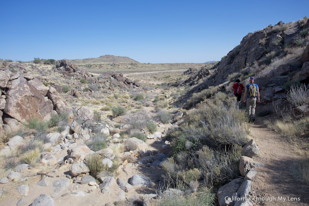
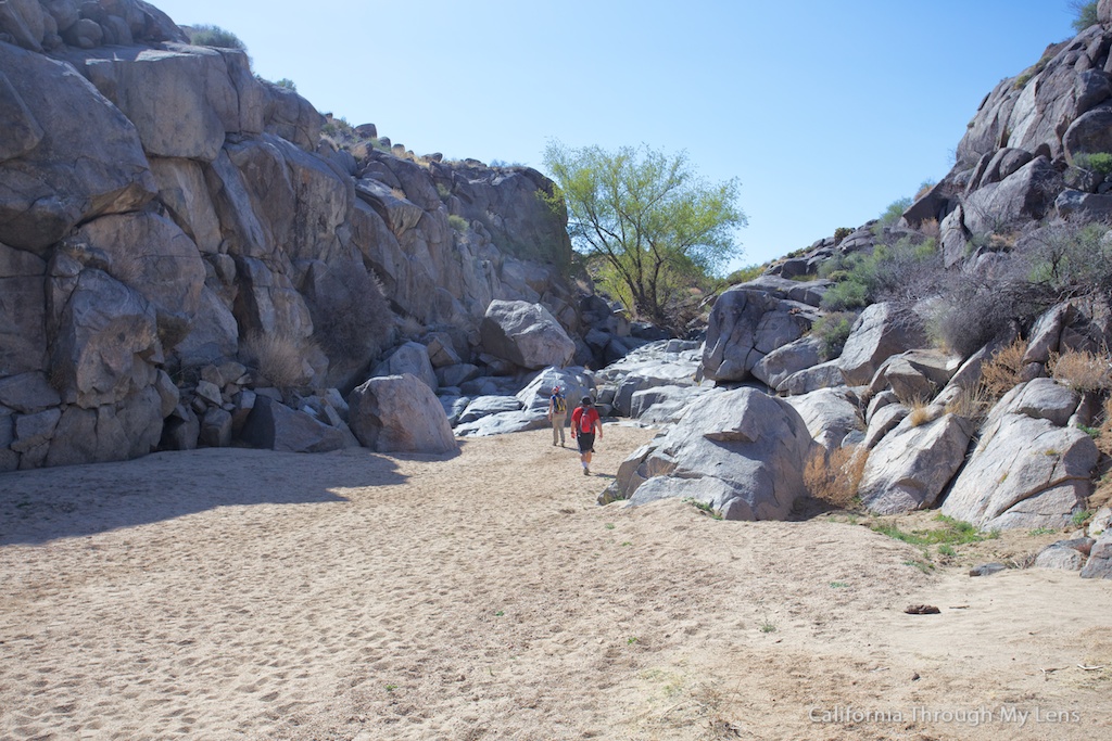
As you get closer to the bottom, you will make your way through a couple of canyon-like areas before emptying into the dry creek bed below.

Rock Springs Trail 6

This is also where the stream is located, and even in the California drought, there was still some stagnant, gross water in this area that was feed from deep below.

Rock Springs Trail 14

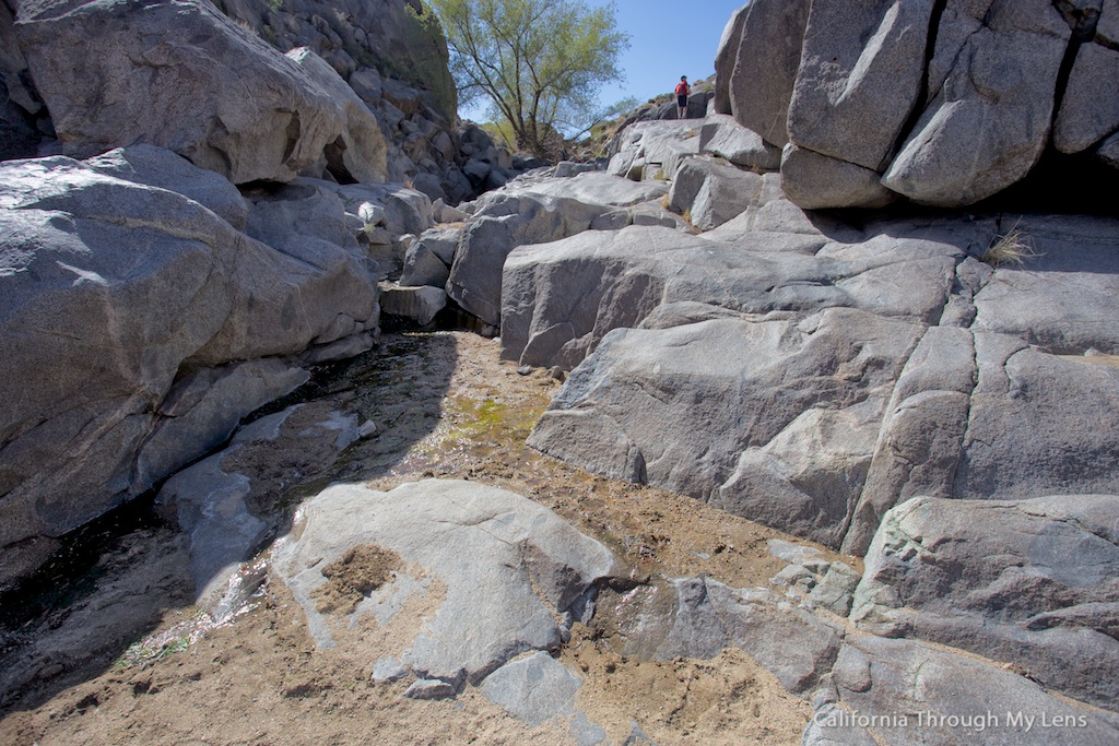
The creek bed is a fun area to explore, and I can imagine it being fun for bouldering and climbing on the big granite cliffs.

Rock Springs Trail 16

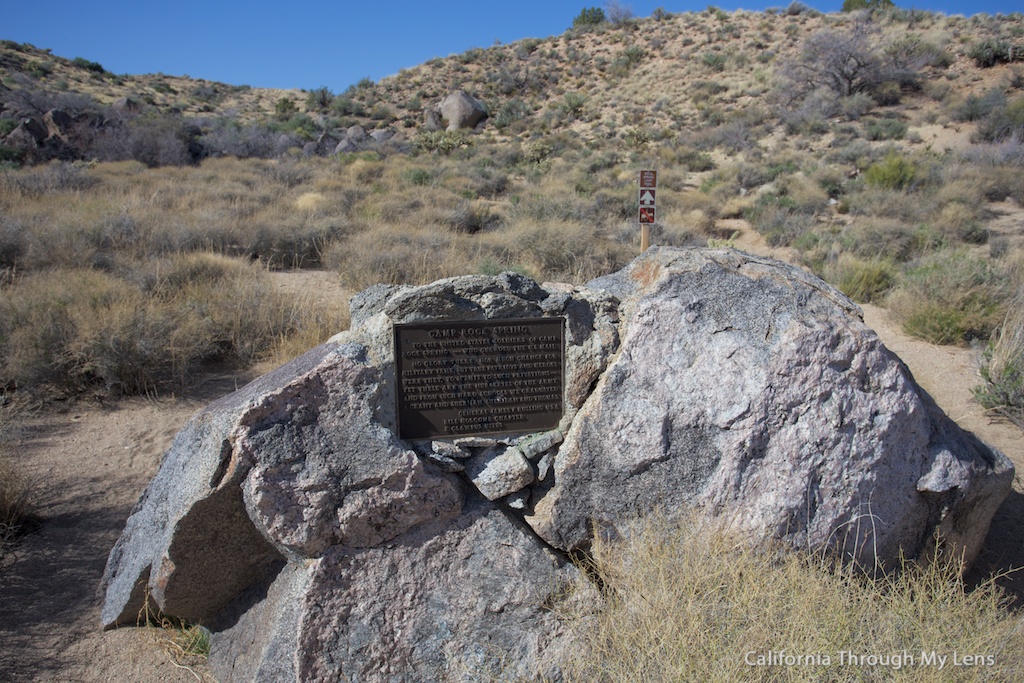
Back on the trail, you will head past a sign and a plaque dedicated to the army base that used to be here. It states that out of the 75 people who served, 25 defected, I am guessing due to the remoteness and lack of water out here.

Rock Springs Trail 8

The trail continues up at a gradual incline now for the next third of a mile. As it continues to go up, you will get excellent views of the dry creek bed and the crazy mountains all around you. My favorite being the spire-like mountain right in front.

Rock Springs Trail 2

The trail continues like this before it ends back at the rock house. You can take as little or as much time as you would like to complete the hike.

Rock Springs Trail 1

While this was a nice trail with some unique history, it is out-of-the-way from most places in the park, and with so many good hikes available, I feel like your time may be better served somewhere like the Kelso Dunes or Rings Trail. If you do the hike, let me know what you thought of it in the comments.

Filed Under: Hikes, Historical Structures, National Parks, Southern California Tagged With: featured, Kelso, Mojave National Preserve, San Bernardino County

Interested in supporting this blog?

This blog is simply a hobby and labor of love for me. If you have enjoyed the posts consider sharing it with your friends. I want as many people as possible to explore this state and you can help by letting them know about all of the great spots!

Join the Newsletter

Subscribe for the four day welcome series and to get the latest content every month.

    We won’t send you spam. Unsubscribe at any time.

    About JoshMc

    Thanks for checking out the blog, I am happy to be sharing my adventures with you! You can get to know me by reading my about me, which includes a video and additional information on the site, myself and my full disclosure. Also, follow along on Twitter here or read all of my posts on this blog here.

    Primary Sidebar

    About

    Josh from California Through My Lens I'm a travel junkie strapped down to one state, focused on seeing as much of it as I can and encouraging others to do the same. More about me.

    Popular Posts

    The Big List of Strange, Fun & Unique Attractions in Southern California
    Pacific Coast Highway: Where to Stop on Your Road Trip
    Top Hiking Trails in Southern California
    Fun Stops on the Drive from Los Angeles to Las Vegas
    24 Things to do in Downtown LA
    17 Things to do in Lake Tahoe
    Donner Pass, Summit Tunnel Hike: Old Abandoned Railroad

    Categories

    Other Resources


    Footer

    Search the site

    Additional Information

    Privacy Policy

    About Us

    Copyright © 2021 · Metro Pro on Genesis Framework · WordPress · Log in

    Coronavirus February 2021 Update: Please note that some information in the posts may have changed and some places may be closed.