• Skip to primary navigation
  • Skip to main content
  • Skip to primary sidebar
  • Skip to footer

California Through My Lens

California Travel, Food, Hiking & Road Trips

  • Start Here
  • Explore
    • Beaches
    • Bizarre
    • Caves
    • Food
    • Hikes
    • Historical Structures
    • Natural Wonders
    • Waterfalls
  • Drive
    • El Camino Real
    • Highway 395
    • LA to Las Vegas
    • Pacific Coast Highway
    • Route 66
  • National Parks
    • Channel Islands
    • Death Valley
    • Joshua Tree
    • Lassen Volcanic
    • Pinnacles
    • Redwoods
    • Sequoia & Kings Canyon
    • Yosemite
  • Cities
    • Los Angeles
    • Palm Springs
    • Sacramento
    • San Diego
    • San Francisco
  • Resources
    • Day Trip Ideas
    • Road Trip eBooks
    • Hotels
    • My Favorite Travel Products
    • Travel Videos
  • Browse By …
    • Map Of Locations
    • Cities
    • Counties
    • National Parks
    • State Parks

Salmon Creek Falls: A Rugged Waterfall Hike in Big Sur

Last Modified: May 15, 2020

51shares
  • Share
  • Tweet

Salmon Creek Falls is a beautiful waterfall in the southern portion of Big Sur that is only a short distance off the road but that features an unmaintained hike to get to its base. With the closures in effect (as of Spring 2018 but not any longer), this trail was right near where Highway 1 was closed and if you want to see as much as you could from the south during that closure, then driving out here to hike this trail was a good option. Do note that there is a lot of poison oak on the trail, so make sure to wear long pants. Here is all the information.

Details

  • 1 mile round trip
  • Lots of rock hopping and stream crossing
  • Hat tip to Hikespeak for showing me this trail
  • Find more great spots in Big Sur here

Getting There

According to Google, the trail starts at around these coordinates (35.815415, -121.359149), but you can search for Salmon Creek Falls in Google Maps as well. It is about 5 miles past Ragged Point, heading north on Highway 1. You will reach a large bend in the road right after crossing a small bridge, and there is a dirt pull off where you can park.

The Trail

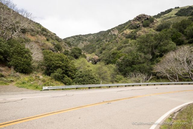
From the small parking area at the bend, my wife and I followed a little dirt path down to the water. I think, looking back, there may have been a better trail on the other side of the bridge that might have been easier, but that is not the way we went.

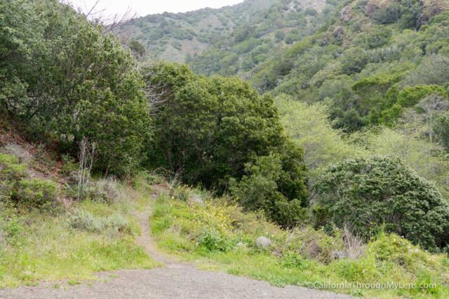
From the water, we followed a use path that went under tree branches and over rocks pretty much the entire way to the falls.

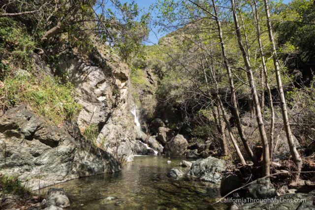
It was not easy and required some rock hopping across the stream, but since it was only about a half mile, we eventually made it to the waterfall.

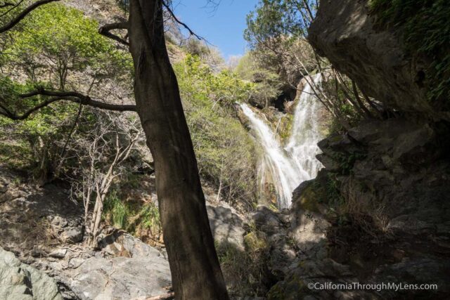
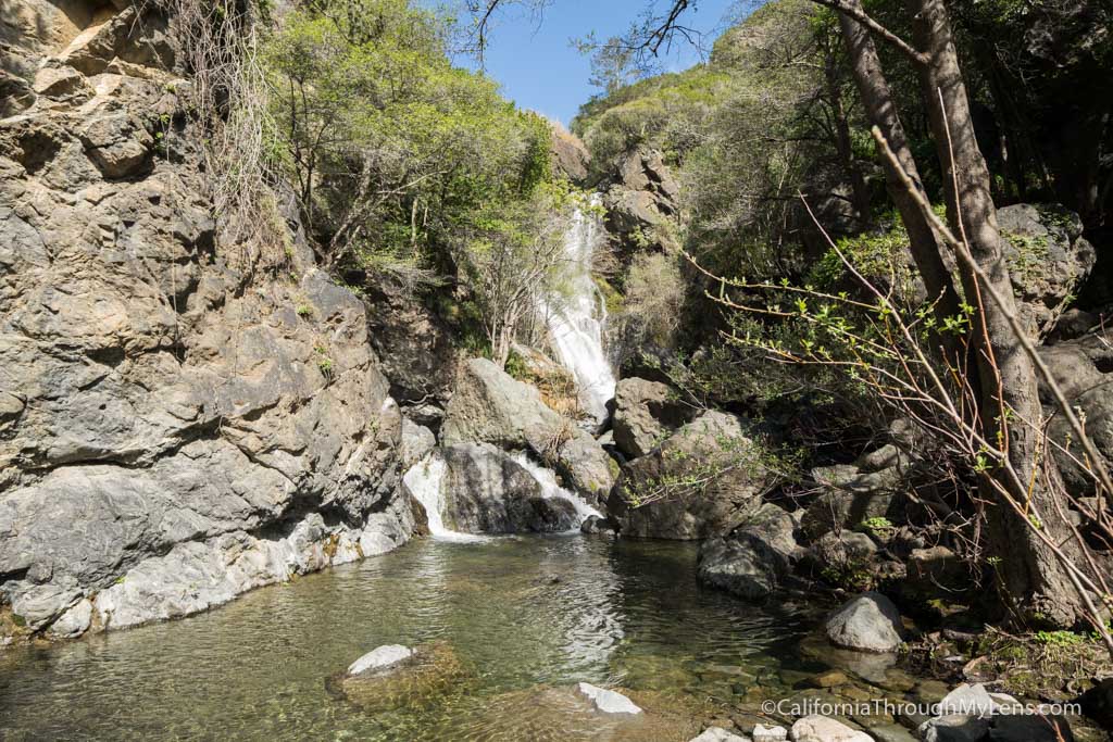
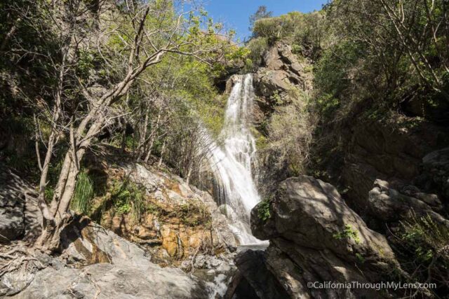
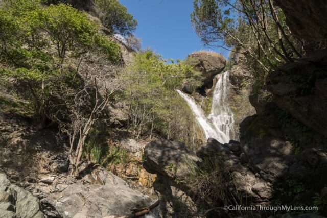
The 100-foot waterfall is beautiful, with two streams coming down and connecting to create a significant flow.

The water levels were high when we went, so there was no good way to the actual base of the falls, but luckily we could see it well from where we were.

After checking out the falls for a little while, we headed back, trying to find a better trail, but ending up just going the way we initially went. It was an adventure avoiding the poison oak, but it was a lot of fun.

Check it out and let me know if you find an official trail in the comments.

Filed Under: Central California, Waterfalls Tagged With: Big Sur, San Luis Obispo County

Interested in supporting this blog?

This blog is simply a hobby and labor of love for me. If you have enjoyed the posts consider sharing it with your friends. I want as many people as possible to explore this state and you can help by letting them know about all of the great spots!

Join the Newsletter

Subscribe for the four day welcome series and to get the latest content every month.

    We won’t send you spam. Unsubscribe at any time.

    About JoshMc

    Thanks for checking out the blog, I am happy to be sharing my adventures with you! You can get to know me by reading my about me, which includes a video and additional information on the site, myself and my full disclosure. Also, follow along on Twitter here or read all of my posts on this blog here.

    Primary Sidebar

    About

    Josh from California Through My Lens I'm a travel junkie strapped down to one state, focused on seeing as much of it as I can and encouraging others to do the same. More about me.

    Popular Posts

    The Big List of Strange, Fun & Unique Attractions in Southern California
    Pacific Coast Highway: Where to Stop on Your Road Trip
    Top Hiking Trails in Southern California
    Fun Stops on the Drive from Los Angeles to Las Vegas
    24 Things to do in Downtown LA
    17 Things to do in Lake Tahoe
    Donner Pass, Summit Tunnel Hike: Old Abandoned Railroad

    Categories

    Other Resources


    Footer

    Search the site

    Additional Information

    Privacy Policy

    About Us

    Copyright © 2021 · Metro Pro on Genesis Framework · WordPress · Log in

    Coronavirus January 2021 Update: Please note that some information in the posts may have changed and some places may be closed.