Castle Dome Hike in Castle Crags State Park
Castle Crags State Park is located right off Highway 5 in Siskiyou County. The park is easy to miss and the craggy rocks that jut out of the landscape are hard to see, meaning that many people simply drive by now even knowing this awesome park is right there. The park has dozens of miles of hiking trails, with the Pacific Crest Trail running right through it, and while I haven’t explored it as much as I would like, I have done the parks main trail Castle Dome, which is a difficult hike to a stunning viewpoint. Here is all the information if you want to hike to Castle Dome yourself.
Details
- Length: 5.4 miles
- Total Elevation Gain: 2200 ft
- Difficulty Level: Moderate (but difficult for the distance and steep hiking at the end)
- Information from 2017 and 2022
Video
Here is a video I made on the hike on my recent visit in 2022.
Getting There
The park costs $10 to get into, and it has one main road that leads to the trailhead for the Castle Dome hike. The hike is around 2.7 miles to get to the base of the dome and another half mile, plus a lot of elevation and scrambling, to get to the top. If you don’t have ropes and climbing abilities though you will not want to go to the top of Castle Dome, just the base. You can get to the base with no problem, but you should be prepared if you want to get to the top safely. I would assume that is why the trail ends at the base; they didn’t want people pushing their luck.
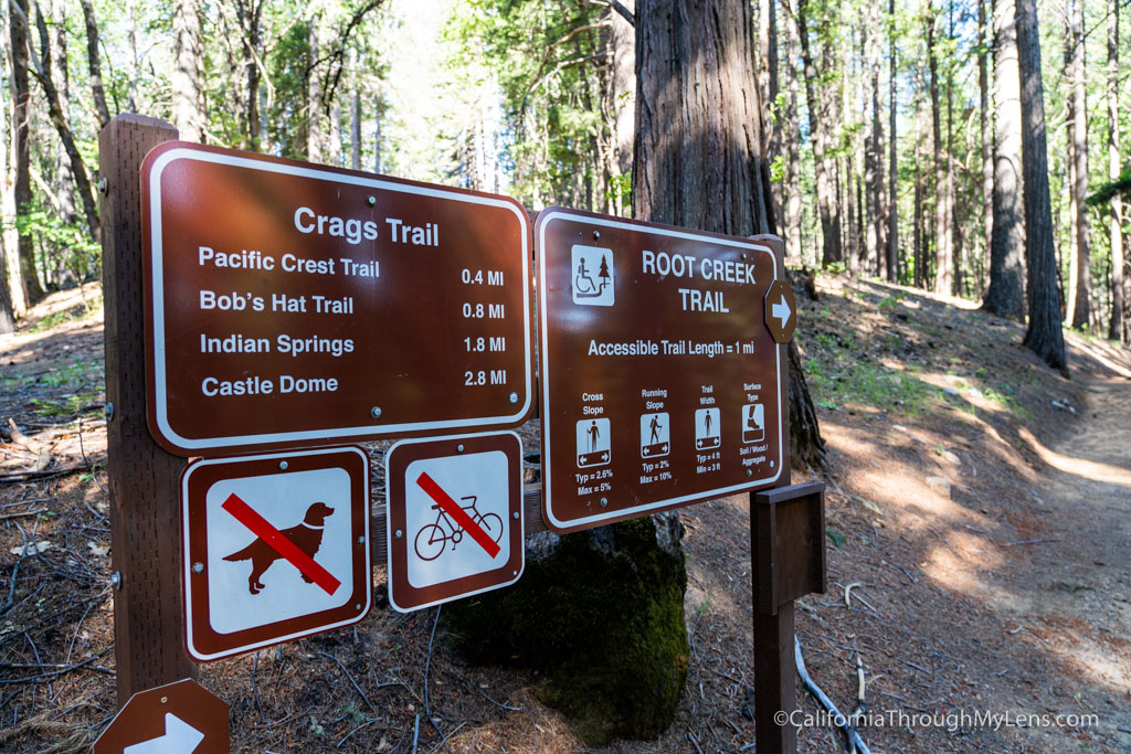
The trail starts easy enough; it slowly meanders for the first quarter-mile through a beautiful forest before you reach the split in the road. From this point on, you will be doing nothing but going up. I would even say there is probably not much flat terrain at all the rest of the hike. Obviously, this is par for the course on a hike that is less than three miles but still climbs 2,000 feet of elevation. You can plan on around 700 feet per mile, and a tough hike. I saw many people not prepared for the hike while I was walking down. Make sure you have a lot of water and take your time.
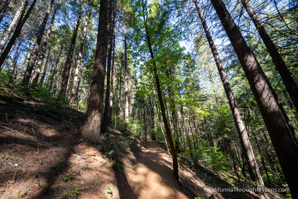
The trail climbs to the top of the first hill and intersects with the PCT. The PCT is only part of the trail for about 10 feet, but it is cool to walk on and to see it for a second. From there, the trail continues up for a while through dense forest. It is nice that the first area is very shaded. There are a couple of offshoots from the trail on the way up, and I didn’t have an opportunity to take them.
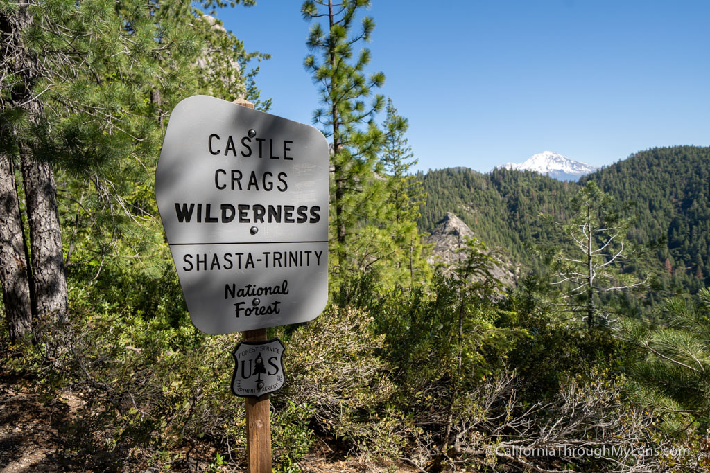
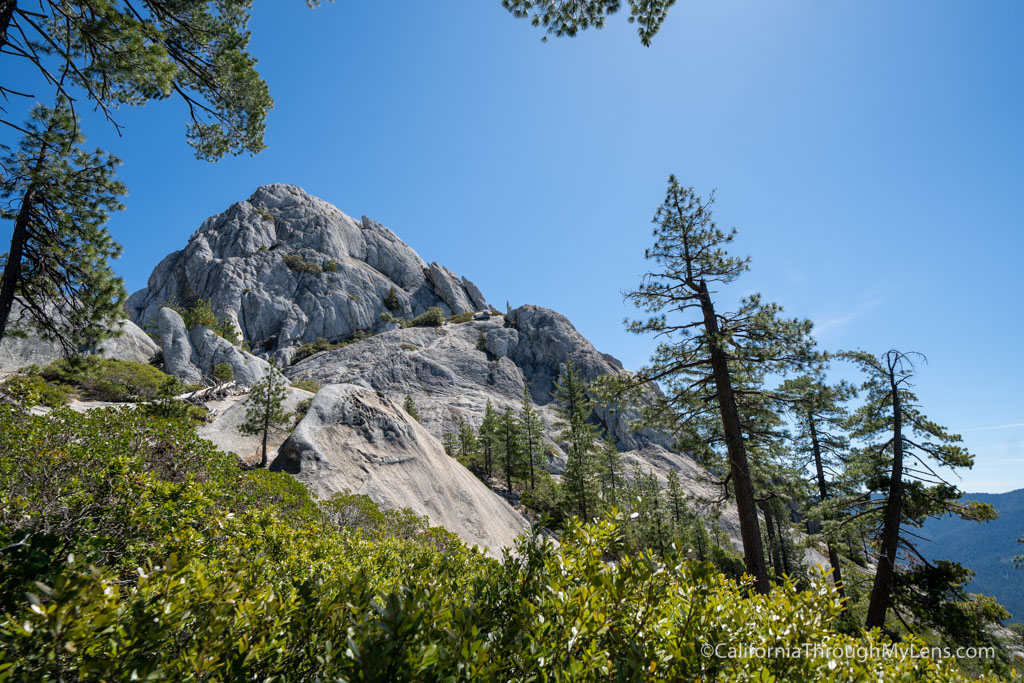
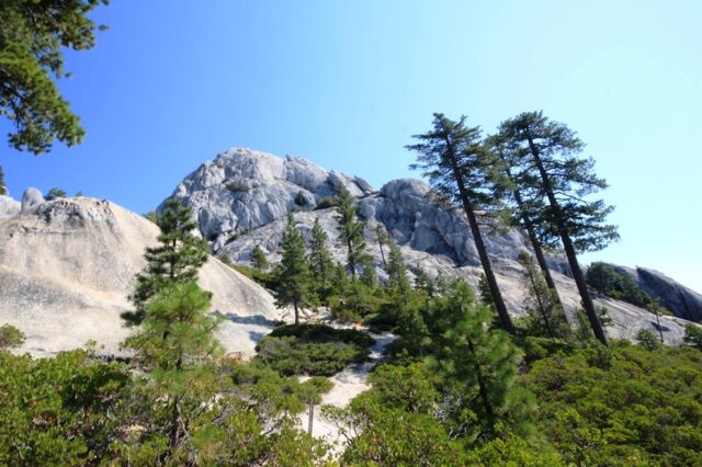
After about two miles, the trail leaves the trees and starts the final climb up to the Crags. You will notice this with the sign stating you are now entering the Castle Crag Wilderness.
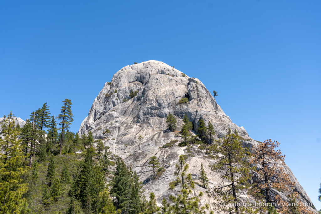
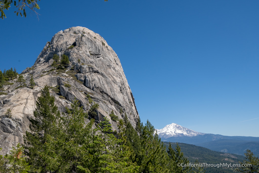
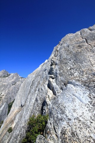
This part of the trail is in direct sunlight and can be very hot. This is where the water and early start become lifesavers. The climb goes over many rocks and feels a lot like stairs as you are heading up. As you turn the final corner, you will get amazing views of Castle Dome and Mt Shasta, roughly 30 miles away, if it is clear.
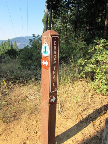
At the top of the hill, you have the option to proceed right to the Castle Dome or proceed left to hike up to the other crags. We went to the dome, and after about 300 yards, you will reach the end of the trail right at the base of the dome.
While Zac was exploring another area, I decided to try to hike Castle Dome. The first 100 yards are so is nothing more than some glorified scrambling with somewhat steep drops, but once you get past that, the trail starts to get sketchy.
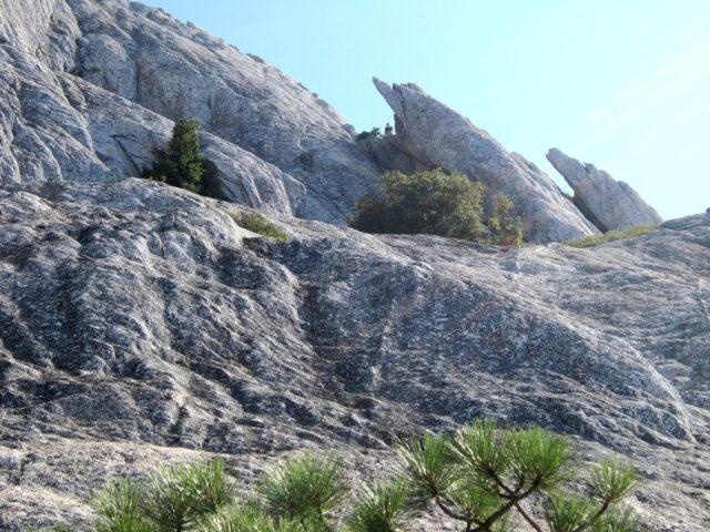
Once you make it to the initial plateau, you will head around to the front of the dome and have to navigate a small ledge by holding onto a manzanita tree (terrifying). Then you will see a gully that you can proceed up another 100 feet in. Once you reach the top of the gully though, is where I decided to turn around. Let me stress to you that even getting to the point is very sketchy and should not be taken lightly.
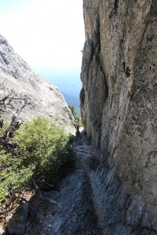
At the top of the gully, there is a series of small stair looking cut-outs in the rock. These proceed up at about an 80-degree angle and seem to be the way to the summit. The only problem here is that they have about a 300-foot drop if you lose your footing, and losing your footing looks like it would be easy.
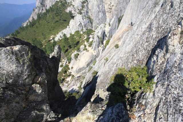
I elected to turn back around, and I really would not recommend anyone try to do this without some type of rope to keep you safe. It’s a bummer to stop less than 50 feet below the summit, but I would rather live another day. The below picture is looking up to where I stopped, you can see me in the top middle of the picture.
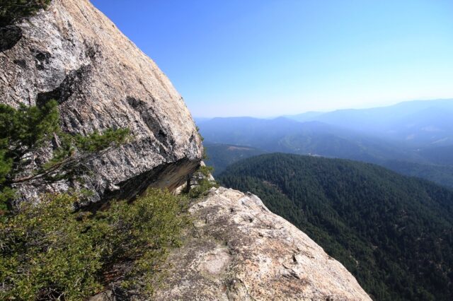
From there, we simply had some lunch and proceeded back down to the car. We also took the short trail to the vista point and stopped for a picture.
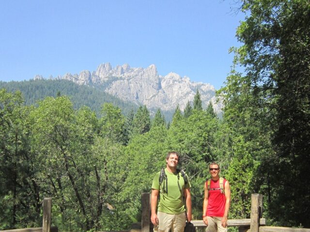
Castle Crags is a great place to hike, so much beauty and hardly any people to share it with. I would recommend visiting the park if you have a chance, especially on a Highway 5 road trip. Let me know your thoughts in the comments.