Rancheria Falls Near Huntington Lake in the Sierra Nevadas
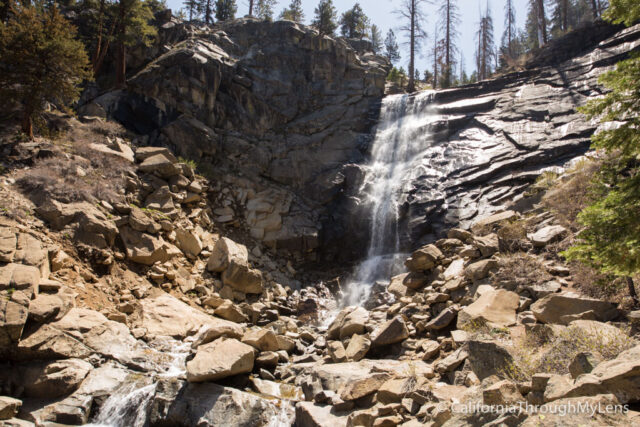
Located about 20 miles past Shaver Lake near Huntington Lake, Rancheria Falls is a 150-foot waterfall that cascades over a granite cliff face and is beautiful to behold. The trail itself is straightforward, if the road is open, and a long uphill hike if it is closed. When I went, the road was closed, so that is what this review is of. Even with the road closed though, it is still a fantastic hike that I highly recommend if you are in the Shaver Lake area. Here is all the information.
Details
- 4.5 miles if the road is closed, 2 miles if it isn’t
- 650 feet of elevation if the road is closed less than 100 feet if it isn’t
- I did this hike in 2016
Getting There
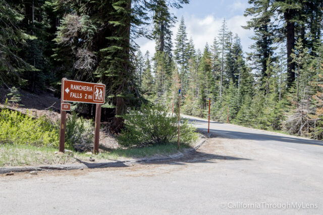
From Highway 189, there is a turn off about a mile past China Peak Ski Resort, which has a sign for Rancheria Falls. Technically the road is Forest Route 8S31. If this area is open, then you will drive about 2 miles up the road to the parking lot for the trailhead. There is a split about 3/4ths of a mile in, and from here, there should be a sign pointing you right, which is the direction you want to go. If you go when this road is closed, then you will need to park here and walk from the start of the road up to the trailhead, which is around 2 miles extra.
The Hike
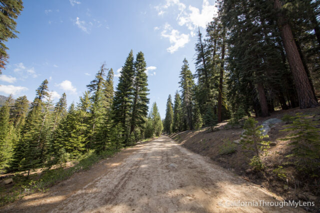
From the turn off on the road, you will simply be walking up a dirt road for about a mile and a quarter. This section is a well-maintained trail, but it does go uphill the entire way, so it is a good walk. Also, I saw no people from the time I left the road to when I got back.
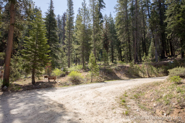
About a half-mile in, you will reach a bend where the road splits, head to the right here to continue towards the falls trailhead.

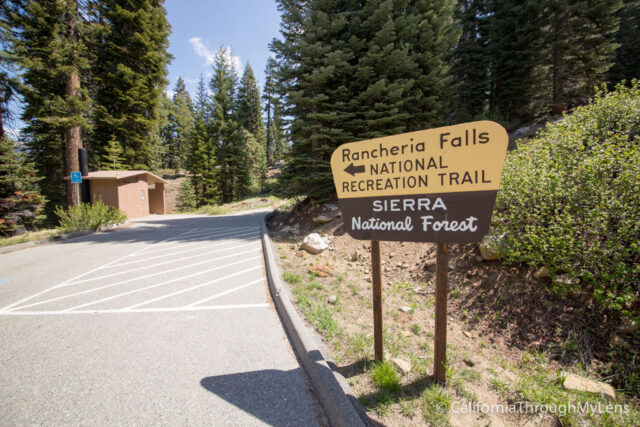
The trail bends one more time before you are making your way towards the parking lot for the trailhead. The parking lot can hold about six cars, and it has a nice sign and a bathroom.
The rest of the trail is well maintained and well-traveled. You will be on it for about a mile, and it is a very gentle grade, which is mostly flat.
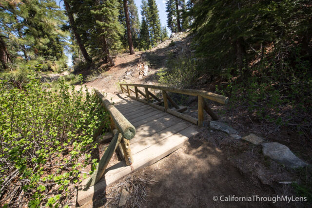
This area is well shaded and is a beautiful walk that makes the uphill road I climbed to get here worth it. There are momentary breaks in the trees where you can catch a glimpse of the lake below.
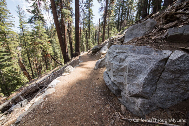
When you see the granite rocks on the right of the trail, you will know that you are close to the falls, and you should even be able to start hearing them.
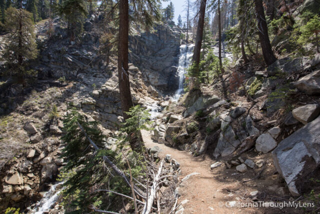
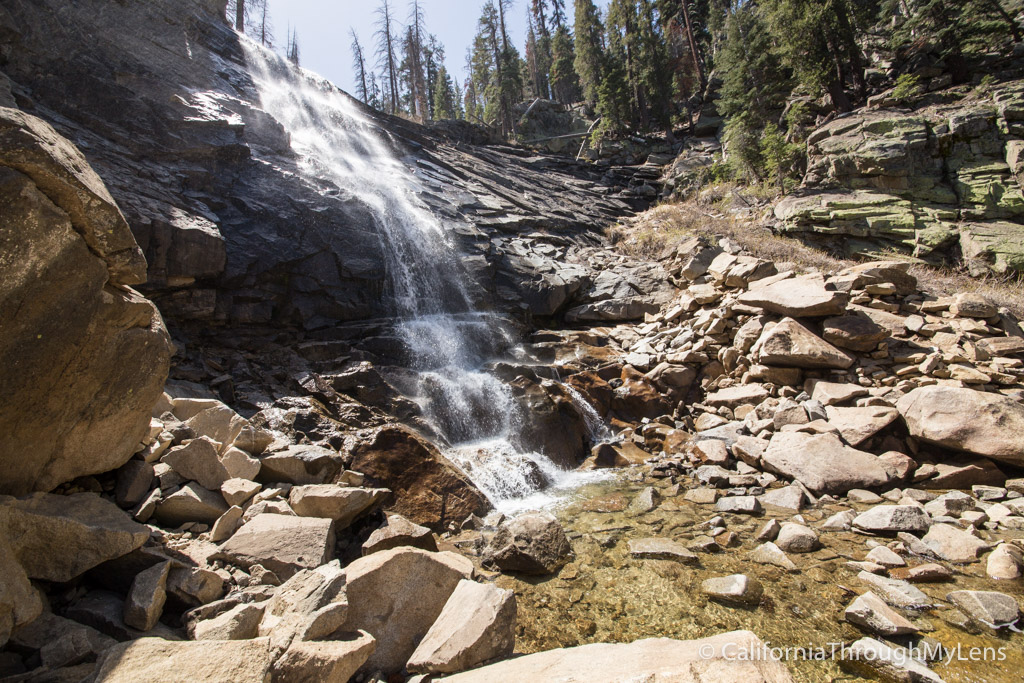
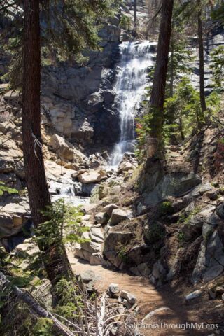
As you approach, you will get a bunch of amazing views of the falls through the trees. I loved the way the trees framed the shot for me here, and the size of the waterfall was even bigger than I expected.
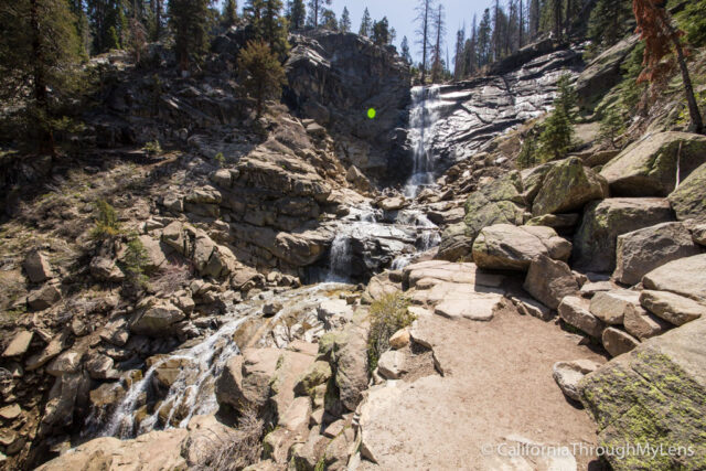
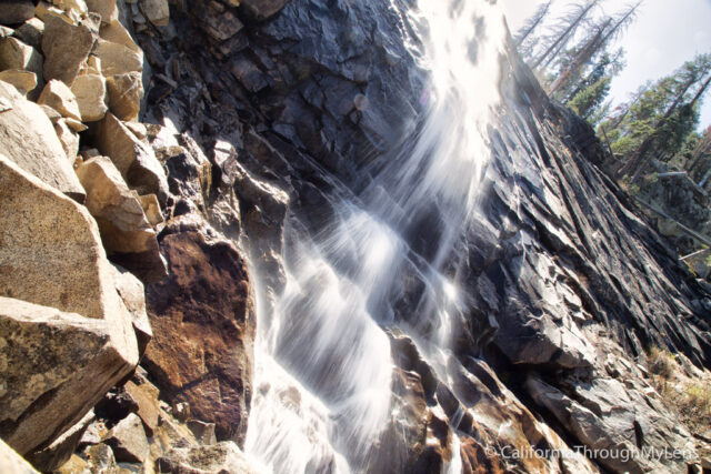
The trail ends at an excellent viewpoint for the falls, and you can stop here if you want to head back. There are a bunch of granite rocks that you can climb on to get closer to the falls, and I climbed down to the base of the falls itself.
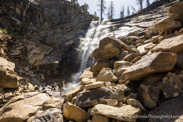
Since the water level was low, I hopped a few rocks to get a view of the falls from the other side as well. I imagine during different times of the year this area would have too much water and you wouldn’t be able to do this.

It looks like some people may scramble up the rocks to get above the falls, but I didn’t do that, and I don’t recommend it as it looks like it could be sketchy.
From here, you simply take time to enjoy the falls then make you way back the trail you came in on. Hopefully, the road is open when you go so that you have a short hike back, but I will say it was nice to have it closed as I had the trail and the falls to myself the entire time I was there, so I can’t complain.
Let me know if you have been in the comments and if there are other hikes you recommend in the area. I really did like this area, so I can’t wait to head up there and explore more. You can see all of the waterfalls I have explored in California here.