Anacapa Island Day Trip Guide: Channel Islands National Park
Channel Islands National Park was a place that was high on my list to visit when I began the blog almost 10 years ago. Due to it being 14 miles off the coast of California at its shortest distance and 55 miles at its furthest, this series of islands hold untouched beauty in their remoteness and they are a stunning part of California. After finally booking a ticket on the boat that takes you across, I set out to visit the closest and smallest of the Channel Islands, Anacapa in 2012, and then visited it again to update this post in 2021. It is a great island for a day trip and it has some beautiful views, wildlife, and even a lighthouse. Here is all the information on Anacapa and if you want to read about all the Channel Island, you can here.
Details
- The closest island and the easiest for a day trip
- Cost is around $60-70 round trip
- You have to spend around 4 hours on the island it can be a long time since it is pretty small
- Around 2 miles of trails
- Information from my visit in 2012 and 2021
Getting To Anacapa
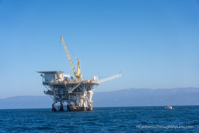
To get to Anacapa Island, the boat usually leaves at around 9:30 AM (this is the most popular time) and sets out on the hour ride to the drop off point on the island. During that time, you will cross into the channel and potentially see large freight shipping boats as well as wildlife like dolphins and whales. The crew always seems interested in showing everyone a good time, so they usually slow down by the dolphins and let everyone take pictures.
Video from 2021
Anacapa Island
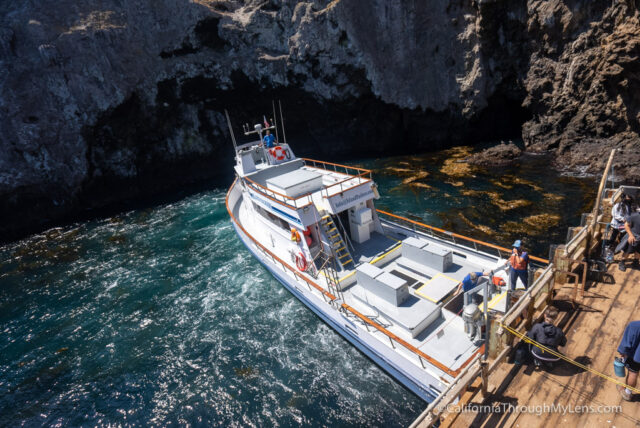
After about an hour, we pulled up to the dock at Anacapa, and about 90% of the boat’s 50 passengers got off. While this seemed like a lot, the 2.5 square mile island was large enough to never make it look crowded.

From the dock, you climb about 150 stairs until you reach the central upper shelf of the island as well as the path to the visitor center. This dock is the only area on the entire island with sea access, as the island is on a cliff and has a good 50 to 100-foot drop at all sides.
Most people opted to take the time out for lunch, but since it was already 11:30 AM and the boat was picking us up again at 3:15 PM, we set out with one of the volunteers on a mile walk to the main draw of the island, Inspiration Point.
The walk was great, and the guide that we had was knowledgeable about the island and its history. He also took us to a couple of the significant viewpoints on the island; then after the tour ended, he let us walk around and explore to our heart’s content. I would recommend this tour if it is offered, but if you simply want to walk the island yourself, here are the standout areas.
Landing Cove
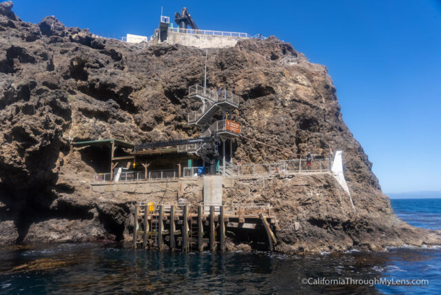
This area is where the boat backs in to let you off and pick you up. It is also the area where you can dive into the kelp forest and drop in your kayaks to explore the caves from the water.
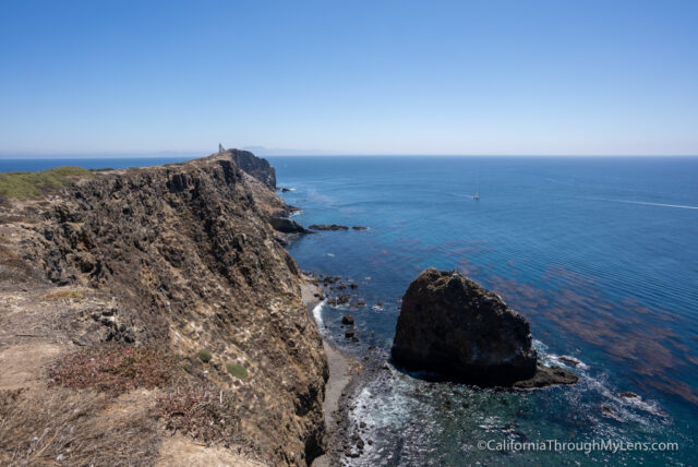
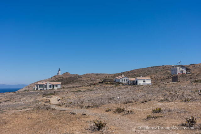
The Lighthouse
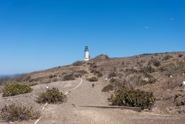
At the southern tip of the island is this beautiful lighthouse. The old mirrors for reflecting the light have been moved into the visitor’s center, but you can still walk up and see the lighthouse while hearing the loud beeping it makes every minute. Unfortunately, you cannot get within 50 feet of it, but it’s worth walking up to.

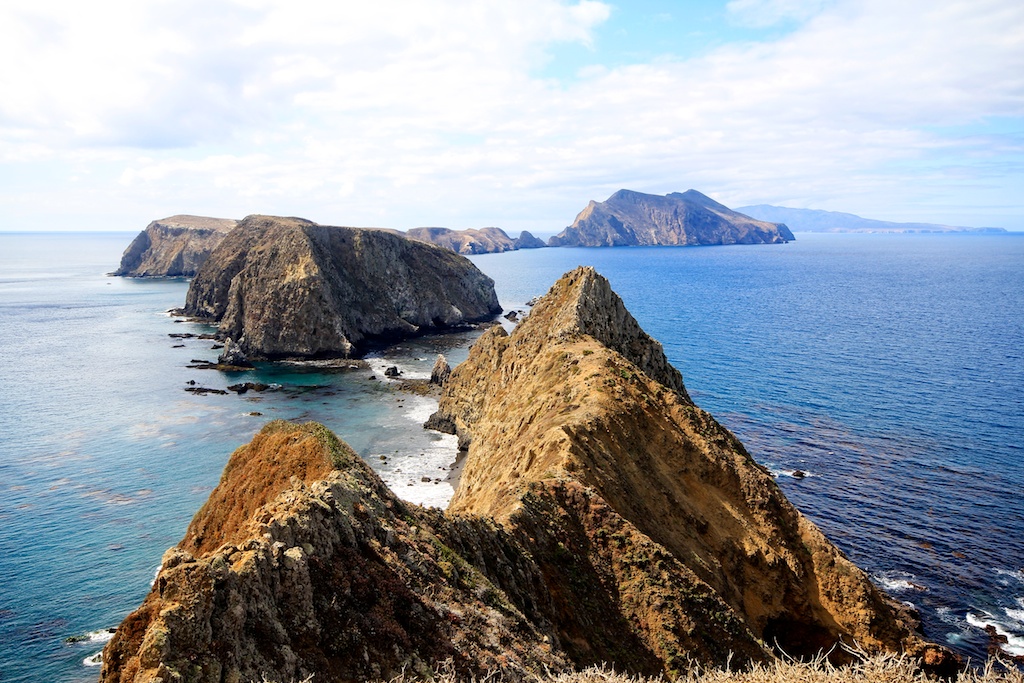
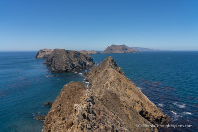
Inspiration Point

The main highlight of the island, Inspiration Point, provides stunning vistas of the two other parts of Anacapa. The viewpoint looks over the middle island as it wraps around to the base of the west island. You can also see the silhouette of Santa Cruz in the background as well. It is a beautiful spot that you will want to spend some time at, especially since you will have time to waste while on the island.

Cathedral Cove

Another stand-out area on Anacapa, Cathedral Cove, is a stunning example of what a beach can look like. Sitting on the edge, overlooking this cove, made me feel like I had left California and was in some tropical paradise like Hawaii. I only wish I was able to go down to the beach, but I will save that for another kayaking trip.
Pinniped Point
On the west side of the island, this point had some unique rock formations and overlooked another beautiful cove. It is also one of the more significant drops on the island, so make sure you don’t get too close to the edge.
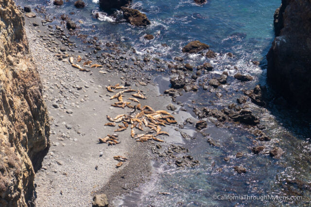
You can hear all of the seals below you and there were dozens to see when we visited.
Campground
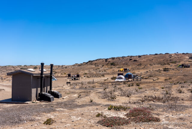
Right smack in the middle of the island is the ten spot campground. It was only $15 a night when we looked (as of 2013), but I would recommend not staying overnight here as a day trip is perfect to see this island.
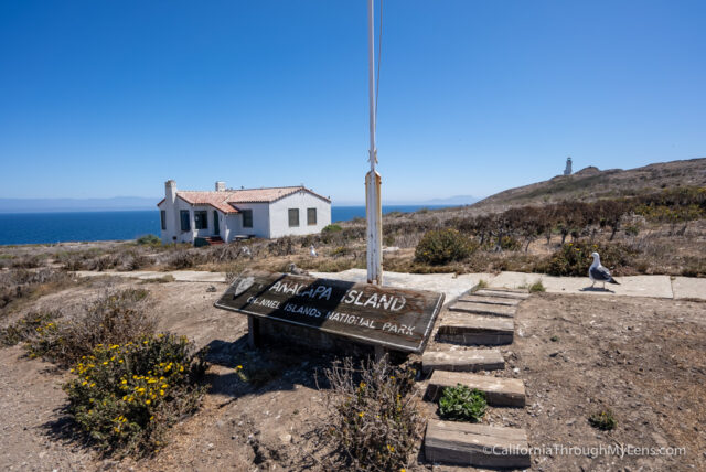
Visitor Center

About 150 feet from where the boat lets off is a small visitor center complete with brochures, some photos, history, and the old light from the lighthouse. Not a lot to see here but a good central point with pit toilets (this is all that are on the island).
Nesting Grounds
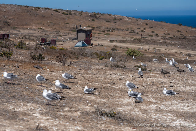
I do have to mention that if you visit in May – July, this is the typical nesting time for the gulls and there are thousands of them on the island. It is loud, dirty and they may even be territorial. I actually enjoyed this unique wildlife experience but wanted to note that if you go during this time.
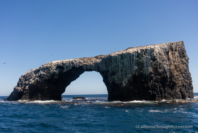
Arch Rock
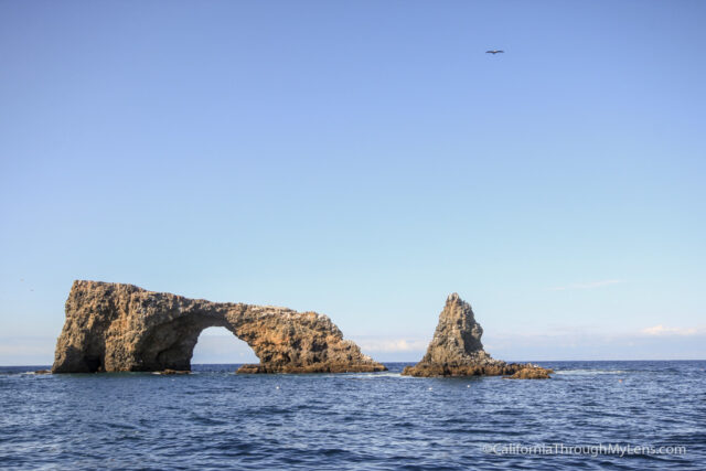
Lastly, on the south side of the island is a huge rock in the sea that completes a full arch. It is about 40 feet tall and hollow for about 20 feet in its center. This rock is not accessible from the land, and you would need to boat or kayak to it, but it is cool and was the logo that the volunteers were wearing on their jackets.
Video Recap
Here is a video I took of the different points from above, complete with a short timelapse at the end (from my visit in 2012).
All in all, the Channel Islands are a beautiful trip that everyone in California needs to take at least once. As soon as you set foot on the island and start to explore, I guarantee you will be shocked at how amazing they are. I cannot wait to get to the other islands. Let me know what you think in the comments.