Hiking Mt Konocti, the Dormant Volcano Near Clear Lake
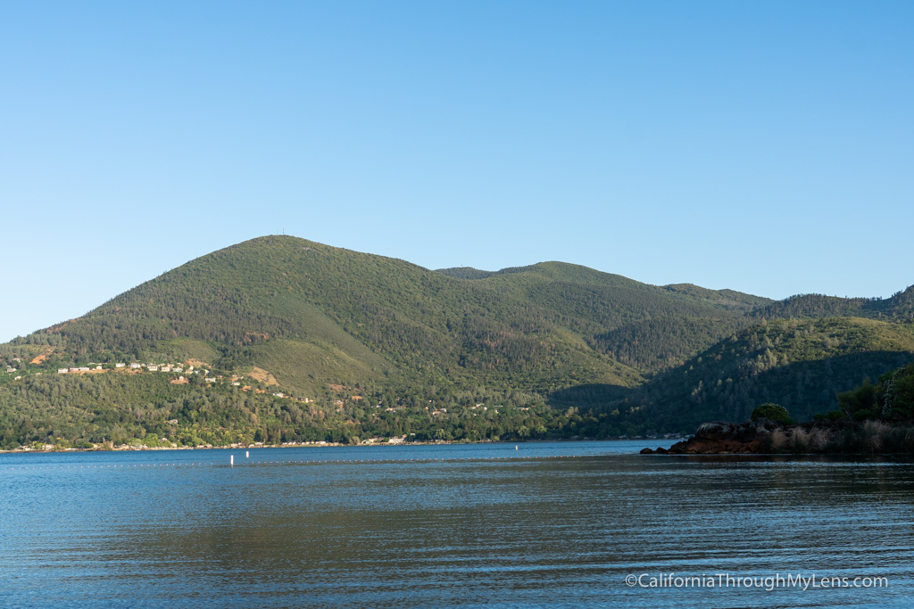
Mt Konocti is a prominent mountain and dormant volcano on the south side of Clear Lake, a lake in Northern California. It is a recognizable part of the landscape and is an awesome hike with fun history and beautiful views. The mountain has five distinct peaks, with 4 of the 5 at around 4,000 feet of elevation. I got a chance to hike Wright Peak and Howard Peak (the two tallest) in 2021, and here is all the information on this fun hike.
Details
- 7.5 miles round trip
- 1800 feet of elevation
- Mostly walking a dirt road to the summit
- Location: 518 Konocti Rd, Kelseyville, CA 95451
Mt Konocti Video
Here is a video I made on the hike.
Getting There

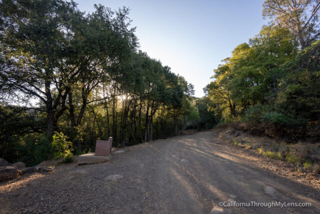
To get to the trailhead, I recommend grabbing the directions directly from AllTrails or making your way up to Mt Konocti County Park. There is a parking area right near the end of the dirt road that begins the trail up the mountain.
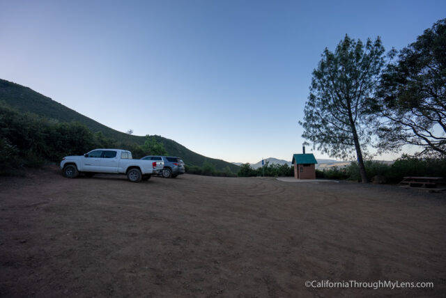
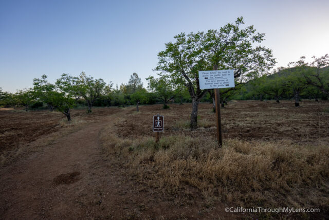
It is right near the metal gate that stops you from driving further, and there is a bathroom there as well. There was only one car in the parking lot when I went.
The Trail up Mt Konocti
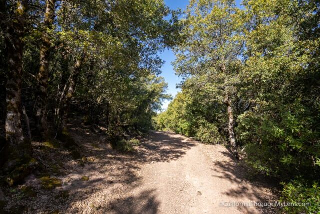
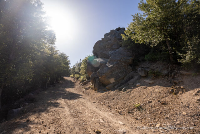
The trail to the two main peaks, Wright and Howard, is basically just walking a dirt road the entire way. It is boring in the beginning, but it gets pretty great at the end.
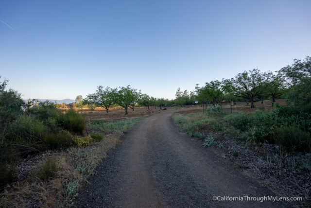
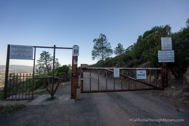
The trail starts by walking through the metal gate and continuing on the road.
The road then connects with an area of private property that you need to cross. There is a trail that has been approved to cross the property, so please make sure to stay on it when in this section.
This trail goes around and up a small hill before connecting with the dirt road again, which you will take the rest of the way to the summit.
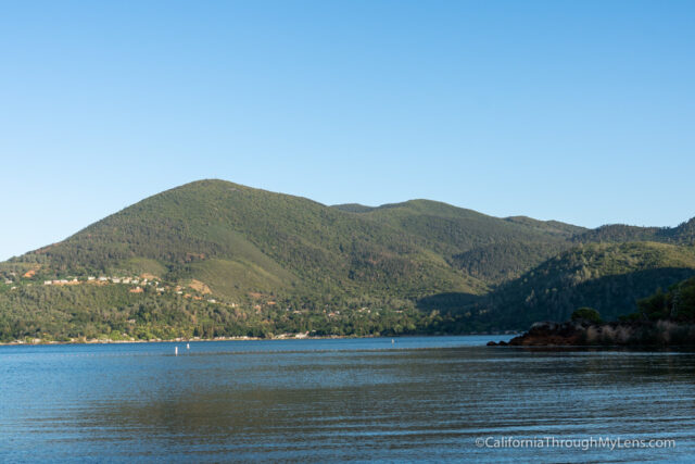
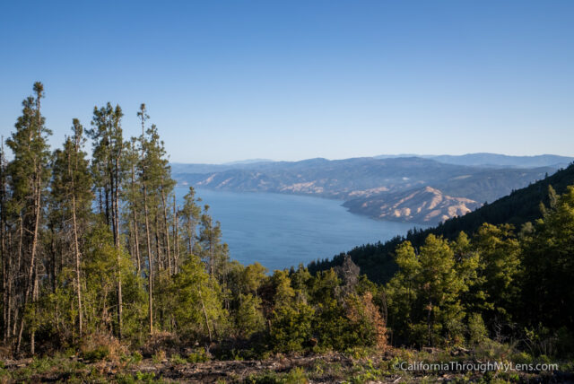
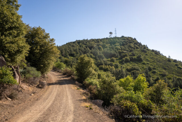
As you walk up the road, you will be in and out of the shade, and during breaks in the trees, you will start to see views out towards the lake.
There are markers every half mile or so that tell you how far you are from the summit.
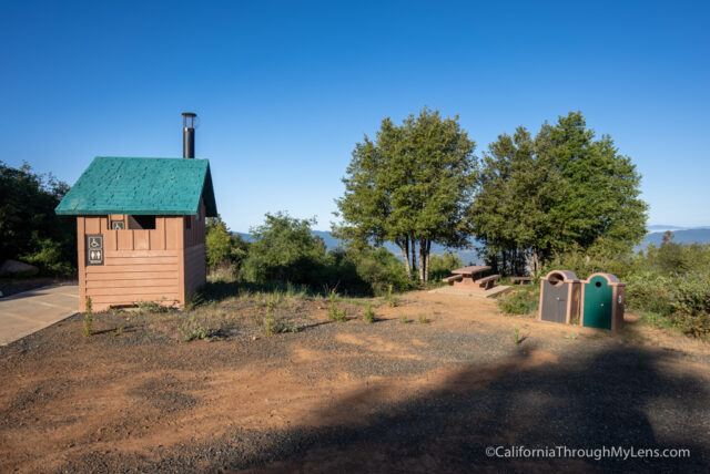
Eventually, you reach the halfway point, where there is another bathroom, two picnic benches, and amazing views.
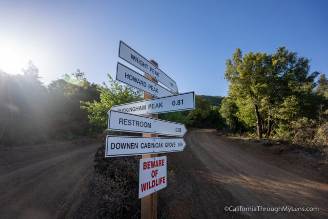
There is a split in the trail here, and one way goes out to Buckingham Peak while the other goes up to Howard and Wright. We went to the right, but I would love to go back and see the view from Buckingham as well.
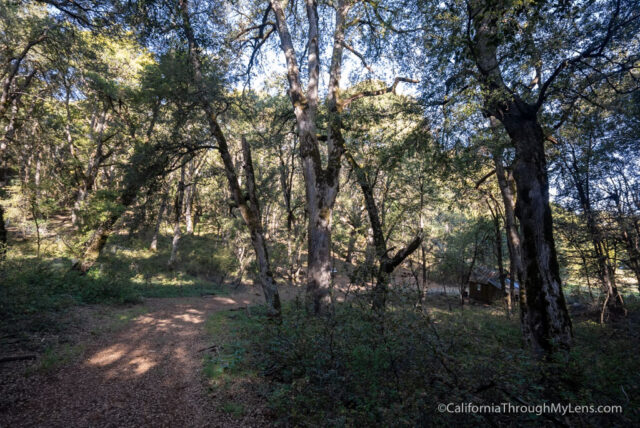
As you leave on this trail, you will be in the shade for a little while but will still be walking the main dirt road. This is where the trail gets unique and historic; I would recommend having an AllTrails download, so you don’t miss it.
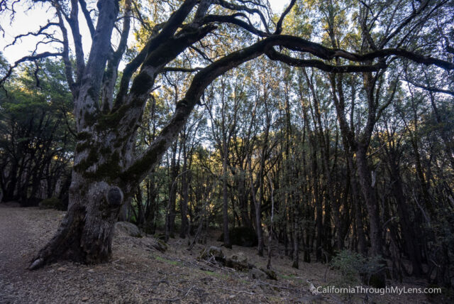
Here the trail goes into a surreal grove of Maul Oak Trees. These trees are massive, and it feels like you are in Harry Potter or something.
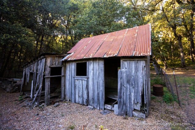
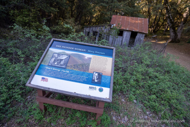
Look for the trail to the right when you are going through the grove as that will take you down to Mary Downen’s (a pioneer woman who homesteaded in the area) cabin.
Mary Downen’s Cabin
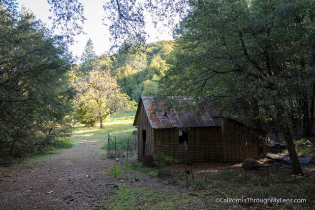
This old cabin was constructed in the early 1900s, and it is still in pretty good shape, all things considered. It is enjoyable to see it on this trail.
Read more about Mary Downen here, as she sounds like an amazing woman.
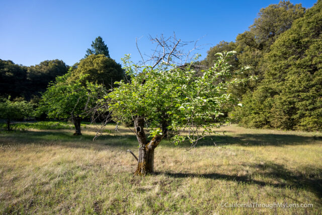
Next to her cabin, you can also see her walnut orchards which are stunning as well.
After exploring this area, head back to the main trail and continue.
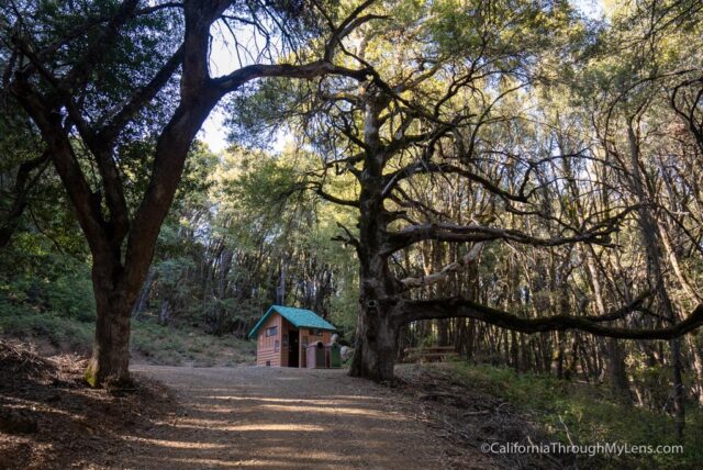
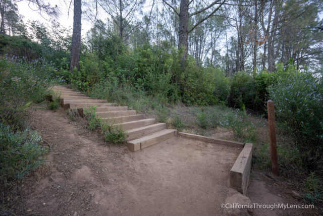
You will reach another bathroom and picnic table before leaving the shade behind and finishing the last push to the summit.
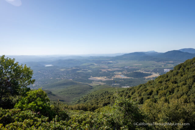
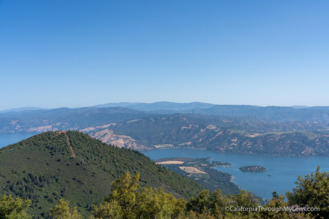
This is where the views get really impressive, looking east out over the valley.
Eventually, you will reach a bend to go left to Howard Peak and right to Wright Peak. I went to Howard Peak first.
Howard Peak
The hike up to Howard Peak is along another dirt road. It is a little steep and has some loose rock at the end.

The summit is small with antennas, but the view out towards the lake is pretty impressive. If you can only do one peak though, skip this one and do Wright Peak.
After getting back to the main road, you will continue along the second path, a wide dirt road that bends around and takes you up to Wright Peak.
Plane Crash

Right as you get near the summit, look to the right, and you will see an information plaque about a plane crash and the actual remains of what’s left of the plane.

This fatal crash happened in the 1970s when Mervin and Julia Enzler flew from Santa Rosa back to Ukiah. It is crazy that there are still pieces of the plane up here.
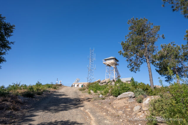
From there, the summit is in view, with the fire tower on top.
Wright Peak
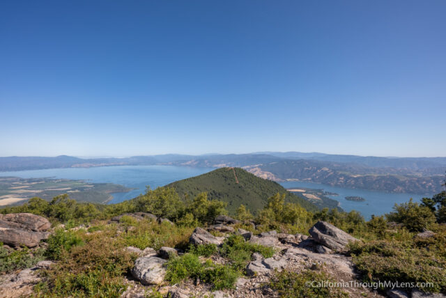
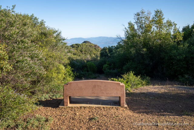
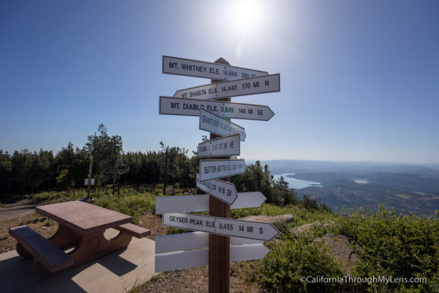
The summit has great views in all directions and was well worth the effort. On a clear day, you can see all the way to Mt Shasta, the sign says.
I explored for a while before finding a rock to sit and relax at. It is pretty amazing to have a hike like this close to the city and with such great views.
After relaxing, I made my way back down to the trailhead on the dirt road that I came up. This is a great hike and one that I really enjoyed, even if it isn’t as rugged as what I am used to. Let me know if you have done it in the comments!